List of the 1733 Spanish Plate Fleet Shipwrecks
|
1733 Spanish Plate Fleet Shipwrecks Multiple Property Submission | |
 | |
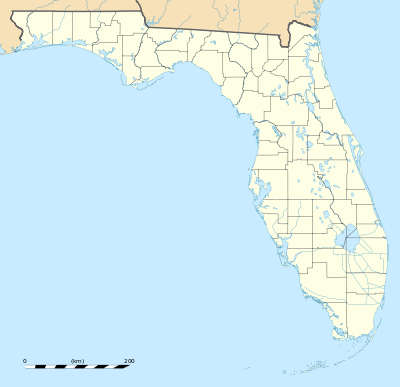
| Location | Monroe County, Florida |
|---|---|
| Coordinates | 25°0′0″N 81°0′0″W / 25.00000°N 81.00000°WCoordinates: 25°0′0″N 81°0′0″W / 25.00000°N 81.00000°W |
| MPS | "1733 Spanish Plate Fleet Shipwrecks - Multiple Property Documentation Form" (PDF). National Park Service. Retrieved 2014-09-15. |
| NRHP Reference # | 64500947 |
The following shipwrecks in Monroe County, Florida were added to the National Register of Historic Places as part of the 1733 Spanish Plate Fleet Shipwrecks Multiple Property Submission (or MPS).[1][2]
| Resource Name | Also known as | Location | Nearest town/city | Added |
| San Jose Shipwreck Site | San Jose Y Las Animas or Nao San Jose de Animas | approximately four miles southeast of Plantation Key | Plantation Key vicinity | March 18, 1975 |
| San Felipe Shipwreck Site | El Lerri, El Terri, or Tyrri | east of Lower Matecumbe Key and south of the wreck of the San Pedro. | Islamorada vicinity | August 11, 1994 |
| San Pedro Shipwreck Site | 1¼ miles south of Indian Key | Islamorada vicinity | May 31, 2001 | |
| Angustias Shipwreck Site | approximately a mile south of U.S. 1 in Long Key Channel | Layton vicinity | June 15, 2006 | |
| Chavez Shipwreck Site | seaward end of Snake Creek off Windley Key | Islamorada vicinity | June 15, 2006 | |
| El Gallo Indiano Shipwreck Site | seaward end of channel #5 bet. Craig Key and Long Key | Layton vicinity | June 15, 2006 | |
| El Infante Shipwreck Site | four miles offshore Plantation Key | Plantation vicinity | June 15, 2006 | |
| El Rubi Shipwreck Site | four miles offshore Plantation Key | Tavernier vicinity | June 15, 2006 | |
| Herrara Shipwreck Site | 2½ miles offshore Whale Harbor | Islamorada vicinity | June 15, 2006 | |
| Populo Shipwreck Site | Biscayne National Park | Homestead vicinity | June 15, 2006 | |
| San Francisco Shipwreck Site | seaward end of Channel #2 off Craig Key | Layton vicinity | June 15, 2006 | |
| Sueco de Arizon Shipwreck Site | 1,600 yards offshore Conch Key | Layton | June 15, 2006 | |
| Tres Puentes Shipwreck Site | seaward edge of Hawk Channel of Islamorada | Islamorada vicinity | June 15, 2006 | |
Gallery
 Populo shipwreck site
References
| Wikimedia Commons has media related to 1733 Spanish Plate Fleet Shipwrecks. |
- ↑ Jennifer F. McKinnon. "Creating a Shipwreck Trail:Documenting the 1733 SpanishPlate Fleet Wrecks". academia.edu. Retrieved August 9, 2014.
- ↑ Division of Historical Resources, Bureau of Archaeological Research. "1733 Spanish Galleon Trail - Locations of the 1733 Spanish Plate Fleet Shipwrecks". flheritage.com. Florida Department of State. Retrieved August 9, 2014.
This article is issued from Wikipedia - version of the 11/25/2016. The text is available under the Creative Commons Attribution/Share Alike but additional terms may apply for the media files.

