| [3] |
Name on the Register[4] |
Image |
Date listed[5] |
Location |
City or town |
Description |
|---|
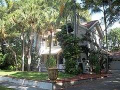
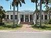
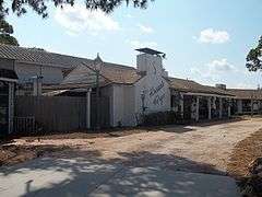
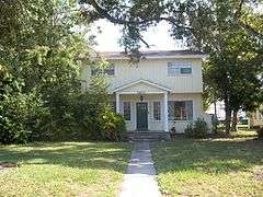
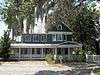
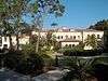
| 1 |
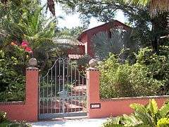
Austin HouseW |
|
000000001998-02-05-0000February 5, 1998
(#98000062) |
227 Delmar Avenue
27°24′16″N 82°34′14″W / 27.404444°N 82.570556°W / 27.404444; -82.570556 (Austin House) |
Sarasota |
Part of the Whitfield Estates Subdivision MPS
|
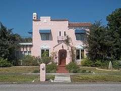
| 2 |
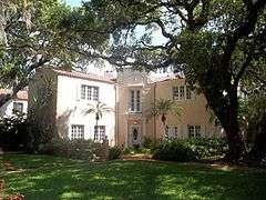
John M. Beasley HouseW |
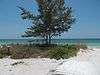
|
000000001996-03-05-0000March 5, 1996
(#96000358) |
7706 Westmoreland Drive
27°24′12″N 82°34′16″W / 27.403333°N 82.571111°W / 27.403333; -82.571111 (John M. Beasley House) |
Sarasota |
Part of the Whitfield Estates Subdivision MPS
|
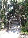
| 3 |
Braden Castle Park Historic District |
|
000000001983-05-09-0000May 9, 1983
(#83001428) |
Roughly bounded by the Manatee and Braden Rivers, Ponce DeLeon Street, and Pelot Avenue
27°29′56″N 82°31′49″W / 27.498889°N 82.530278°W / 27.498889; -82.530278 (Braden Castle Park Historic District) |
Bradenton |
|
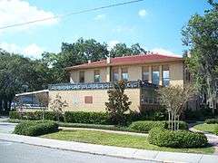
| 4 |
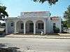
Bradenton Carnegie Library |
|
000000001987-04-09-0000April 9, 1987
(#87000616) |
1405 Fourth Avenue, W.
27°29′46″N 82°34′33″W / 27.496111°N 82.575833°W / 27.496111; -82.575833 (Bradenton Carnegie Library) |
Bradenton |
|
| 5 |
Cortez Historic District |
|
000000001995-03-16-0000March 16, 1995
(#95000250) |
Bounded by Cortez Road, 119th Street, W., Sarasota Bay, and 124th Street Court, W.
27°28′03″N 82°41′02″W / 27.4675°N 82.683889°W / 27.4675; -82.683889 (Cortez Historic District) |
Cortez |
|
| 6 |
Curry Houses Historic District |
Upload image |
000000002015-09-08-0000September 8, 2015
(#15000571) |
4th Ave. E. between 12th & 14th Sts. E.
27°29′47″N 82°33′00″W / 27.4963°N 82.55°W / 27.4963; -82.55 (Curry Houses Historic District) |
Bradenton |
|
| 7 |
De Soto National Memorial |
|
000000001966-10-15-0000October 15, 1966
(#66000078) |
5 miles (8.0 km) west of Bradenton
27°31′25″N 82°38′35″W / 27.523611°N 82.643056°W / 27.523611; -82.643056 (De Soto National Memorial) |
Bradenton |
Operated by the National Park Service, the site commemorates the landing in 1539 of Spaniard Hernando de Soto's expeditionary force in the Tampa Bay vicinity, at the start of the first major European exploratory venture in what is now the Southeastern United States.
|
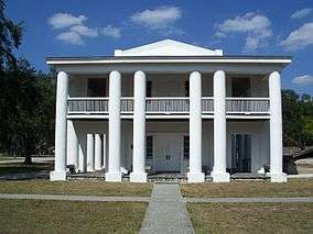
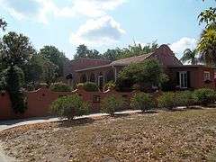
| 8 |
Robert Gamble House |
|
000000001970-08-12-0000August 12, 1970
(#70000189) |
On U.S. Route 301
27°31′21″N 82°31′36″W / 27.5225°N 82.526667°W / 27.5225; -82.526667 (Robert Gamble House) |
Ellenton |
Greek Revival vernacular style, known as the Gamble Mansion, built of tabby concrete circa 1850, on a sugar cane plantation close to the Manatee River. Preserved since the 1920s, it is open to the public as an Historic State Park. Unusual feature is an in-ground, covered cistern; there are ruins of a large brick sugarmill a half-mile to the north. The home is of historic interest as a place of refuge for Confederate cabinet official Judah P. Benjamin, who escaped the U.S. from here after the C.S.A. was defeated in 1865. Also on the property is the c1872 Patten House.
|
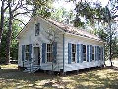
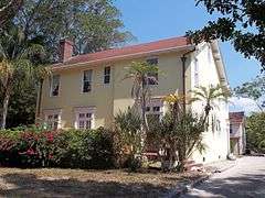
| 9 |
Johnson Helm House |
|
000000002009-09-02-0000September 2, 2009
(#09000671) |
2104 53rd Avenue, East, SR 70
27°26′51″N 82°32′17″W / 27.4475°N 82.538056°W / 27.4475; -82.538056 (Johnson Helm House) |
Oneco |
|
| 10 |
Rufus P. Jordan House |
|
000000002005-08-12-0000August 12, 2005
(#05000844) |
760 Broadway Street
27°26′16″N 82°40′55″W / 27.437778°N 82.681944°W / 27.437778; -82.681944 (Rufus P. Jordan House) |
Longboat Key |
|
| 11 |
Kreissle Forge |
|
000000001996-12-02-0000December 2, 1996
(#96001370) |
7947 Tamiami Trail
27°24′02″N 82°33′54″W / 27.400556°N 82.565°W / 27.400556; -82.565 (Kreissle Forge) |
Sarasota |
|
| 12 |
Madira Bickel Mounds |
|
000000001970-08-12-0000August 12, 1970
(#70000190) |
Address Restricted
27°33′55″N 82°35′34″W / 27.565176°N 82.592825°W / 27.565176; -82.592825 (Madira Bickel Mounds) |
Terra Ceia |
Native American ceremonial mound revealing three periods of occupation beginning 2,000 years ago. Now a state archaeological site.[6]
|
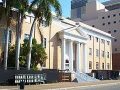
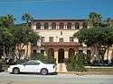
| 13 |
Manatee County Courthouse |
|
000000001998-06-11-0000June 11, 1998
(#98000676) |
1115 Manatee Avenue West
27°29′39″N 82°34′23″W / 27.494167°N 82.573056°W / 27.494167; -82.573056 (Manatee County Courthouse) |
Bradenton |
|
| 14 |
Old Manatee County Courthouse |
|
000000001976-06-29-0000June 29, 1976
(#76000601) |
Manatee Avenue and 15th Street, East
27°29′39″N 82°32′52″W / 27.494167°N 82.547778°W / 27.494167; -82.547778 (Old Manatee County Courthouse) |
Bradenton |
|
| 15 |
Midway Subdivision Historic District |
|
000000001998-05-29-0000May 29, 1998
(#98000587) |
7201 15th Street, E.
27°24′39″N 82°32′45″W / 27.410833°N 82.545833°W / 27.410833; -82.545833 (Midway Subdivision Historic District) |
Sarasota |
|
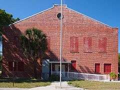
| 16 |
Palmetto Armory |
|
000000002012-10-17-0000October 17, 2012
(#12000865) |
810 6th St., W.
27°31′00″N 82°34′27″W / 27.51666°N 82.5741°W / 27.51666; -82.5741 (Palmetto Armory) |
Palmetto |
|
| 17 |
Palmetto Historic District |
|
000000001986-11-06-0000November 6, 1986
(#86003166) |
Roughly bounded by Twenty-first Avenue, Seventh Street, Fifth Avenue, and the Manatee River
27°30′53″N 82°34′41″W / 27.514722°N 82.578056°W / 27.514722; -82.578056 (Palmetto Historic District) |
Palmetto |
|
| 18 |
Portavant Mound Site |
|
000000001994-12-23-0000December 23, 1994
(#94001475) |
Address Restricted
27°31′52″N 82°37′36″W / 27.531131°N 82.626548°W / 27.531131; -82.626548 (Portavant Mound Site) |
Palmetto |
1200-year-old Native American temple mound—the largest in southwest Florida—and midden complex. Now part of a county park.[7]
|
| 19 |
Egbert Reasoner House |
|
000000001995-05-04-0000May 4, 1995
(#95000555) |
3004 53rd Avenue East
27°26′48″N 82°31′34″W / 27.446667°N 82.526111°W / 27.446667; -82.526111 (Egbert Reasoner House) |
Oneco |
|
| 20 |
Regina Shipwreck Site |
|
000000002005-12-06-0000December 6, 2005
(#05001355) |
Offshore of Bradenton Beach
27°28′15″N 82°42′10″W / 27.470833°N 82.702778°W / 27.470833; -82.702778 (Regina Shipwreck Site) |
Bradenton Beach |
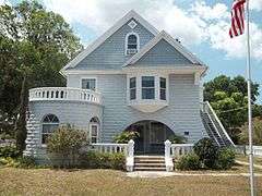
|
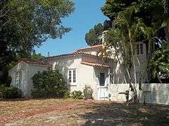
| 21 |
Reid-Woods HouseW |
|
000000002000-08-31-0000August 31, 2000
(#00001033) |
373 Whitfield Avenue, Whitfield Estates
27°24′45″N 82°34′06″W / 27.4125°N 82.568333°W / 27.4125; -82.568333 (Reid-Woods House) |
Sarasota |
Part of the Whitfield Estates Subdivision MPS
|
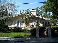
| 22 |
Richardson House |
|
000000002003-01-08-0000January 8, 2003
(#02001676) |
1603 1st Avenue, W.
27°29′54″N 82°34′42″W / 27.498333°N 82.578333°W / 27.498333; -82.578333 (Richardson House) |
Bradenton |
|
| 23 |
Seagate |
|
000000001983-01-21-0000January 21, 1983
(#83001429) |
6565 North Tamiami Trail
27°23′29″N 82°33′52″W / 27.391389°N 82.564444°W / 27.391389; -82.564444 (Seagate) |
Sarasota |
|
| 24 |
Shaw's Point Archeological District |
|
000000002001-04-06-0000April 6, 2001
(#01000342) |
Address Restricted
|
Bradenton |
|
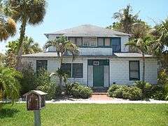
| 25 |
Paul M. Souder HouseW |
|
000000002000-11-02-0000November 2, 2000
(#00001282) |
242 Greenwood Avenue
27°24′18″N 82°34′11″W / 27.405°N 82.569722°W / 27.405; -82.569722 (Paul M. Souder House) |
Sarasota |
Part of the Whitfield Estates Subdivision MPS
|
| 26 |
Stevens-Gilchrist HouseW |
|
000000002001-08-17-0000August 17, 2001
(#01000887) |
235 Delmar Avenue
27°24′13″N 82°34′13″W / 27.403611°N 82.570278°W / 27.403611; -82.570278 (Stevens-Gilchrist House) |
Sarasota |
Part of the Whitfield Estates Subdivision MPS
|
| 27 |
Terra Ceia Village Improvement Association Hall |
|
000000002003-09-16-0000September 16, 2003
(#03000942) |
1505 Center Road
27°34′22″N 82°34′54″W / 27.572778°N 82.581667°W / 27.572778; -82.581667 (Terra Ceia Village Improvement Association Hall) |
Terra Ceia |
Part of the Clubhouses of Florida's Woman's Clubs MPS
|
| 28 |
Villa Serena ApartmentsW |
|
000000002000-09-29-0000September 29, 2000
(#00001172) |
7014 Willow Street
27°24′55″N 82°34′07″W / 27.415278°N 82.568611°W / 27.415278; -82.568611 (Villa Serena Apartments) |
Sarasota |
Part of the Whitfield Estates Subdivision MPS
|
| 29 |
Whitfield Estates-Lantana Avenue Historic DistrictW |
|
000000001997-03-08-0000March 8, 1997
(#97000209) |
332-336 Lantana Avenue
27°24′47″N 82°34′10″W / 27.413056°N 82.569444°W / 27.413056; -82.569444 (Whitfield Estates-Lantana Avenue Historic District) |
Sarasota |
Part of the Whitfield Estates Subdivision MPS
|
| 30 |
Whitfield Estates-Broughton Street Historic DistrictW |
|
000000001993-10-29-0000October 29, 1993
(#93001159) |
7207, 7211, 7215, 7219, and 7316 Broughton Street
27°24′18″N 82°34′12″W / 27.405°N 82.57°W / 27.405; -82.57 (Whitfield Estates-Broughton Street Historic District) |
Sarasota |
|
| 31 |
Woman's Club of Palmetto |
|
000000001986-03-06-0000March 6, 1986
(#86000380) |
910 Sixth Street, W.
27°30′59″N 82°34′29″W / 27.516389°N 82.574722°W / 27.516389; -82.574722 (Woman's Club of Palmetto) |
Palmetto |
|