Masaka–Villa Maria–Bukomansimbi–Sembabule Road
| Masaka–Villa Maria–Bukomansimbi–Sembabule Road | |
|---|---|
| Route information | |
| Length: | 30 mi (50 km) |
| Major junctions | |
| South end: | Nyendo |
| Villa Maria | |
| North end: | Sembabule |
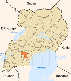
Masaka–Villa Maria–Bukomansimbi–Sembabule Road also Nyendo–Villa Maria–Bukomansimbi–Sembabule Road, is a road in the Central Region of Uganda, connecting the towns of Masaka in Masaka District, Villa Maria in Kalungu District, Bukomansimbi in Bukomansimbi District to Sembabule in Sembabule District.
Location
The road starts at Nyendo, a neighborhood in the city of Masaka and ends in the town of Sembabule, a total distance of about 48 kilometres (30 mi).[1]
Overview
This road is the principal transport corridor between the districts of Masaka, Kalungu, Bukomansimbi and Sembabule.[2] The road is under the jurisdiction of the Uganda National Roads Authority.[3]
Upgrading to bitumen
After many years of being included in the annual budget speeches without action, work to upgrade the gravel road to class 2 bitumen finally began in February 2015. Construction work was contracted to the China Railway Number 3 Engineering Group Company Limited at a cost of UGX:239 billion.[4] The Villa Maria–Bukomansimbi–Sembabule section, measuring 38 kilometres (24 mi),[5] is part of the 110 kilometres (68 mi) Kanoni–Kabulasoke–Sembabule–Villa Maria Road.[6] The 11 kilometres (7 mi) Masaka–Villa Maria section[7] remains gravel surfaced.
See also
References
- ↑ Globefeed.com (4 August 2016). "Distance between Villa Road, Masaka, Central Region, Uganda and Rainbow Motel (Sembabule), Sembabule, Central Region, Uganda". Glbefeed.com. Retrieved 4 August 2016.
- ↑ Sadab Kitatta Kaaya (11 November 2012). "MPs to call demos over poor roads". The Observer (Uganda). Kampala. Retrieved 4 August 2015.
- ↑ Mambule, Ali (1 May 2015). "UNRA to build flyover at black spot in Masaka". Daily Monitor. Kampala. Retrieved 4 August 2016.
- ↑ Bindhe, Edward. "Construction of Villa-Sembabule Highway Finally Starts". Kampala: Uganda Radio Network. Retrieved 25 February 2015.
- ↑ Globefeed.com (4 August 2016). "Distance between Bukalasa Minor Seminary, Villa Road, Kalungu, Central Region, Uganda and Rainbow Motel (Sembabule), Sembabule, Central Region, Uganda". Globefeed.com. Retrieved 4 August 2016.
- ↑ Kobusingye, Sarah (24 February 2015). "Sembabule District To Finally Connect With The Rest of Uganda". Galaxy FM Radio. Retrieved 4 August 2016.
- ↑ Globefeed.com (4 August 2016). "Distance between Villa Road, Masaka, Central Region, Uganda and Bukalasa Minor Seminary, Villa Road, Kalungu, Central Region, Uganda". Globefeed.com. Retrieved 4 August 2016.
External links
Coordinates: 00°07′34″S 31°33′22″E / 0.12611°S 31.55611°E
