| [3] |
Name on the Register |
Image |
Date listed[4] |
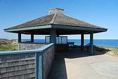
Location |
City or town |
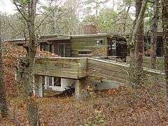
Description |
|---|
| 1 |
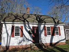
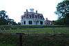
Ahearn House and Summer House |
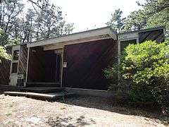
|
000000001984-11-21-0000November 21, 1984
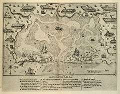
(#84000575) |
Pamet Point Rd.
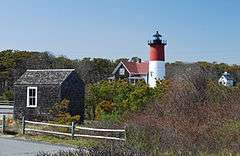
41°57′33″N 70°02′42″W / 41.9592°N 70.045°W / 41.9592; -70.045 (Ahearn House and Summer House) |
Wellfleet |
|
| 2 |
Atwood-Higgins Historic District |
|
000000002010-07-28-0000July 28, 2010
(#10000508) |
Bound Brook Island Rd.
41°57′12″N 70°03′26″W / 41.9533°N 70.0572°W / 41.9533; -70.0572 (Atwood-Higgins Historic District) |
Wellfleet |
Expansion of an earlier listing of the Thomas Atwood House.
|
| 3 |
Fort Hill Rural Historic District |
|
000000002001-04-05-0000April 5, 2001
(#00001656) |
Fort Hill Rd, Cape Cod National Seashore
41°49′10″N 69°57′56″W / 41.8194°N 69.9656°W / 41.8194; -69.9656 (Fort Hill Rural Historic District) |
Eastham |
|
| 4 |
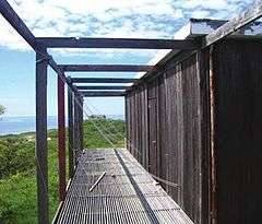
The Beacon |
|
000000001987-06-15-0000June 15, 1987
(#87001527) |
Off Cable Rd.
41°50′42″N 69°57′36″W / 41.845°N 69.96°W / 41.845; -69.96 (The Beacon) |
Eastham |
The longest-used of the Three Sisters of Nauset. The other two are listed separately (see Three Sisters of Nauset (Twin Lights) below); the three decommissioned lighthouses have since been reunited.
|
| 5 |
French Cable Hut |
|
000000001976-04-22-0000April 22, 1976
(#76000153) |
East of North Eastham at the junction of Cable Rd. and Ocean View Dr.
41°51′34″N 69°57′07″W / 41.8594°N 69.9519°W / 41.8594; -69.9519 (French Cable Hut) |
North Eastham |
|
| 6 |
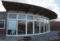
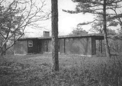
Ruth and Robert Hatch, Jr., House |
|
000000002014-02-25-0000February 25, 2014
(#14000018) |
309 Bound Brook Way
41°57′21″N 70°04′29″W / 41.955969°N 70.074643°W / 41.955969; -70.074643 (Ruth and Robert Hatch, Jr., House) |
Wellfleet |
Mid 20th Century Modern Residential Architecture on Outer Cape Cod MPS
|
| 7 |
Jedediah Higgins House |
|
000000001984-11-21-0000November 21, 1984
(#84000550) |
Higgins Hollow Rd.
42°00′35″N 70°03′06″W / 42.0097°N 70.0517°W / 42.0097; -70.0517 (Jedediah Higgins House) |
North Truro |
|
| 8 |
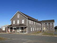
Highland House |
|
000000001975-06-05-0000June 5, 1975
(#75000157) |
Off U.S. Route 6 on Cape Cod National Seashore
42°02′25″N 70°03′56″W / 42.0403°N 70.0656°W / 42.0403; -70.0656 (Highland House) |
Truro |
|
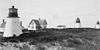
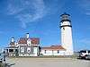
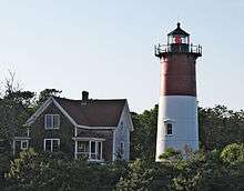
| 9 |
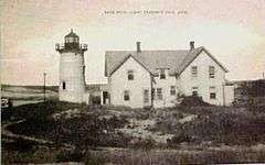
Highland Light Station |
|
000000001987-06-15-0000June 15, 1987
(#87001463) |
Off U.S. Route 6
42°02′48″N 70°04′10″W / 42.046667°N 70.069444°W / 42.046667; -70.069444 (Highland Light Station) |
Truro |
|
| 10 |
Peter Kugel House |
|
000000002014-02-25-0000February 25, 2014
(#14000019) |
188 Long Pond Rd.
41°56′40″N 69°59′53″W / 41.944321°N 69.998033°W / 41.944321; -69.998033 (Peter Kugel House) |
Wellfleet |
Mid 20th Century Modern Residential Architecture on Outer Cape Cod MPS
|
| 11 |
Samuel and Minette Kuhn House |
|
000000002014-02-25-0000February 25, 2014
(#14000020) |
420 Griffins Island Rd.
41°56′45″N 70°04′06″W / 41.945744°N 70.068283°W / 41.945744; -70.068283 (Samuel and Minette Kuhn House) |
Wellfleet |
Mid 20th Century Modern Residential Architecture on Outer Cape Cod MPS
|
| 12 |
Marconi Wireless Station Site |
|
000000001975-05-02-0000May 2, 1975
(#75000158) |
1 mile northeast of Cape Cod National Seashore
41°54′50″N 69°58′20″W / 41.9139°N 69.9722°W / 41.9139; -69.9722 (Marconi Wireless Station Site) |
South Wellfleet |
|
| 13 |
Nauset Archeological District |
|
000000001993-04-19-0000April 19, 1993
(#93000607) |
Fort Hill Road area
41°49′08″N 69°57′46″W / 41.8189°N 69.9629°W / 41.8189; -69.9629 (Nauset Archeological District) |
Eastham |
|
| 14 |
Nauset Beach Light |
|
000000001987-06-15-0000June 15, 1987
(#87001484) |
Nauset Beach
41°51′15″N 69°57′06″W / 41.8542°N 69.9517°W / 41.8542; -69.9517 (Nauset Beach Light) |
Eastham |
|
| 15 |
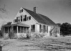
John Newcomb House |
|
000000001988-09-15-0000September 15, 1988
(#88001457) |
near Williams Pond
41°57′53″N 70°00′23″W / 41.9647°N 70.0064°W / 41.9647; -70.0064 (John Newcomb House) |
Wellfleet |
Also known as Thoreau's "House of the Wellfleet Oysterman"
|
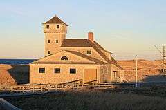
| 16 |
Old Harbor U.S. Life Saving Station |
|
000000001975-08-18-0000August 18, 1975
(#75000159) |
Northeast of Chatham on Nauset Beach
41°41′52″N 69°55′46″W / 41.6978°N 69.9294°W / 41.6978; -69.9294 (Old Harbor U.S. Life Saving Station) |
Chatham |
|
| 17 |
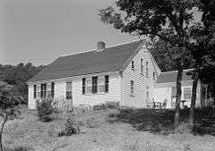
Edward Penniman House and Barn |
|
000000001976-05-28-0000May 28, 1976
(#76000155) |
South of Eastham at Fort Hill and Governor Prence Rds.
41°49′07″N 69°57′57″W / 41.8185°N 69.9657°W / 41.8185; -69.9657 (Edward Penniman House and Barn) |
Eastham |
|
| 18 |
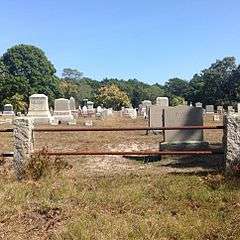
Pine Grove Cemetery |
|
000000002013-03-20-0000March 20, 2013
(#13000096) |
Cemetery Rd.
41°58′34″N 70°03′34″W / 41.975987°N 70.059435°W / 41.975987; -70.059435 (Pine Grove Cemetery) |
Truro |
|
| 19 |
Race Point Light Station |
|
000000001987-06-15-0000June 15, 1987
(#87001482) |
Race Point Beach
42°03′40″N 70°14′33″W / 42.0611°N 70.2425°W / 42.0611; -70.2425 (Race Point Light Station) |
Provincetown |
|
| 20 |
Anthony and Allison Sirna Studio |
|
000000002014-02-25-0000February 25, 2014
(#14000021) |
60 Way #4
41°57′29″N 69°59′38″W / 41.958045°N 69.99397°W / 41.958045; -69.99397 (Anthony and Allison Sirna Studio) |
Wellfleet |
Mid 20th Century Modern Residential Architecture on Outer Cape Cod MPS
|
| 21 |
Samuel Smith Tavern Site |
|
000000001977-11-11-0000November 11, 1977
(#77000108) |
Great Island
41°55′12″N 70°03′26″W / 41.919906°N 70.05711°W / 41.919906; -70.05711 (Samuel Smith Tavern Site) |
Wellfleet |
17th century tavern site accessible via Great Island Trail
|
| 22 |
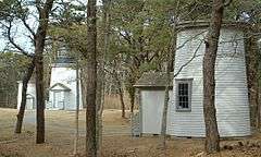
Three Sisters of Nauset (Twin Lights) |
|
000000001987-06-15-0000June 15, 1987
(#87001502) |
Off Cable Rd.
41°50′42″N 69°57′36″W / 41.845°N 69.96°W / 41.845; -69.96 (Three Sisters of Nauset (Twin Lights)) |
Eastham |
Two of the three decommissioned lighthouses of the Three Sisters of Nauset; The Beacon (listed separately) is the third. At the time of their nomination, these two lights were separate from The Beacon; they have since been reunited.
|
| 23 |
Vera and Laszlo Tisza House |
|
000000002014-02-25-0000February 25, 2014
(#14000022) |
2 Deer Trail
41°57′36″N 69°59′55″W / 41.960074°N 69.998642°W / 41.960074; -69.998642 (Vera and Laszlo Tisza House) |
Wellfleet |
Mid 20th Century Modern Residential Architecture on Outer Cape Cod MPS
|
| 24 |
Truro Highlands Historic District |
|
000000002011-11-22-0000November 22, 2011
(#11000823) |
Highland Light Rd.
42°02′22″N 70°03′44″W / 42.039342°N 70.062253°W / 42.039342; -70.062253 (Truro Highlands Historic District) |
Truro |
Includes Highland Light, Highland House, and other buildings along Highland Light Road.
|
| 25 |
Paul and Madeleine Weidlinger House |
|
000000002014-02-25-0000February 25, 2014
(#14000023) |
54 Valley Rd.
41°57′36″N 70°00′24″W / 41.960013°N 70.006628°W / 41.960013; -70.006628 (Paul and Madeleine Weidlinger House) |
Wellfleet |
Mid 20th Century Modern Residential Architecture on Outer Cape Cod MPS |