| [3] |
Name on the Register[4] |
Image |
Date listed[5] |
Location |
City or town |
Description |
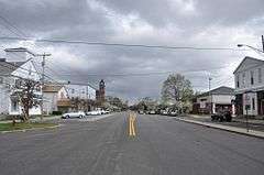
|---|
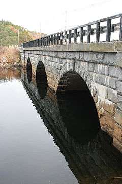
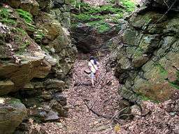
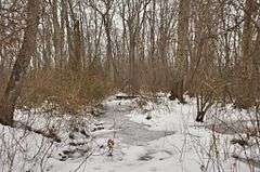
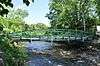
| 1 |
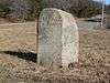
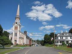
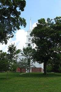
1767 Milestones |
|
000000001971-04-07-0000April 7, 1971
(#71000084) |
Between Boston and Springfield along the old Upper Boston Post Road.
42°17′35″N 71°44′58″W / 42.2931°N 71.7494°W / 42.2931; -71.7494 (1767 Milestones) |
Brookfield, East Brookfield, Leicester, Northborough, Shrewsbury, Spencer, Warren, and West Brookfield |
Also includes markers located in Worcester, as well as Hampden, Middlesex, Norfolk, and Suffolk Counties.
|
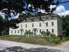
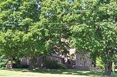
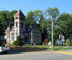
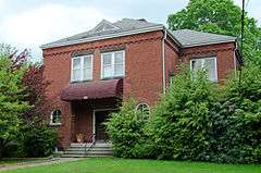
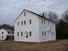
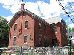
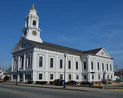
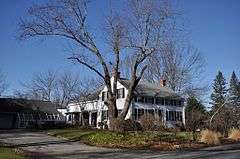
| 2 |
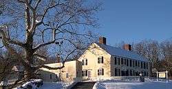
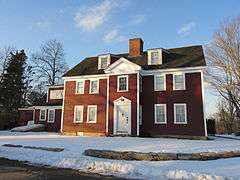
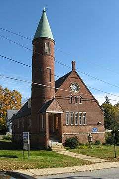
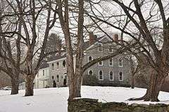
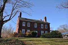
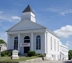
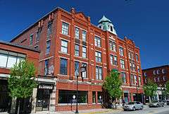
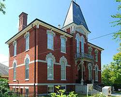
Nathan C. Aldrich House and Resthaven Chapel |
|
000000002006-05-17-0000May 17, 2006
(#06000399) |
111 Providence St.
42°05′13″N 71°31′57″W / 42.0869°N 71.5325°W / 42.0869; -71.5325 (Nathan C. Aldrich House and Resthaven Chapel) |
Mendon |
|
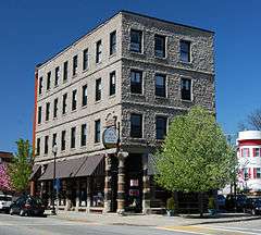
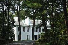
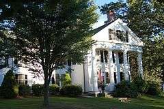
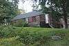
| 3 |
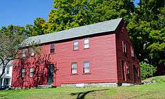
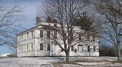
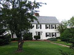
Ethan Allen House and Gun Shop |
|
000000001995-10-12-0000October 12, 1995
(#95001167) |
37 Waterville St.
42°14′14″N 71°42′23″W / 42.2372°N 71.7064°W / 42.2372; -71.7064 (Ethan Allen House and Gun Shop) |
Grafton |
|
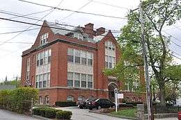
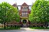
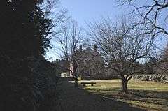
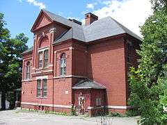
| 4 |
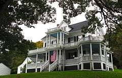
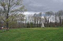
Bancroft Memorial Library |
|
000000001999-02-12-0000February 12, 1999
(#99000188) |
50 Hopedale St.
42°07′49″N 71°32′30″W / 42.130278°N 71.541667°W / 42.130278; -71.541667 (Bancroft Memorial Library) |
Hopedale |
|
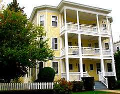
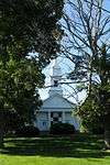
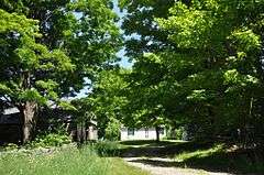
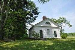
| 5 |
Barlin Acres |
Upload image |
000000001982-11-26-0000November 26, 1982
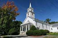
(#82000487) |
284 School St.
42°20′04″N 71°43′22″W / 42.3344°N 71.7228°W / 42.3344; -71.7228 (Barlin Acres) |
Boylston |
Now occupied by a golf course; historic photo needed.
|
| 6 |
Barnes-Hill House |
|
000000002016-01-26-0000January 26, 2016
(#15001007) |
12 N. Brookfield Rd.
42°15′41″N 72°00′50″W / 42.2613°N 72.0139°W / 42.2613; -72.0139 (Barnes-Hill House) |
Spencer |
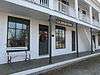
|
| 7 |
Barre Common District |
|
000000001976-05-04-0000May 4, 1976
(#76000298) |
Bounded roughly by South, Exchange, Main, Pleasant, Broad, School and Grove Sts.
42°25′20″N 72°06′20″W / 42.4222°N 72.1056°W / 42.4222; -72.1056 (Barre Common District) |
Barre |
|
| 8 |
Bartlett's Bridge |
|
000000002000-02-10-0000February 10, 2000
(#00000077) |
Clara Barton Rd. over the French River
42°09′17″N 71°52′59″W / 42.1547°N 71.8831°W / 42.1547; -71.8831 (Bartlett's Bridge) |
Oxford |
|
| 9 |
Clara Barton Homestead |
|
000000001977-09-22-0000September 22, 1977
(#77000202) |
3 mi (4.8 km) west of Oxford on Clara Barton Rd.
42°09′12″N 71°53′45″W / 42.1533°N 71.8958°W / 42.1533; -71.8958 (Clara Barton Homestead) |
Oxford |
|
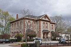
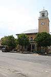
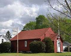
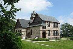
| 10 |
Beaman Memorial Public Library |
|
000000002016-05-16-0000May 16, 2016
(#16000251) |
8 Newton St.
42°21′54″N 71°46′59″W / 42.365057°N 71.783178°W / 42.365057; -71.783178 (Beaman Memorial Public Library) |
West Boylston |
|
| 11 |
Berlin Town Hall |
|
000000002011-09-15-0000September 15, 2011
(#11000663) |
12 Woodward Ave.
42°22′55″N 71°38′13″W / 42.3819°N 71.6369°W / 42.3819; -71.6369 (Berlin Town Hall) |
Berlin |
|
| 12 |
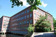
Bigelow Carpet Company Woolen Mills |
|
000000001983-10-06-0000October 6, 1983
(#83004107) |
Main St.
42°25′01″N 71°41′26″W / 42.4169°N 71.6906°W / 42.4169; -71.6906 (Bigelow Carpet Company Woolen Mills) |
Clinton |
|
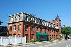
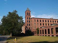
| 13 |
Bigelow Carpet Mill |
|
000000001978-12-22-0000December 22, 1978
(#78000467) |
Union and High Sts.
42°24′55″N 71°41′10″W / 42.4153°N 71.6861°W / 42.4153; -71.6861 (Bigelow Carpet Mill) |
Clinton |
|
| 14 |
Bigelow Tavern Historic District |
|
000000001992-09-24-0000September 24, 1992
(#92000043) |
60, 64 and 65 Worcester St.
42°21′55″N 71°46′55″W / 42.3653°N 71.7819°W / 42.3653; -71.7819 (Bigelow Tavern Historic District) |
West Boylston |
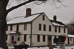
|
| 15 |
Black Tavern |
|
000000001985-05-09-0000May 9, 1985
(#85000981) |
140, 142 Dudley Center Rd.
42°02′45″N 71°55′47″W / 42.0458°N 71.9297°W / 42.0458; -71.9297 (Black Tavern) |
Dudley |
|
| 16 |
Blackstone Canal Historic District |
|
000000001995-08-15-0000August 15, 1995
(#73000328) |
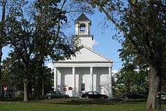
Blackstone to Worcester, Massachusetts
41°56′30″N 71°27′50″W / 41.9417°N 71.464°W / 41.9417; -71.464 (Blackstone Canal Historic District) |
Blackstone, Grafton, Millbury, Millville, Northbridge, and Sutton |
Initial listing was for 3.5 mile section of canal in Northbridge and Uxbridge; expanded to include entire length in Massachusetts in 1995 (#95001004).
|
| 17 |
Blackstone Manufacturing Company Historic District |
|
000000001995-08-25-0000August 25, 1995
(#95001038) |
Roughly the area surrounding Butler, Canal, Church, County, Ives, Main, Mendon, Old Mendon, and School Sts.
42°00′58″N 71°32′41″W / 42.0161°N 71.5447°W / 42.0161; -71.5447 (Blackstone Manufacturing Company Historic District) |
Blackstone |
|
| 18 |
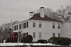
Blackstone Viaduct |
Upload image |
000000002002-02-05-0000February 5, 2002
(#01001558) |
Canal, Farnum and Mill Sts.
42°00′55″N 71°32′00″W / 42.015278°N 71.533333°W / 42.015278; -71.533333 (Blackstone Viaduct) |
Blackstone |
|
| 19 |
Bolton Center Historic District |
|
000000001997-11-17-0000November 17, 1997
(#97001296) |
Roughly along Main St. between Harvard Rd. and Interstate 495
42°26′07″N 71°36′35″W / 42.435278°N 71.609722°W / 42.435278; -71.609722 (Bolton Center Historic District) |
Bolton |
|
| 20 |
Bowers School |
|
000000001983-11-10-0000November 10, 1983
(#83004108) |
411 Water St.
42°25′09″N 71°40′18″W / 42.419167°N 71.671667°W / 42.419167; -71.671667 (Bowers School) |
Clinton |
|
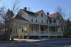
| 21 |
J.D.C. Bradley House |
|
000000001999-02-26-0000February 26, 1999
(#99000260) |
5 Sadie Hutt Lane
42°18′59″N 71°32′34″W / 42.3164°N 71.5428°W / 42.3164; -71.5428 (J.D.C. Bradley House) |
Southborough |
Register listing is at 60 Sears Rd.
|
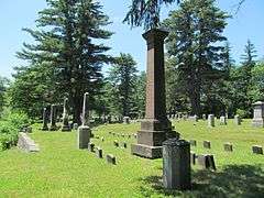
| 22 |
Brookfield Cemetery |
|
000000002003-05-09-0000May 9, 2003
(#03000384) |
Main St.
42°13′02″N 72°06′49″W / 42.217222°N 72.113611°W / 42.217222; -72.113611 (Brookfield Cemetery) |
Brookfield |
|
| 23 |
Brookfield Common Historic District |
|
000000001990-02-23-0000February 23, 1990
(#90000161) |
Roughly Howard, Sherman, Prouty, W. Main, Main, and Upper River Sts.
42°12′51″N 72°06′09″W / 42.214167°N 72.1025°W / 42.214167; -72.1025 (Brookfield Common Historic District) |
Brookfield |
|
| 24 |
Brown-Davis-Frost Farm |
|
000000001995-12-13-0000December 13, 1995
(#95001444) |
17 Whitney St.
42°22′29″N 71°53′19″W / 42.3747°N 71.8886°W / 42.3747; -71.8886 (Brown-Davis-Frost Farm) |
Jefferson |
|
| 25 |
Bullard House |
|
000000002011-09-15-0000September 15, 2011
(#11000664) |
4 Woodward Ave.
42°22′54″N 71°38′14″W / 42.381667°N 71.637222°W / 42.381667; -71.637222 (Bullard House) |
Berlin |
|
| 26 |
Camp Atwater |
|
000000001982-04-15-0000April 15, 1982
(#82004477) |
Shore Rd.
42°14′22″N 72°03′00″W / 42.2394°N 72.05°W / 42.2394; -72.05 (Camp Atwater) |
North Brookfield |
|
| 27 |
Cedar Swamp Archeological District |
|
000000001988-05-23-0000May 23, 1988
(#88000587) |
Along the border with Hopkinton in Middlesex County[6]
42°15′36″N 71°35′06″W / 42.26°N 71.585°W / 42.26; -71.585 (Cedar Swamp Archeological District) |
Westborough |
Extends into Hopkinton, Middlesex County
|
| 28 |
Central Street Historic District |
|
000000002003-06-20-0000June 20, 2003
(#03000550) |
Roughly bounded by Central, Quaker, West, Chesley, Bow, Prospect, and Fletcher Sts.
42°01′29″N 71°34′57″W / 42.02467°N 71.582623°W / 42.02467; -71.582623 (Central Street Historic District) |
Millville |
|
| 29 |
Charlton Center Historic District |
|
000000001995-10-20-0000October 20, 1995
(#95001227) |
Roughly Main St. from Mugget Hill Rd. to Masonic Home Rd. and adjacent roads
42°08′02″N 71°58′09″W / 42.133889°N 71.969167°W / 42.133889; -71.969167 (Charlton Center Historic District) |
Charlton |
|
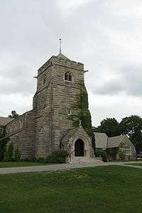
| 30 |
Chestnut Hill Meetinghouse |
|
000000001984-11-13-0000November 13, 1984
(#84000434) |
Chestnut and Thayer Sts.
42°02′27″N 71°34′58″W / 42.040833°N 71.582778°W / 42.040833; -71.582778 (Chestnut Hill Meetinghouse) |
Millville |
|
| 31 |
George Clapp House |
|
000000001997-08-21-0000August 21, 1997
(#97000919) |
44 North St.
42°12′43″N 71°40′51″W / 42.211944°N 71.680833°W / 42.211944; -71.680833 (George Clapp House) |
Grafton |
|
| 32 |
Corcoran School |
|
000000002000-02-04-0000February 4, 2000
(#00000039) |
40 Walnut St.
42°25′00″N 71°41′03″W / 42.416667°N 71.684167°W / 42.416667; -71.684167 (Corcoran School) |
Clinton |
|
| 33 |
Crossman Bridge |
|
000000002010-12-27-0000December 27, 2010
(#10001065) |
Gilbert Rd. over Quaboag River
42°12′37″N 72°14′44″W / 42.210278°N 72.245556°W / 42.210278; -72.245556 (Crossman Bridge) |
Warren |
|
| 34 |
Dana Common Historic and Archaeological District |
|
000000002013-03-04-0000March 4, 2013
(#13000052) |
Gate 40 off Hardwick Rd.
42°26′57″N 72°12′24″W / 42.449048°N 72.206619°W / 42.449048; -72.206619 (Dana Common Historic and Archaeological District) |
Petersham |
|
| 35 |
District Five Schoolhouse |
|
000000001991-06-05-0000June 5, 1991
(#91000697) |
School St. between Boyden and 1st Sts.
42°02′34″N 71°52′58″W / 42.0428°N 71.8828°W / 42.0428; -71.8828 (District Five Schoolhouse) |
Webster |
Now houses the Dudley-Webster Historical Society.
|
| 36 |
District No. 4 School |
|
000000002016-10-11-0000October 11, 2016
(#16000713) |
191 East St.
42°29′18″N 72°09′10″W / 42.488405°N 72.152903°W / 42.488405; -72.152903 (District No. 4 School) |
Petersham |
|
| 37 |
District No. 5 School |
|
000000002016-07-18-0000July 18, 2016
(#16000455) |
311 East St.
42°29′06″N 72°07′59″W / 42.485047°N 72.132921°W / 42.485047; -72.132921 (District No. 5 School) |
Petersham |
|
| 38 |
District No. 5 School |
|
000000002013-08-27-0000August 27, 2013
(#13000622) |
2 Old Mill Rd.
42°17′29″N 71°44′29″W / 42.291342°N 71.741323°W / 42.291342; -71.741323 (District No. 5 School) |
Shrewsbury |
|
| 39 |
Downtown Clinton Historic District |
|
000000001985-02-21-0000February 21, 1985
(#85000319) |
Roughly bounded by Union and Prospects Sts. on High and Church Sts.
42°25′02″N 71°40′59″W / 42.417222°N 71.683056°W / 42.417222; -71.683056 (Downtown Clinton Historic District) |
Clinton |
|
| 40 |
Eagleville Historic District |
|
000000002010-09-24-0000September 24, 2010
(#10000786) |
Main St., Princeton St., High St
42°21′35″N 71°52′55″W / 42.3597°N 71.8819°W / 42.3597; -71.8819 (Eagleville Historic District) |
Holden |
|
| 41 |
East Blackstone Friends Meetinghouse |
|
000000001995-08-22-0000August 22, 1995
(#95001035) |
197 Elm St.
42°03′09″N 71°31′23″W / 42.0525°N 71.523056°W / 42.0525; -71.523056 (East Blackstone Friends Meetinghouse) |
Blackstone |
|
| 42 |
East Blackstone Village Historic District |
|
000000001995-09-06-0000September 6, 1995
(#95001040) |
Roughly the area along Elm St. at the junction with Summer St.
42°02′39″N 71°30′57″W / 42.044167°N 71.515833°W / 42.044167; -71.515833 (East Blackstone Village Historic District) |
Blackstone |
|
| 43 |
East Princeton Village Historic District |
|
000000002004-03-18-0000March 18, 2004
(#04000188) |
Roughly Main St. and Leominster Rd.
42°28′23″N 71°50′14″W / 42.473056°N 71.837222°W / 42.473056; -71.837222 (East Princeton Village Historic District) |
Princeton |
|
| 44 |
Eddy Block |
|
000000001980-12-03-0000December 3, 1980
(#80000470) |
119-131 Main St. and 4 Davis St.
42°02′56″N 71°53′05″W / 42.048889°N 71.884722°W / 42.048889; -71.884722 (Eddy Block) |
Webster |
|
| 45 |
Elm Hill Farm Historic District |
|
000000001991-05-16-0000May 16, 1991
(#91000600) |
E. Main St. east of its junction with Brookfield Rd.
42°13′16″N 72°05′10″W / 42.221111°N 72.086111°W / 42.221111; -72.086111 (Elm Hill Farm Historic District) |
Brookfield |
|
| 46 |
Farnum's Gate Historic District |
|
000000001995-08-25-0000August 25, 1995
(#95001039) |
Roughly the area surrounding the junction of Main and Blackstone Sts.
42°01′08″N 71°31′56″W / 42.018889°N 71.532222°W / 42.018889; -71.532222 (Farnum's Gate Historic District) |
Blackstone |
|
| 47 |
Farnumsville Historic District |
|
000000001996-02-16-0000February 16, 1996
(#96000052) |
Roughly bounded by Providence Rd., Cross, Main, Harding and Depot Sts. and Maple Ave.
42°10′28″N 71°41′03″W / 42.174444°N 71.684167°W / 42.174444; -71.684167 (Farnumsville Historic District) |
Grafton |
|
| 48 |
Fernside-Vacation House for Working Girls |
|
000000002002-06-27-0000June 27, 2002
(#02000695) |
162 Mountain Rd.
42°28′06″N 71°53′04″W / 42.468333°N 71.884444°W / 42.468333; -71.884444 (Fernside-Vacation House for Working Girls) |
Princeton |
|
| 49 |
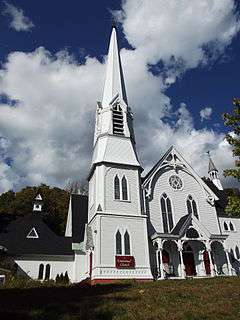
First Baptist Church of Northborough |
|
000000002016-04-12-0000April 12, 2016
(#16000157) |
52 Main St.
42°19′11″N 71°38′19″W / 42.319607°N 71.638721°W / 42.319607; -71.638721 (First Baptist Church of Northborough) |
Northborough |
|
| 50 |
First Methodist Church |
|
000000001990-11-02-0000November 2, 1990
(#90001720) |
75 Walnut St.
42°25′00″N 71°41′03″W / 42.416667°N 71.684167°W / 42.416667; -71.684167 (First Methodist Church) |
Clinton |
|
| 51 |
First Presbyterian Society Meeting House |
|
000000002010-09-09-0000September 9, 2010
(#10000722) |
20 Main St.
42°11′32″N 71°45′37″W / 42.192222°N 71.760278°W / 42.192222; -71.760278 (First Presbyterian Society Meeting House) |
Millbury |
|
| 52 |
Nathan Fisher House |
|
000000001980-03-25-0000March 25, 1980
(#80001679) |
34 West Main St.[7]
42°17′03″N 71°37′30″W / 42.284167°N 71.625°W / 42.284167; -71.625 (Nathan Fisher House) |
Westborough |
|
| 53 |
Fisherville Historic District |
|
000000001996-02-16-0000February 16, 1996
(#96000056) |
Roughly bounded by Main, Elmwood, Ferry and Sampson Sts.
42°10′37″N 71°41′40″W / 42.1769°N 71.6944°W / 42.1769; -71.6944 (Fisherville Historic District) |
Grafton |
|
| 54 |
Jedediah Foster Homesite |
|
000000002013-08-27-0000August 27, 2013
(#13000623) |
Foster Hill Rd.,
42°13′55″N 72°07′40″W / 42.232°N 72.1278°W / 42.232; -72.1278 (Jedediah Foster Homesite) |
West Brookfield |
|
| 55 |
Four Corners-Goodnow Farm Historic District |
|
000000002015-08-10-0000August 10, 2015
(#15000510) |
Gates, Goodnow, Old Colony, Rhodes & Thompson Rds.
42°27′43″N 71°55′47″W / 42.4619°N 71.9297°W / 42.4619; -71.9297 (Four Corners-Goodnow Farm Historic District) |
Princeton |
|
| 56 |
Freegrace Marble Farm Historic District |
|
000000001989-11-13-0000November 13, 1989
(#89001967) |
80 Burbank Rd.
42°09′44″N 71°45′02″W / 42.1622°N 71.7506°W / 42.1622; -71.7506 (Freegrace Marble Farm Historic District) |
Sutton |
|
| 57 |
Gay Farm |
|
000000001977-09-22-0000September 22, 1977
(#77000201) |
South of Petersham off Nichewaug Rd.
42°27′50″N 72°11′06″W / 42.4639°N 72.185°W / 42.4639; -72.185 (Gay Farm) |
Petersham |
|
| 58 |
Rev. Samuel Gay House |
|
000000001997-11-24-0000November 24, 1997
(#97001450) |
10 Williamsville Rd.
42°28′44″N 72°00′55″W / 42.4789°N 72.0153°W / 42.4789; -72.0153 (Rev. Samuel Gay House) |
Hubbardston |
|
| 59 |
Gilbertville Historic District |
|
000000001991-12-26-0000December 26, 1991
(#91001848) |
Roughly Main, Church, High, North, Broad and Bridge Sts.
42°18′24″N 72°12′32″W / 42.306667°N 72.208889°W / 42.306667; -72.208889 (Gilbertville Historic District) |
Hardwick |
|
| 60 |
Gillon Block |
|
000000001982-10-21-0000October 21, 1982
(#82000488) |
189 Main St.
42°08′26″N 71°31′15″W / 42.140556°N 71.520833°W / 42.140556; -71.520833 (Gillon Block) |
Milford |
|
| 61 |
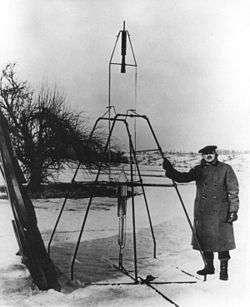
Goddard Rocket Launching Site |
|
000000001966-11-13-0000November 13, 1966
(#66000654) |
Ninth fairway, Pakachoag Golf Course, Pakachoag Rd.
42°13′06″N 71°48′46″W / 42.218333°N 71.812778°W / 42.218333; -71.812778 (Goddard Rocket Launching Site) |
Auburn |
National Historic Landmark
|
| 62 |
John B. Gough House |
|
000000001974-03-19-0000March 19, 1974
(#74001763) |
215 Main St.
42°19′42″N 71°45′22″W / 42.328333°N 71.756111°W / 42.328333; -71.756111 (John B. Gough House) |
Boylston |
National Historic Landmark
|
| 63 |
Grafton Common Historic District |
|
000000001988-06-22-0000June 22, 1988
(#88000707) |
Roughly Worcester, Oak, Millbury, Church, South, Upton, and North Sts.
42°12′22″N 71°41′10″W / 42.206111°N 71.686111°W / 42.206111; -71.686111 (Grafton Common Historic District) |
Grafton |
|
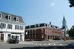
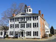
| 64 |
Grafton Inn |
|
000000001980-06-16-0000June 16, 1980
(#80001675) |
25 Central Sq.
42°12′23″N 71°41′08″W / 42.206389°N 71.685556°W / 42.206389; -71.685556 (Grafton Inn) |
Grafton |
|
| 65 |
Grove Street School |
|
000000001996-07-05-0000July 5, 1996
(#96000737) |
23 Grove St.
42°14′48″N 71°59′34″W / 42.246667°N 71.992778°W / 42.246667; -71.992778 (Grove Street School) |
Spencer |
|
| 66 |
Hardwick Village Historic District |
|
000000001991-12-19-0000December 19, 1991
(#91001849) |
Petersham, Barre, Greenwich, Ruggles Hill and Gilbertville Rds.
42°20′54″N 72°11′49″W / 42.348333°N 72.196944°W / 42.348333; -72.196944 (Hardwick Village Historic District) |
Hardwick |
|
| 67 |
Hassanamisco Reservation |
|
000000002011-09-06-0000September 6, 2011
(#11000615) |
80 Brigham Hill Rd.
42°12′39″N 71°42′18″W / 42.210833°N 71.705°W / 42.210833; -71.705 (Hassanamisco Reservation) |
Grafton |
|
| 68 |
Stephen Hastings House |
|
000000002005-12-06-0000December 6, 2005
(#05001363) |
20 Squareshire Rd.
42°24′29″N 71°44′26″W / 42.4081°N 71.7406°W / 42.4081; -71.7406 (Stephen Hastings House) |
Sterling |
|
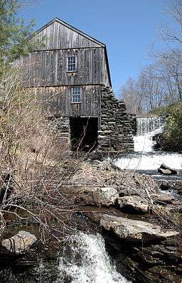
| 69 |
Hayward Mill |
|
000000001991-06-17-0000June 17, 1991
(#91000695) |
Junction of North and Cook Sts., on the Mumford River
42°04′30″N 71°42′43″W / 42.075°N 71.7119°W / 42.075; -71.7119 (Hayward Mill) |
Douglas |
|
| 70 |
Holden Center Historic District |
|
000000001977-12-22-0000December 22, 1977
(#77000194) |
Main, Maple, Highland, and Reservoir Sts.
42°21′03″N 71°51′47″W / 42.3508°N 71.8631°W / 42.3508; -71.8631 (Holden Center Historic District) |
Holden |
|
| 71 |
Holland-Towne House |
|
000000001990-08-13-0000August 13, 1990
(#89002327) |
North Street
42°30′01″N 72°11′06″W / 42.5003°N 72.185°W / 42.5003; -72.185 (Holland-Towne House) |
Petersham |
|
| 72 |
Hopedale Village Historic District |
|
000000002002-06-12-0000June 12, 2002
(#02000635) |
Roughly bounded by Milford Town Line, Malquin Dr., Mendon Town Line and Upton Town Line
42°07′35″N 71°32′12″W / 42.1264°N 71.5368°W / 42.1264; -71.5368 (Hopedale Village Historic District) |
Hopedale |
|
| 73 |
Hubbard-Dawson House |
|
000000001995-12-13-0000December 13, 1995
(#95001443) |
925 Main St.
42°20′37″N 71°51′08″W / 42.3436°N 71.8522°W / 42.3436; -71.8522 (Hubbard-Dawson House) |
Holden |
|
| 74 |
Hubbardston Public Library |
|
000000001998-08-19-0000August 19, 1998
(#98000989) |
7 Main St.
42°28′30″N 72°00′28″W / 42.475°N 72.0078°W / 42.475; -72.0078 (Hubbardston Public Library) |
Hubbardston |
|
| 75 |
Hubbardston Town Common Historic District |
|
000000002000-11-22-0000November 22, 2000
(#00001396) |
Main and Brigham Sts.
42°28′30″N 72°00′22″W / 42.475°N 72.006111°W / 42.475; -72.006111 (Hubbardston Town Common Historic District) |
Hubbardston |
|
| 76 |
Hudson House |
|
000000001978-02-08-0000February 8, 1978
(#78000480) |
Northeast of Oxford on Hudson Rd.
42°08′32″N 71°50′12″W / 42.142222°N 71.836667°W / 42.142222; -71.836667 (Hudson House) |
Oxford |
|
| 77 |
Huguenot Fort |
|
000000001988-04-27-0000April 27, 1988
(#88000424) |
Fort Hill Rd.
42°05′55″N 71°50′50″W / 42.098611°N 71.847222°W / 42.098611; -71.847222 (Huguenot Fort) |
Oxford |
|
| 78 |
E. N. Jenckes Store |
|
000000001988-01-28-0000January 28, 1988
(#87002558) |
Main St.
42°04′18″N 71°42′51″W / 42.071667°N 71.714167°W / 42.071667; -71.714167 (E. N. Jenckes Store) |
Douglas |
|
| 79 |
Knowlton Hat Factory |
|
000000001982-06-01-0000June 1, 1982
(#82004467) |
134 Main St.
42°10′10″N 71°37′27″W / 42.169444°N 71.624167°W / 42.169444; -71.624167 (Knowlton Hat Factory) |
Upton |
|
| 80 |
Lancaster Mills |
|
000000002010-01-29-0000January 29, 2010
(#10000005) |
1-55, 75, 99, 1-R Green St., 20 Cameron St.
42°24′42″N 71°40′48″W / 42.411561°N 71.680131°W / 42.411561; -71.680131 (Lancaster Mills) |
Clinton |
|
| 81 |
Linwood Historic District |
|
000000001989-06-16-0000June 16, 1989
(#88002753) |
Roughly Linwood Ave., Maple Ct., and Pine Ct.
42°05′54″N 71°38′49″W / 42.098333°N 71.646944°W / 42.098333; -71.646944 (Linwood Historic District) |
Northbridge |
|
| 82 |
Joseph Lothrop House |
|
000000001980-03-27-0000March 27, 1980
(#80001680) |
208 Turnpike Rd.
42°17′01″N 71°37′34″W / 42.283611°N 71.626111°W / 42.283611; -71.626111 (Joseph Lothrop House) |
Westborough |
Listed in the "Shrewsbury vicinity".
|
| 83 |
Lyman School for Boys |
|
000000001994-07-25-0000July 25, 1994
(#94000693) |
Junction of Oak and South Sts.
42°17′24″N 71°37′50″W / 42.29°N 71.630556°W / 42.29; -71.630556 (Lyman School for Boys) |
Westborough |
|
| 84 |
Main Street Historic District |
|
000000002006-05-10-0000May 10, 2006
(#06000360) |
Main, Lincoln, Preston, Walnut Sts., Chestnut Hill Rd., Burns Ave.
42°01′40″N 71°34′44″W / 42.027778°N 71.578889°W / 42.027778; -71.578889 (Main Street Historic District) |
Millville |
|
| 85 |
Main Street Historic District |
|
000000001982-04-06-0000April 6, 1982
(#82004484) |
175-299 and 228-274 Main St.
42°02′57″N 71°52′56″W / 42.049167°N 71.882222°W / 42.049167; -71.882222 (Main Street Historic District) |
Webster |
|
| 86 |
Manning-Ball House |
|
000000001995-12-13-0000December 13, 1995
(#95001442) |
370 Manning St.
42°23′10″N 71°50′08″W / 42.3861°N 71.8356°W / 42.3861; -71.8356 (Manning-Ball House) |
Jefferson |
|
| 87 |
Maples Cottage |
|
000000001980-03-25-0000March 25, 1980
(#80001681) |
East of Shrewsbury on Oak St.
42°17′08″N 71°37′38″W / 42.285556°N 71.627222°W / 42.285556; -71.627222 (Maples Cottage) |
Westborough |
|
| 88 |
Marlborough Brook Filter Beds |
|
000000001990-01-18-0000January 18, 1990
(#89002286) |
Framingham Rd.
42°19′47″N 71°32′09″W / 42.3297°N 71.5358°W / 42.3297; -71.5358 (Marlborough Brook Filter Beds) |
Southborough |
Extends into Marlborough, Middlesex County
|
| 89 |
Matthews Fulling Mill Site |
|
000000001975-11-12-0000November 12, 1975
(#75000302) |
Address Restricted
|
North Brookfield |
1749 mill site near New Braintree line
|
| 90 |
Memorial Hall |
|
000000001985-05-09-0000May 9, 1985
(#85000983) |
30 School St.
42°08′32″N 71°31′10″W / 42.14223°N 71.519322°W / 42.14223; -71.519322 (Memorial Hall) |
Milford |
|
| 91 |
Mendon Center Historic District |
|
000000002003-06-19-0000June 19, 2003
(#03000552) |
Roughly bounded by Main, Hastings, Maple, North, Washington, and George Sts.
42°06′28″N 71°33′13″W / 42.107838°N 71.553569°W / 42.107838; -71.553569 (Mendon Center Historic District) |
Mendon |
|
| 92 |
Milford Town Hall |
|
000000001977-09-22-0000September 22, 1977
(#77000200) |
52 Main St.
42°08′33″N 71°31′02″W / 42.1425°N 71.517222°W / 42.1425; -71.517222 (Milford Town Hall) |
Milford |
|
| 93 |
Moore State Park Historic District |
|
000000002004-05-21-0000May 21, 2004
(#04000535) |
off Massachusetts Route 31
42°19′06″N 71°57′26″W / 42.3182°N 71.9572°W / 42.3182; -71.9572 (Moore State Park Historic District) |
Paxton |
|
| 94 |
Mount Vernon Cemetery |
|
000000002008-05-29-0000May 29, 2008
(#08000465) |
Church St.
42°21′52″N 71°46′52″W / 42.364569°N 71.781106°W / 42.364569; -71.781106 (Mount Vernon Cemetery) |
West Boylston |
|
| 95 |
Azariah Newton House |
|
000000001999-10-14-0000October 14, 1999
(#99001252) |
44 Silver Hill Rd.
42°10′02″N 71°32′08″W / 42.167222°N 71.535556°W / 42.167222; -71.535556 (Azariah Newton House) |
Milford |
|
| 96 |
No. 4 Schoolhouse |
|
000000001988-06-22-0000June 22, 1988
(#88000711) |
Farrington Rd.
42°26′43″N 72°05′05″W / 42.445278°N 72.084722°W / 42.445278; -72.084722 (No. 4 Schoolhouse) |
Barre |
|
| 97 |
North Avenue Rural Historic District |
|
000000002003-07-25-0000July 25, 2003
(#03000683) |
85-147 North Ave., 6-8 Trask Rd., 4-16 Hopedale St.
42°07′34″N 71°34′01″W / 42.126111°N 71.566944°W / 42.126111; -71.566944 (North Avenue Rural Historic District) |
Mendon |
|
| 98 |
North Brookfield Town House |
|
000000002001-10-28-0000October 28, 2001
(#01001185) |
185 N. Main St.
42°16′07″N 72°05′06″W / 42.268703°N 72.085054°W / 42.268703; -72.085054 (North Brookfield Town House) |
North Brookfield |
|
| 99 |
Northside Village Historic District |
|
000000001977-10-05-0000October 5, 1977
(#77000195) |
Stafford St., Northside and Cemetery Rds.
42°09′53″N 71°57′24″W / 42.164722°N 71.956667°W / 42.164722; -71.956667 (Northside Village Historic District) |
Charlton |
|
| 100 |
Oakdale Village Historic District |
|
000000001996-07-05-0000July 5, 1996
(#96000738) |
11-68 N. Main, 8–24 May, 6-10 Green, 12-23 High, 4-68 Laurel, 14-34 Waushacum, and park at Thomas and N. Main
42°23′20″N 71°47′48″W / 42.388889°N 71.796667°W / 42.388889; -71.796667 (Oakdale Village Historic District) |
West Boylston |
|
| 101 |
Old Douglas Center Historic District |
|
000000002001-10-28-0000October 28, 2001
(#01001186) |
Roughly bounded by Church, Common, Main, NW. Main, SW. Main, and Webster Sts.
42°03′14″N 71°44′23″W / 42.05377°N 71.739671°W / 42.05377; -71.739671 (Old Douglas Center Historic District) |
Douglas |
|
| 102 |
Old Indian Cemetery |
|
000000002006-05-17-0000May 17, 2006
(#06000400) |
50 Cottage St.
42°14′12″N 72°08′47″W / 42.236667°N 72.146389°W / 42.236667; -72.146389 (Old Indian Cemetery) |
West Brookfield |
|
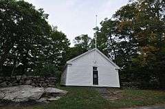
| 103 |
Old Stone Church |
|
000000001973-04-13-0000April 13, 1973
(#73000329) |
Off MA 140
42°22′29″N 71°46′59″W / 42.374722°N 71.783056°W / 42.374722; -71.783056 (Old Stone Church) |
West Boylston |
|
| 104 |
Oxford Main Street Historic District |
|
000000002011-08-24-0000August 24, 2011
(#11000586) |
Barton, Charlton, Church, E. Main, Elm, Fremont, & Main Sts., Quobaug Ave., Sigourney St., Sutton Ave., West St. Jackson
42°07′01″N 71°51′53″W / 42.116944°N 71.864722°W / 42.116944; -71.864722 (Oxford Main Street Historic District) |
Oxford |
|
| 105 |
Paddock Farm |
|
000000001996-02-23-0000February 23, 1996
(#96000143) |
259 Salisbury St.
42°20′02″N 71°50′57″W / 42.3339°N 71.8492°W / 42.3339; -71.8492 (Paddock Farm) |
Holden |
|
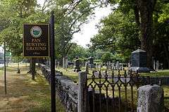
| 106 |
Pan Burying Ground |
|
000000002007-07-11-0000July 11, 2007
(#07000682) |
477 Main St.
42°25′50″N 71°35′24″W / 42.4306°N 71.59°W / 42.4306; -71.59 (Pan Burying Ground) |
Bolton |
|
| 107 |
Petersham Common Historic District |
|
000000001982-05-11-0000May 11, 1982
(#82004481) |
MA 32/122
42°29′25″N 72°11′08″W / 42.4903°N 72.1856°W / 42.4903; -72.1856 (Petersham Common Historic District) |
Petersham |
|
| 108 |
Pleasant Street School |
|
000000001996-07-05-0000July 5, 1996
(#96000736) |
54 Pleasant St.
42°14′54″N 71°59′51″W / 42.248333°N 71.9975°W / 42.248333; -71.9975 (Pleasant Street School) |
Spencer |
|
| 109 |
Prescott Town House |
|
000000001989-02-21-0000February 21, 1989
(#89000043) |
MA 32
42°29′56″N 72°11′01″W / 42.498889°N 72.183611°W / 42.498889; -72.183611 (Prescott Town House) |
Petersham |
Former town hall of Prescott, Massachusetts.
|
| 110 |
Princeton Center Historic District |
|
000000001999-02-26-0000February 26, 1999
(#99000259) |
Junction of Hubbardston and Mountain Rds.
42°26′57″N 71°52′43″W / 42.449167°N 71.878611°W / 42.449167; -71.878611 (Princeton Center Historic District) |
Princeton |
Boundary increase (added 2006-03-10): Princeton, MA
|
| 111 |
Prospect Heights Historic District |
|
000000001990-09-05-0000September 5, 1990
(#90001344) |
Roughly bounded by Prospect Heights, Prospect, and Water Sts.
42°08′10″N 71°31′55″W / 42.136111°N 71.531944°W / 42.136111; -71.531944 (Prospect Heights Historic District) |
Milford |
|
| 112 |
Gen. Rufus Putnam House |
|
000000001972-11-28-0000November 28, 1972
(#72001330) |
344 Main St.
42°22′29″N 71°58′15″W / 42.374722°N 71.970833°W / 42.374722; -71.970833 (Gen. Rufus Putnam House) |
Rutland |
National Historic Landmark
|
| 113 |
Quinapoxet River Bridge |
|
000000001990-04-08-0000April 8, 1990
(#89002292) |
Thomas St. over the Quinapoxet River at the Wachusett Reservoir
42°23′06″N 71°47′52″W / 42.385°N 71.797778°W / 42.385; -71.797778 (Quinapoxet River Bridge) |
West Boylston |
|
| 114 |
Rider Tavern |
|
000000001976-05-19-0000May 19, 1976
(#76000292) |
Northeast of Charlton on Stafford St., off U.S. Route 90
42°09′52″N 71°57′14″W / 42.164444°N 71.953889°W / 42.164444; -71.953889 (Rider Tavern) |
Charlton |
|
| 115 |
Rock Castle School |
|
000000001989-06-07-0000June 7, 1989
(#89000437) |
Prospect St.
42°03′13″N 71°52′41″W / 42.0536°N 71.8781°W / 42.0536; -71.8781 (Rock Castle School) |
Webster |
Converted to residential use.
|
| 116 |
Rockdale Common Housing District |
|
000000001983-03-31-0000March 31, 1983
(#83000611) |
4-20 McBride, 46-58 Plantation, and 37-42 Taft Sts.
42°09′09″N 71°38′50″W / 42.1525°N 71.647222°W / 42.1525; -71.647222 (Rockdale Common Housing District) |
Northbridge |
|
| 117 |
Rogers House |
|
000000001982-06-01-0000June 1, 1982
(#82004471) |
28 Boyden Rd.
42°20′59″N 71°51′29″W / 42.3497°N 71.8581°W / 42.3497; -71.8581 (Rogers House) |
Holden |
|
| 118 |
Russell Corner Historic District |
|
000000002006-02-22-0000February 22, 2006
(#06000060) |
Merriam, Gregory Hill, East Princeton and Sterling Rds. and Bullock Lane
42°27′14″N 71°52′06″W / 42.453889°N 71.868333°W / 42.453889; -71.868333 (Russell Corner Historic District) |
Princeton |
|
| 119 |
Sawyer Homestead |
|
000000002000-09-13-0000September 13, 2000
(#00001036) |
108 Maple St.
42°25′59″N 71°43′49″W / 42.433056°N 71.730278°W / 42.433056; -71.730278 (Sawyer Homestead) |
Sterling |
|
| 120 |
Shrewsbury Historic District |
|
000000001976-10-08-0000October 8, 1976
(#76000309) |
Church Rd., Main, Prospect, Boylston, and Grafton Sts.
42°17′53″N 71°42′50″W / 42.298056°N 71.713889°W / 42.298056; -71.713889 (Shrewsbury Historic District) |
Shrewsbury |
|
| 121 |
Shumway Block |
|
000000001980-12-03-0000December 3, 1980
(#80000468) |
112-116 Main St.
42°02′55″N 71°53′07″W / 42.0486°N 71.8853°W / 42.0486; -71.8853 (Shumway Block) |
Webster |
|
| 122 |
South Union School |
|
000000002011-02-18-0000February 18, 2011
(#11000021) |
21 Highland St.
42°16′05″N 71°31′49″W / 42.268056°N 71.530278°W / 42.268056; -71.530278 (South Union School) |
Southborough |
|
| 123 |
Southwick-Daniels Farm |
|
000000001995-08-22-0000August 22, 1995
(#95001030) |
286 Mendon St.
42°03′26″N 71°32′54″W / 42.057222°N 71.548333°W / 42.057222; -71.548333 (Southwick-Daniels Farm) |
Blackstone |
|
| 124 |
Spaulding Block |
|
000000001980-12-03-0000December 3, 1980
(#80000466) |
141-143 Main St.
42°02′56″N 71°53′05″W / 42.0489°N 71.8847°W / 42.0489; -71.8847 (Spaulding Block) |
Webster |
|
| 125 |
Spencer Town Center Historic District |
|
000000001986-06-26-0000June 26, 1986
(#86001399) |
Main between High and North Sts.; also 215-270 and 35-73 Main, 2-16 Linden, 3-24 Ash, 26-73 Cherry, 6–19 May, and 8 Park Sts.; also 10-29 Grove, 1-51 High, 9-85 Mechanic, 13-72 Pleasant, 5-62 Wall Sts., and parts of Prouty, Lincoln, Cherry and Jones Sts.; also Luther Hill Park
42°14′42″N 71°59′33″W / 42.245°N 71.9925°W / 42.245; -71.9925 (Spencer Town Center Historic District) |
Spencer |
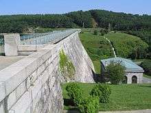
District has been enlarged three times; each set of addresses represents an increase.
|
| 126 |
John Spurr House |
|
000000001976-04-26-0000April 26, 1976
(#76000293) |
Main St.
42°08′06″N 71°58′10″W / 42.135°N 71.969444°W / 42.135; -71.969444 (John Spurr House) |
Charlton |
|
| 127 |
Sterling Center Historic District |
|
000000001988-04-14-0000April 14, 1988
(#88000425) |
Roughly bounded by Meetinghouse Hill and Main, Maple and Kendall Hill, Boulding, Worcester and Princeton
42°26′10″N 71°45′41″W / 42.436111°N 71.761389°W / 42.436111; -71.761389 (Sterling Center Historic District) |
Sterling |
|
| 128 |
Stevens Linen Works Historic District |
|
000000002010-09-17-0000September 17, 2010
(#10000751) |
8–10 Mill St., 2 W. Main St., 2 Curfew Ln., Ardlock Pl.
42°03′01″N 71°53′24″W / 42.0503°N 71.89°W / 42.0503; -71.89 (Stevens Linen Works Historic District) |
Dudley |
Includes the main factory, related industrial buildings, and worker housing.
|
| 129 |
Joseph Stone House |
|
000000001986-01-09-0000January 9, 1986
(#86000028) |
35 Stone St.
42°11′07″N 71°49′51″W / 42.185278°N 71.830833°W / 42.185278; -71.830833 (Joseph Stone House) |
Auburn |
|
| 130 |
Stony Farm |
|
000000001995-12-13-0000December 13, 1995
(#95001441) |
428 Salisbury St.
42°19′37″N 71°51′04″W / 42.3269°N 71.8511°W / 42.3269; -71.8511 (Stony Farm) |
Holden |
|
| 131 |
Sturbridge Common Historic District |
|
000000001977-11-09-0000November 9, 1977
(#77000656) |
Main St. between Hall Rd. and Interstate 84
42°06′25″N 72°04′44″W / 42.106944°N 72.078889°W / 42.106944; -72.078889 (Sturbridge Common Historic District) |
Sturbridge |
|
| 132 |
Sudbury Dam Historic District |
|
000000001990-01-18-0000January 18, 1990
(#89002265) |
Southeastern end of Sudbury Reservoir off MA 30
42°18′21″N 71°29′30″W / 42.3058°N 71.4917°W / 42.3058; -71.4917 (Sudbury Dam Historic District) |
Southborough |
Extends into Framingham, Middlesex County
|
| 133 |
Sutton Center Historic District |
|
000000002001-05-25-0000May 25, 2001
(#01000541) |
Roughly Boston Rd., Singletary Ave., and Uxbridge Rd.
42°09′05″N 71°45′54″W / 42.151389°N 71.765°W / 42.151389; -71.765 (Sutton Center Historic District) |
Sutton |
|
| 134 |
Tantiusques Reservation |
|
000000001983-10-06-0000October 6, 1983
(#83004141) |
Leadmine Rd.
42°03′26″N 72°07′52″W / 42.057222°N 72.131111°W / 42.057222; -72.131111 (Tantiusques Reservation) |
Sturbridge |
|
| 135 |
Ted's Diner |
Upload image |
000000002000-11-29-0000November 29, 2000
(#00001395) |
67 Main St.
42°08′34″N 71°31′05″W / 42.142778°N 71.518056°W / 42.142778; -71.518056 (Ted's Diner) |
Milford |
Demolished in 2002.[8]
|
| 136 |
Benjamin Thayer House |
|
000000002009-12-30-0000December 30, 2009
(#09001174) |
200 Farm St.
42°02′49″N 71°31′47″W / 42.047°N 71.5297°W / 42.047; -71.5297 (Benjamin Thayer House) |
Blackstone |
|
| 137 |
Thom Block |
|
000000001983-06-23-0000June 23, 1983
(#83003435) |
83-89 Main St.
42°08′32″N 71°31′07″W / 42.1422°N 71.5186°W / 42.1422; -71.5186 (Thom Block) |
Milford |
|
| 138 |
Thompson School |
|
000000001989-06-07-0000June 7, 1989
(#89000436) |
Prospect St.
42°03′02″N 71°52′42″W / 42.0506°N 71.8783°W / 42.0506; -71.8783 (Thompson School) |
Webster |
Converted to residential use.
|
| 139 |
Tuttle Square School |
|
000000002002-03-08-0000March 8, 2002
(#02000129) |
41 South St.
42°11′29″N 71°50′06″W / 42.1914°N 71.835°W / 42.1914; -71.835 (Tuttle Square School) |
Auburn |
|
| 140 |
Upton State Forest-Civilian Conservation Corps Resources Historic District |
|
000000002014-10-08-0000October 8, 2014
(#14000841) |
205 Westborough Rd.
42°12′33″N 71°36′29″W / 42.2091°N 71.6081°W / 42.2091; -71.6081 (Upton State Forest-Civilian Conservation Corps Resources Historic District) |
Upton |
|
| 141 |
Upton Center Historic District |
|
000000002015-01-14-0000January 14, 2015
(#14001150) |
Church, Main, Milford, Nelson, N. Main, Plain, Pleasant, School & Warren Sts.
42°10′26″N 71°36′11″W / 42.1739°N 71.6031°W / 42.1739; -71.6031 (Upton Center Historic District) |
Upton |
|
| 142 |
Upton Town Hall |
|
000000001999-02-12-0000February 12, 1999
(#99000185) |
1 Main St.
42°10′26″N 71°35′32″W / 42.1739°N 71.5922°W / 42.1739; -71.5922 (Upton Town Hall) |
Upton |
|
| 143 |
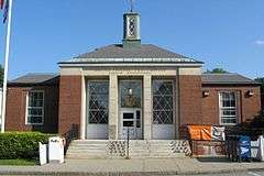
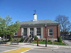
US Post Office-Millbury Main |
|
000000001987-10-15-0000October 15, 1987
(#87001764) |
119 Elm St.
42°11′27″N 71°44′59″W / 42.1908°N 71.7497°W / 42.1908; -71.7497 (US Post Office-Millbury Main) |
Millbury |
|
| 144 |
US Post Office-Whitinsville Main |
|
000000001987-10-15-0000October 15, 1987
(#86003433) |
58 Church St.
42°06′38″N 71°39′47″W / 42.1106°N 71.6631°W / 42.1106; -71.6631 (US Post Office-Whitinsville Main) |
Northbridge |
|
| 145 |
Vintonville Historic District |
|
000000002006-08-23-0000August 23, 2006
(#06000717) |
Roughly bounded by Cottage, Green, Pine, Brigham, Beach Sts., and rear of properties along the east side of South St.
42°15′59″N 71°36′33″W / 42.2664°N 71.6092°W / 42.2664; -71.6092 (Vintonville Historic District) |
Westborough |
|
| 146 |
Wachusett Aqueduct Linear District |
|
000000001990-01-18-0000January 18, 1990
(#89002276) |
Along Wachusett Aqueduct from Wachusett Reservoir to Sudbury Reservoir
42°20′01″N 71°35′27″W / 42.3336°N 71.5908°W / 42.3336; -71.5908 (Wachusett Aqueduct Linear District) |
Berlin, Clinton, and Northborough, Southborough |
Extends into Marlborough, Middlesex County
|
| 147 |
Wachusett Dam Historic District |
|
000000001990-01-18-0000January 18, 1990
(#89002269) |
Northern end of Wachusett Reservoir at Lancaster Millpond
42°24′17″N 71°41′17″W / 42.4047°N 71.6881°W / 42.4047; -71.6881 (Wachusett Dam Historic District) |
Clinton |
|
| 148 |
Gen. Artemas Ward Homestead |
|
000000001976-05-04-0000May 4, 1976
(#76000308) |
Main St., opposite Dean Park
42°17′42″N 71°41′50″W / 42.295°N 71.6972°W / 42.295; -71.6972 (Gen. Artemas Ward Homestead) |
Shrewsbury |
|
| 149 |
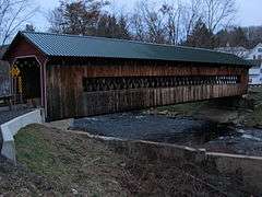
Ware-Hardwick Covered Bridge |
|
000000001986-05-08-0000May 8, 1986
(#86001006) |
Old Gilbertville Rd. and Bridge St.
42°18′37″N 72°12′45″W / 42.3103°N 72.2125°W / 42.3103; -72.2125 (Ware-Hardwick Covered Bridge) |
Hardwick |
|
| 150 |
Warren First Congregational Church-Federated Church |
|
000000002004-11-27-0000November 27, 2004
(#04001258) |
25 Winthrop Terrace
42°12′49″N 72°11′31″W / 42.2136°N 72.1919°W / 42.2136; -72.1919 (Warren First Congregational Church-Federated Church) |
Warren |
|
| 151 |
Warren Public Library |
|
000000002000-03-13-0000March 13, 2000
(#00000146) |
Main St. at Bacon St.
42°12′48″N 72°11′35″W / 42.2132°N 72.1931°W / 42.2132; -72.1931 (Warren Public Library) |
Warren |
|
| 152 |
Warren Town Hall |
|
000000002001-06-14-0000June 14, 2001
(#01000650) |
1 Main St.
42°12′46″N 72°11′43″W / 42.2128°N 72.1953°W / 42.2128; -72.1953 (Warren Town Hall) |
Warren |
|
| 153 |
Jonah Warren House |
|
000000001998-11-05-0000November 5, 1998
(#98001331) |
64 Warren St.
42°14′54″N 71°36′12″W / 42.2483°N 71.6033°W / 42.2483; -71.6033 (Jonah Warren House) |
Westborough |
|
| 154 |
Washburn Square-Leicester Common Historic District |
|
000000002006-02-22-0000February 22, 2006
(#06000062) |
Main St., Washburn Sq., 3 Paxton St.
42°14′46″N 71°54′13″W / 42.2461°N 71.9036°W / 42.2461; -71.9036 (Washburn Square-Leicester Common Historic District) |
Leicester |
|
| 155 |
Waters Farm |
|
000000001985-04-04-0000April 4, 1985
(#85000695) |
53 Waters Rd.
42°06′21″N 71°47′02″W / 42.1058°N 71.7839°W / 42.1058; -71.7839 (Waters Farm) |
Sutton |
|
| 156 |
Asa Waters Mansion |
|
000000001978-02-14-0000February 14, 1978
(#78000479) |
123 Elm St.
42°11′24″N 71°45′46″W / 42.19°N 71.7628°W / 42.19; -71.7628 (Asa Waters Mansion) |
Millbury |
|
| 157 |
Webster Municipal Buildings Historic District |
|
000000002012-03-27-0000March 27, 2012
(#12000152) |
350 Main, 29 Negus, & 2 Lake Sts.
42°02′59″N 71°52′48″W / 42.0496°N 71.880°W / 42.0496; -71.880 (Webster Municipal Buildings Historic District) |
Webster |
|
| 158 |
West Brick School |
|
000000002011-03-01-0000March 1, 2011
(#11000070) |
1592 Old Turnpike Rd.
42°21′44″N 72°04′54″W / 42.3622°N 72.0817°W / 42.3622; -72.0817 (West Brick School) |
Oakham |
|
| 159 |
West Brookfield Center Historic District |
|
000000001990-06-28-0000June 28, 1990
(#90000885) |
Roughly Central and Cottage Sts. from Sherman St. to Lake St. and west, N. and S. Main Sts. from Chapman Ave. to Maple St.
42°14′04″N 72°08′30″W / 42.2344°N 72.1417°W / 42.2344; -72.1417 (West Brookfield Center Historic District) |
West Brookfield |
|
| 160 |
West Main Street Historic District |
|
000000001987-06-16-0000June 16, 1987
(#87000884) |
Roughly bounded by Milk, Main, Blake, and Fay Sts.; also 83-118 W. Main St.; also roughly bounded by Charles, Forbes, South and Cross Sts.; also portions of E. Main St., High St., Lincoln St., Milk St., Prospect and Spring Sts.
42°16′07″N 71°37′04″W / 42.2686°N 71.6178°W / 42.2686; -71.6178 (West Main Street Historic District) |
Westborough |
Second, third, and fourth sets of boundaries represent boundary increases of 000000001990-12-06-0000December 6, 1990, 000000001987-06-16-0000June 16, 1987, and 000000002009-05-29-0000May 29, 2009 respectively
|
| 161 |
West Sutton Historic District |
|
000000002001-08-08-0000August 8, 2001
(#01000871) |
Central Turnpike and Douglas, Town Farm, and West Sutton Rds.
42°07′02″N 71°48′11″W / 42.1172°N 71.8031°W / 42.1172; -71.8031 (West Sutton Historic District) |
Sutton |
|
| 162 |
West Village Historic District |
|
000000002009-10-16-0000October 16, 2009
(#09000827) |
Allen Hill, Goodnow, Hubbardston, and Radford Rds.
42°27′06″N 71°53′05″W / 42.4518°N 71.8847°W / 42.4518; -71.8847 (West Village Historic District) |
Princeton |
|
| 163 |
Westborough State Hospital |
|
000000001994-01-21-0000January 21, 1994
(#93001488) |
Along Lyman St. north of Chauncy Lake, and the junction of South St. and MA 9
42°18′04″N 71°36′37″W / 42.3011°N 71.6103°W / 42.3011; -71.6103 (Westborough State Hospital) |
Westborough |
|
| 164 |
Weston Aqueduct Linear District |
|
000000001990-01-18-0000January 18, 1990
(#89002274) |
Along Weston Aqueduct from Sudbury Reservoir to Weston Reservoir
42°20′00″N 71°22′32″W / 42.3333°N 71.3756°W / 42.3333; -71.3756 (Weston Aqueduct Linear District) |
Southborough |
Extends into Middlesex County
|
| 165 |
White Homestead-Salem Cross Inn |
|
000000001975-04-14-0000April 14, 1975
(#09000619) |
260 West Main Street
42°14′41″N 72°10′25″W / 42.2446°N 72.1735°W / 42.2446; -72.1735 (White Homestead-Salem Cross Inn) |
West Brookfield |
|
| 166 |
Whitcomb Inn and Farm |
|
000000002002-05-02-0000May 2, 2002
(#02000431) |
43 Old Sugar Rd.
42°26′44″N 71°34′54″W / 42.4456°N 71.5817°W / 42.4456; -71.5817 (Whitcomb Inn and Farm) |
Bolton |
|
| 167 |
Whitinsville Historic District |
|
000000001983-04-07-0000April 7, 1983
(#83000613) |
Church, East, Fletcher, Hill, Woodland, Lake, and Water Sts., Castle Hill Rd., and Linwood Ave.
42°06′28″N 71°40′00″W / 42.1078°N 71.6667°W / 42.1078; -71.6667 (Whitinsville Historic District) |
Northbridge |
|
| 168 |
Wickaboag Valley Historic District |
|
000000002000-10-27-0000October 27, 2000
(#00001201) |
Roughly bounded by the Wickaboag Pond, Mill Stone Rd., Madden Rd., and the New Braintree border
42°15′11″N 72°09′14″W / 42.2530°N 72.154°W / 42.2530; -72.154 (Wickaboag Valley Historic District) |
West Brookfield |
|
| 169 |
Oliver Wight House |
|
000000001982-06-01-0000June 1, 1982
(#82004483) |
Main St.
42°06′41″N 72°05′22″W / 42.1114°N 72.0894°W / 42.1114; -72.0894 (Oliver Wight House) |
Sturbridge |
|
| 170 |
Willard House and Clock Museum |
|
000000001982-06-01-0000June 1, 1982
(#82004470) |
11 Willard St.
42°14′20″N 71°40′25″W / 42.2389°N 71.6736°W / 42.2389; -71.6736 (Willard House and Clock Museum) |
Grafton |
|
| 171 |
Willard-Fisk House |
|
000000001996-02-23-0000February 23, 1996
(#96000163) |
121 Whitney St.
42°22′44″N 71°53′11″W / 42.3789°N 71.8864°W / 42.3789; -71.8864 (Willard-Fisk House) |
Holden |
|
| 172 |
Woodlawn Cemetery |
|
000000002013-07-23-0000July 23, 2013
(#13000535) |
2 Woodlawn St.
42°25′10″N 71°41′29″W / 42.41933°N 71.691297°W / 42.41933; -71.691297 (Woodlawn Cemetery) |
Clinton |
|


.jpg)


.jpg)


.jpg)