| [3] |
Name on the Register[4] |
Image |
Date listed[5] |
Location |
City or town |
Description |
|---|
| 1 |
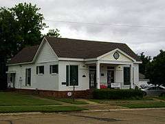
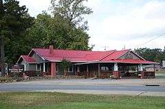
Arkadelphia Boy Scout Hut |
|
000000002002-01-28-0000January 28, 2002
(#01001526) |
8th St.
34°07′45″N 93°03′16″W / 34.129167°N 93.054444°W / 34.129167; -93.054444 (Arkadelphia Boy Scout Hut) |
Arkadelphia |
|
| 2 |
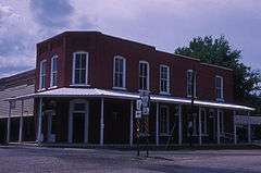
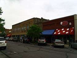
Arkadelphia Commercial Historic District |
|
000000002011-07-20-0000July 20, 2011
(#11000464) |
Roughly Main St. between 5th & 7th Sts., & Clinton St between 6th & 9th Sts.
34°07′12″N 93°03′13″W / 34.12°N 93.053611°W / 34.12; -93.053611 (Arkadelphia Commercial Historic District) |
Arkadelphia |
1870-1961 commercial core of Clark County
|
| 3 |
Arkadelphia Confederate Monument |
|
000000001996-05-03-0000May 3, 1996
(#96000507) |
Courthouse lawn, near the southeastern corner of the junction of 6th and Caddo Sts.
34°07′12″N 93°03′03″W / 34.12°N 93.050833°W / 34.12; -93.050833 (Arkadelphia Confederate Monument) |
Arkadelphia |
|
| 4 |
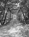
Arkansas 7/51 Bridge |
|
000000002006-02-01-0000February 1, 2006
(#05001591) |
Highways 7 and 51
34°07′23″N 93°02′47″W / 34.123056°N 93.046389°W / 34.123056; -93.046389 (Arkansas 7/51 Bridge) |
Arkadelphia |
1933 Parker Through Truss spanning the Ouachita River
|
| 5 |
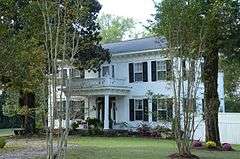
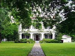
James E. M. Barkman House |
|
000000001974-07-30-0000July 30, 1974
(#74000467) |
406 N. 10th St.
34°07′31″N 93°03′22″W / 34.125278°N 93.056111°W / 34.125278; -93.056111 (James E. M. Barkman House) |
Arkadelphia |
ca. 1860 house in Greek and Gothic Revival styles
|
| 6 |
Bayou Sel |
Upload image |
000000001974-09-10-0000September 10, 1974
(#74000468) |
Address Restricted
|
Arkadelphia |
|
| 7 |
Nannie Gresham Biscoe House |
|
000000002004-01-21-0000January 21, 2004
(#03001450) |
227 Cherry St.
34°07′22″N 93°02′57″W / 34.122778°N 93.049167°W / 34.122778; -93.049167 (Nannie Gresham Biscoe House) |
Arkadelphia |
|
| 8 |
Dr. Boaz House |
|
000000001992-01-28-0000January 28, 1992
(#91002014) |
Highway 26
34°04′23″N 93°22′19″W / 34.073056°N 93.371944°W / 34.073056; -93.371944 (Dr. Boaz House) |
Clear Spring |
|
| 9 |
Bozeman House |
|
000000001978-11-14-0000November 14, 1978
(#78000576) |
West of Arkadelphia on Highway 26
34°05′44″N 93°09′03″W / 34.095556°N 93.150833°W / 34.095556; -93.150833 (Bozeman House) |
Arkadelphia |
|
| 10 |
Clark County Courthouse |
|
000000001978-12-01-0000December 1, 1978
(#78000577) |
4th and Crittenden Sts.
34°07′06″N 93°03′03″W / 34.118333°N 93.050833°W / 34.118333; -93.050833 (Clark County Courthouse) |
Arkadelphia |
|
| 11 |
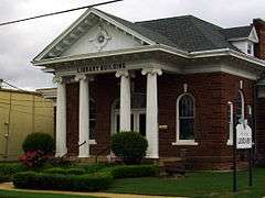
Clark County Library |
|
000000001974-11-05-0000November 5, 1974
(#74000469) |
609 Caddo St.
34°07′14″N 93°03′15″W / 34.120556°N 93.054167°W / 34.120556; -93.054167 (Clark County Library) |
Arkadelphia |
|
| 12 |
Clear Springs Tabernacle |
|
000000001992-02-13-0000February 13, 1992
(#92000057) |
Junction of Highway 26 and Bobo Rd.
34°03′23″N 93°23′31″W / 34.056389°N 93.391944°W / 34.056389; -93.391944 (Clear Springs Tabernacle) |
Okolona |
|
| 13 |
DeGray Creek Bridge |
Upload image |
000000002010-01-21-0000January 21, 2010
(#09001239) |
County Road 50 over DeGray Creek
34°09′37″N 93°11′21″W / 34.160411°N 93.189214°W / 34.160411; -93.189214 (DeGray Creek Bridge) |
Arkadelphia |
Washed away by flooding.
|
| 14 |
Domestic Science Building |
|
000000001982-12-22-0000December 22, 1982
(#82000800) |
11th and Haddock
34°06′19″N 93°03′35″W / 34.105278°N 93.059722°W / 34.105278; -93.059722 (Domestic Science Building) |
Arkadelphia |
|
| 15 |
Elkins' Ferry |
|
000000001994-04-19-0000April 19, 1994
(#94001182) |
Both banks of the Little Missouri River, about 10 miles north of Prescott
33°56′09″N 93°21′12″W / 33.935833°N 93.353333°W / 33.935833; -93.353333 (Elkins' Ferry) |
Prescott |
Site of the Civil War Battle of Elkin's Ferry; one of the Camden Expedition Sites, a National Historic Landmark consisting of sites in several counties; extends into Nevada County
|
| 16 |
Horace Estes House |
|
000000001993-09-21-0000September 21, 1993
(#93000487) |
614 E. Main St.
33°55′00″N 93°08′48″W / 33.916667°N 93.146667°W / 33.916667; -93.146667 (Horace Estes House) |
Gurdon |
|
| 17 |
Flanagin Law Office |
|
000000001977-12-22-0000December 22, 1977
(#77000245) |
320 Clay St.
34°07′08″N 93°03′03″W / 34.118889°N 93.050833°W / 34.118889; -93.050833 (Flanagin Law Office) |
Arkadelphia |
|
| 18 |
Gurdon Jail |
|
000000001989-11-13-0000November 13, 1989
(#89001959) |
W. Joslyn and Front Sts.
33°55′11″N 93°09′14″W / 33.919722°N 93.153889°W / 33.919722; -93.153889 (Gurdon Jail) |
Gurdon |
|
| 19 |
Habicht-Cohn-Crow House |
|
000000001985-10-03-0000October 3, 1985
(#85002717) |
8th and Pine
34°07′21″N 93°03′21″W / 34.1225°N 93.055833°W / 34.1225; -93.055833 (Habicht-Cohn-Crow House) |
Arkadelphia |
1870 Greek Revival house
|
| 20 |
Capt. Charles C. Henderson House |
|
000000001998-08-24-0000August 24, 1998
(#98000957) |
Junction of 10th and Henderson Sts.
34°07′12″N 93°03′25″W / 34.12°N 93.056944°W / 34.12; -93.056944 (Capt. Charles C. Henderson House) |
Arkadelphia |
|
| 21 |
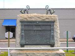
Hoo Hoo Monument |
|
000000001999-09-02-0000September 2, 1999
(#94000821) |
1st St.
33°55′13″N 93°09′14″W / 33.920278°N 93.153889°W / 33.920278; -93.153889 (Hoo Hoo Monument) |
Gurdon |
|
| 22 |
Hudson-Jones House |
|
000000001982-09-30-0000September 30, 1982
(#82002096) |
East of Arkadelphia on Highway 2
34°04′11″N 92°56′33″W / 34.069722°N 92.9425°W / 34.069722; -92.9425 (Hudson-Jones House) |
Arkadelphia |
|
| 23 |
Loy Kirksey House |
|
000000001992-02-03-0000February 3, 1992
(#91000586) |
County Road 59 west of De Gray Lake
34°14′02″N 93°17′45″W / 34.233889°N 93.295833°W / 34.233889; -93.295833 (Loy Kirksey House) |
Fendley |
|
| 24 |
Little Missouri River Bridge |
|
000000001990-04-09-0000April 9, 1990
(#90000536) |
formerly County Road 179, over the Little Missouri River
33°54′10″N 93°18′35″W / 33.902778°N 93.309722°W / 33.902778; -93.309722 (Little Missouri River Bridge) |
Prescott |
Bridge appears to be closed to traffic.
|
| 25 |
Magnolia Manor |
|
000000001972-09-27-0000September 27, 1972
(#72000200) |
0.6 miles southwest of the junction of Interstate 30 and Highway 51
34°06′44″N 93°06′20″W / 34.112222°N 93.105556°W / 34.112222; -93.105556 (Magnolia Manor) |
Arkadelphia |
|
| 26 |
McNeely Creek Bridge |
|
000000002004-05-26-0000May 26, 2004
(#04000495) |
County Road 12
33°53′20″N 93°12′34″W / 33.888889°N 93.209444°W / 33.888889; -93.209444 (McNeely Creek Bridge) |
Beirne |
|
| 27 |
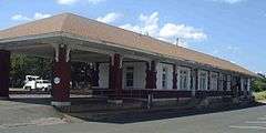
Missouri-Pacific Railroad Depot-Arkadelphia |
|
000000001992-06-11-0000June 11, 1992
(#92000599) |
S. 5th St.
34°07′05″N 93°03′09″W / 34.118136°N 93.052453°W / 34.118136; -93.052453 (Missouri-Pacific Railroad Depot-Arkadelphia) |
Arkadelphia |
|
| 28 |
Missouri-Pacific Railroad Depot-Gurdon |
|
000000001992-06-11-0000June 11, 1992
(#92000609) |
Northwest of the junction of N. 1st and E. Walnut Sts.
33°55′14″N 93°09′07″W / 33.920556°N 93.151944°W / 33.920556; -93.151944 (Missouri-Pacific Railroad Depot-Gurdon) |
Gurdon |
|
| 29 |
Okolona Colored High School Gymnasium |
|
000000002011-09-23-0000September 23, 2011
(#11000686) |
767 Layne St.
33°59′35″N 93°20′23″W / 33.993056°N 93.339722°W / 33.993056; -93.339722 (Okolona Colored High School Gymnasium) |
Okolona |
|
| 30 |
Old Arkansas 51, Curtis to Gum Springs |
|
000000002004-01-21-0000January 21, 2004
(#03001457) |
West of U.S. Route 67, starting approximately 0.5 miles south of the junction of U.S. Route 67 and Curtis Cemetery Rd., and ending at its junction with Highway 26
34°01′58″N 93°06′18″W / 34.032778°N 93.105°W / 34.032778; -93.105 (Old Arkansas 51, Curtis to Gum Springs) |
Curtis |
|
| 31 |
Old Bank of Amity |
|
000000001991-06-05-0000June 5, 1991
(#91000690) |
Northwestern corner of the town square
34°15′55″N 93°27′40″W / 34.265278°N 93.461111°W / 34.265278; -93.461111 (Old Bank of Amity) |
Amity |
|
| 32 |
Old US 67 Rest Area |
|
000000002006-10-05-0000October 5, 2006
(#06000907) |
Western side of Old U.S. Route 67, approx. 0.5 miles south of Middleton
34°01′12″N 93°06′35″W / 34.02°N 93.109722°W / 34.02; -93.109722 (Old US 67 Rest Area) |
Curtis |
|
| 33 |
Peake High School |
|
000000002005-01-19-0000January 19, 2005
(#04001499) |
1600 Caddo St.
34°07′17″N 93°04′03″W / 34.121389°N 93.0675°W / 34.121389; -93.0675 (Peake High School) |
Arkadelphia |
|
| 34 |
Ronoake Baptist Church |
|
000000002011-09-23-0000September 23, 2011
(#11000687) |
North end of Ronoake Baptist Church Rd.
33°56′33″N 93°08′48″W / 33.9425°N 93.1467°W / 33.9425; -93.1467 (Ronoake Baptist Church) |
Gurdon vicinity |
|
| 35 |
Rose Hill Cemetery |
|
000000001999-02-01-0000February 1, 1999
(#98000613) |
1200 block of Main St.
34°07′07″N 93°03′41″W / 34.118611°N 93.061389°W / 34.118611; -93.061389 (Rose Hill Cemetery) |
Arkadelphia |
|
| 36 |
Rosedale Plantation Barn |
|
000000002004-01-21-0000January 21, 2004
(#03001451) |
879 Old Military Rd.
34°09′41″N 93°06′07″W / 34.161389°N 93.101944°W / 34.161389; -93.101944 (Rosedale Plantation Barn) |
Arkadelphia |
|
| 37 |
Ross Site (3CL401) |
Upload image |
000000001985-10-10-0000October 10, 1985
(#85003133) |
Address Restricted
|
Whelen Springs |
|
| 38 |
June Sandidge House |
|
000000001993-02-25-0000February 25, 1993
(#93000093) |
811 Cherry St.
33°55′21″N 93°08′41″W / 33.9225°N 93.144722°W / 33.9225; -93.144722 (June Sandidge House) |
Gurdon |
|
| 39 |
C. E. Thompson General Store and House |
|
000000002001-04-04-0000April 4, 2001
(#01000302) |
3100 Hollywood
34°07′03″N 93°05′49″W / 34.1175°N 93.096944°W / 34.1175; -93.096944 (C. E. Thompson General Store and House) |
Arkadelphia |
|
| 40 |
US 67 Bridge over Little Missouri River |
|
000000002007-01-24-0000January 24, 2007
(#06001271) |
U.S. Route 67
33°52′48″N 93°18′16″W / 33.88°N 93.304444°W / 33.88; -93.304444 (US 67 Bridge over Little Missouri River) |
Prescott |
Extends into Nevada County.
|
| 41 |
W. H. Young House |
|
000000002006-09-20-0000September 20, 2006
(#06000842) |
316 Meador Ln.
34°07′32″N 93°02′21″W / 34.125556°N 93.039167°W / 34.125556; -93.039167 (W. H. Young House) |
Arkadelphia |
|

_004.jpg)

_001.jpg)
