| [3] |
Name on the Register |
Image |
Date listed[4] |
Location |
City or town |
Description |
|---|
| 1 |
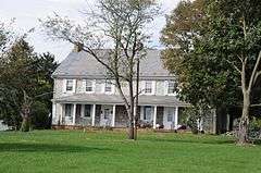
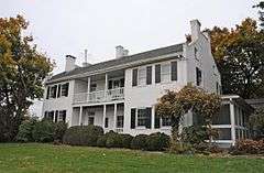
Angle Farm |
|
000000001979-11-20-0000November 20, 1979
(#79002231) |
Southeast of Mercersburg
39°45′53″N 77°51′10″W / 39.764722°N 77.852778°W / 39.764722; -77.852778 (Angle Farm) |
Montgomery Township |
|
| 2 |
Borough Hall of the Borough of Waynesboro |
|
000000001980-12-02-0000December 2, 1980
(#80003496) |
57 East Main Street
39°45′18″N 77°34′36″W / 39.755°N 77.576667°W / 39.755; -77.576667 (Borough Hall of the Borough of Waynesboro) |
Waynesboro |
|
| 3 |
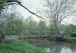
Bridge between Guilford and Hamilton Townships |
|
000000001988-06-22-0000June 22, 1988
(#88000776) |
Legislative Route 28033 over Conococheague Creek near Social Island
39°53′09″N 77°42′48″W / 39.885833°N 77.713333°W / 39.885833; -77.713333 (Bridge between Guilford and Hamilton Townships) |
Guilford and Hamilton Townships |
|
| 4 |
Bridge in Metal Township |
|
000000001988-06-22-0000June 22, 1988
(#88000763) |
Legislative Route 45 Spur east over West Branch Conococheague Creek, near Willow Hill
40°07′13″N 77°46′39″W / 40.120278°N 77.7775°W / 40.120278; -77.7775 (Bridge in Metal Township) |
Metal Township |
|
| 5 |
Brotherton Farm |
|
000000001979-03-30-0000March 30, 1979
(#79002227) |
Southeast of Chambersburg on Falling Spring Road
39°54′43″N 77°36′58″W / 39.911944°N 77.616111°W / 39.911944; -77.616111 (Brotherton Farm) |
Guilford Township |
|
| 6 |
John Brown House |
|
000000001970-03-05-0000March 5, 1970
(#70000548) |
225 East King Street
39°56′20″N 77°39′29″W / 39.938889°N 77.658194°W / 39.938889; -77.658194 (John Brown House) |
Chambersburg |
|
| 7 |
Jeremiah Burns Farm |
|
000000002002-08-15-0000August 15, 2002
(#02000065) |
10988 Fish and Game Road
39°45′58″N 77°31′47″W / 39.76624°N 77.52985°W / 39.76624; -77.52985 (Jeremiah Burns Farm) |
Washington Township |
|
| 8 |
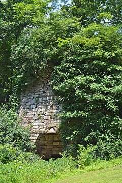
Carrick Furnace |
|
000000001991-09-06-0000September 6, 1991
(#91001133) |
Pennsylvania Route 75 north of Metal
40°01′08″N 77°52′36″W / 40.018889°N 77.876667°W / 40.018889; -77.876667 (Carrick Furnace) |
Metal Township |
|
| 9 |
Chambersburg and Bedford Turnpike Road Company Toll House |
|
000000001978-01-03-0000January 3, 1978
(#78002404) |
West of St. Thomas on U.S. Route 30
39°54′47″N 77°48′50″W / 39.913056°N 77.813889°W / 39.913056; -77.813889 (Chambersburg and Bedford Turnpike Road Company Toll House) |
St. Thomas Township |
|
| 10 |
Chambersburg Historic District |
|
000000001982-08-26-0000August 26, 1982
(#82003789) |
U.S. Routes 11 and 30
39°55′44″N 77°39′41″W / 39.928889°N 77.661389°W / 39.928889; -77.661389 (Chambersburg Historic District) |
Chambersburg |
|
| 11 |
Church Hill Farm |
Upload image |
000000001980-12-02-0000December 2, 1980
(#80003498) |
Northeast of Mercersburg at 8941 Kings Lane
39°50′21″N 77°51′11″W / 39.839167°N 77.853056°W / 39.839167; -77.853056 (Church Hill Farm) |
Peters Township |
|
| 12 |
Coldbrook Farm |
|
000000001996-03-28-0000March 28, 1996
(#96000321) |
955 Spring Lane
39°56′07″N 77°38′32″W / 39.935278°N 77.642222°W / 39.935278; -77.642222 (Coldbrook Farm) |
Chambersburg |
|
| 13 |
Corker Hill |
|
000000002003-03-18-0000March 18, 2003
(#03000131) |
1237 Garver Lane, Scotland
39°58′27″N 77°34′51″W / 39.974167°N 77.580833°W / 39.974167; -77.580833 (Corker Hill) |
Greene Township |
|
| 14 |
Culbertson-Harbison Farm |
|
000000001980-06-27-0000June 27, 1980
(#80003499) |
South of Nyesville on Nyesville Road
40°01′02″N 77°37′44″W / 40.017222°N 77.628889°W / 40.017222; -77.628889 (Culbertson-Harbison Farm) |
Greene Township |
|
| 15 |
Widow Donaldson Place |
|
000000001987-11-05-0000November 5, 1987
(#87001983) |
177 Bear Valley Road near Fort Loudon
39°54′48″N 77°53′45″W / 39.913333°N 77.895833°W / 39.913333; -77.895833 (Widow Donaldson Place) |
Peters Township |
|
| 16 |
Findlay Farm |
Upload image |
000000001983-04-21-0000April 21, 1983
(#83002245) |
6801 Findlay Road near Lamasters
39°49′50″N 77°51′55″W / 39.830556°N 77.865278°W / 39.830556; -77.865278 (Findlay Farm) |
Peters Township |
|
| 17 |
James Finley House |
|
000000001974-11-19-0000November 19, 1974
(#74001783) |
Building No. 505, Letterkenny Army Depot
39°59′56″N 77°38′19″W / 39.998889°N 77.638611°W / 39.998889; -77.638611 (James Finley House) |
Greene Township |
|
| 18 |
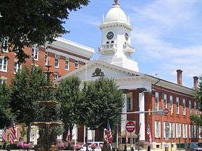
Franklin County Courthouse |
|
000000001974-01-18-0000January 18, 1974
(#74001784) |
1 North Main Street, on Memorial Sq.
39°56′15″N 77°39′38″W / 39.937500°N 77.660556°W / 39.937500; -77.660556 (Franklin County Courthouse) |
Chambersburg |
|
| 19 |
Franklin County Jail |
|
000000001970-01-21-0000January 21, 1970
(#70000549) |
Northwestern corner of King and 2nd Streets
39°56′21″N 77°39′33″W / 39.939167°N 77.659167°W / 39.939167; -77.659167 (Franklin County Jail) |
Chambersburg |
|
| 20 |
Franklin Furnace Historic District |
|
000000001991-09-06-0000September 6, 1991
(#91001136) |
Roughly bounded by Circle Drive and Cinder Street, near Edenville
39°57′32″N 77°49′21″W / 39.958889°N 77.8225°W / 39.958889; -77.8225 (Franklin Furnace Historic District) |
St. Thomas Township |
|
| 21 |
Gass House |
|
000000001977-04-11-0000April 11, 1977
(#77001168) |
East of Chambersburg off U.S. Route 30
39°55′46″N 77°37′46″W / 39.929444°N 77.629444°W / 39.929444; -77.629444 (Gass House) |
Guilford Township |
|
| 22 |
Greencastle Historic District |
|
000000001992-12-24-0000December 24, 1992
(#92001722) |
Roughly bounded by Washington, Pennsylvania Route 2002, Jefferson, Mifflin, Chambers, Grant and Allison, and Baltimore north to Spring Grove
39°47′20″N 77°43′30″W / 39.788889°N 77.725°W / 39.788889; -77.725 (Greencastle Historic District) |
Greencastle |
|
| 23 |
Alexander Hamilton House |
|
000000001980-06-27-0000June 27, 1980
(#80003501) |
45 East Main Street
39°45′18″N 77°34′35″W / 39.755°N 77.576389°W / 39.755; -77.576389 (Alexander Hamilton House) |
Waynesboro |
|
| 24 |
Handycraft Farmstead |
|
000000002002-08-22-0000August 22, 2002
(#02000893) |
11071 Country Club Road
39°45′49″N 77°32′03″W / 39.763611°N 77.534167°W / 39.763611; -77.534167 (Handycraft Farmstead) |
Washington Township |
|
| 25 |
Harbaugh's Reformed Church |
|
000000002002-03-20-0000March 20, 2002
(#02000228) |
14301 and 14269 Harbaugh Church Road
39°43′16″N 77°32′02″W / 39.721111°N 77.533889°W / 39.721111; -77.533889 (Harbaugh's Reformed Church) |
Washington Township |
|
| 26 |
Hays Bridge Historic District |
|
000000001978-07-31-0000July 31, 1978
(#78002402) |
East of Mercersburg on Pennsylvania Routes 331 and 328
39°47′19″N 77°51′15″W / 39.788611°N 77.854167°W / 39.788611; -77.854167 (Hays Bridge Historic District) |
Montgomery Township |
|
| 27 |
Horse Valley Bridge |
|
000000001988-06-22-0000June 22, 1988
(#88000775) |
Legislative Route 28093 over Conodoguinet Creek near Upper Strasburg
40°03′57″N 77°45′34″W / 40.065833°N 77.759444°W / 40.065833; -77.759444 (Horse Valley Bridge) |
Letterkenny Township |
|
| 28 |
Irwinton Historic District |
Upload image |
000000002012-12-26-0000December 26, 2012
(#12001096) |
9717 & 9685 Anderson Rd.
39°47′22″N 77°50′56″W / 39.789544°N 77.848953°W / 39.789544; -77.848953 (Irwinton Historic District) |
Montgomery Township |
|
| 29 |
Robert Kennedy Memorial Presbyterian Church |
|
000000002009-06-06-0000June 6, 2009
(#09000385) |
11799 Mercersburg Road
39°45′51″N 77°51′09″W / 39.7642°N 77.8524°W / 39.7642; -77.8524 (Robert Kennedy Memorial Presbyterian Church) |
Montgomery Township |
|
| 30 |
Lane House |
|
000000001972-01-13-0000January 13, 1972
(#72001123) |
14 North Main Street
39°49′44″N 77°54′17″W / 39.828889°N 77.904722°W / 39.828889; -77.904722 (Lane House) |
Mercersburg |
|
| 31 |
Mansfield |
Upload image |
000000001979-04-26-0000April 26, 1979
(#79002232) |
Southeast of Mercersburg
39°47′34″N 77°51′44″W / 39.792778°N 77.862222°W / 39.792778; -77.862222 (Mansfield) |
Montgomery Township |
|
| 32 |
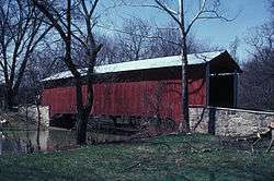
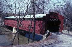
Martin's Mill Covered Bridge |
|
000000001974-02-15-0000February 15, 1974
(#74001786) |
Southwest of Greencastle over Conococheague Creek
39°45′53″N 77°46′33″W / 39.764722°N 77.775833°W / 39.764722; -77.775833 (Martin's Mill Covered Bridge) |
Antrim Township |
|
| 33 |
Masonic Temple |
|
000000001976-06-18-0000June 18, 1976
(#76001640) |
74 South 2nd Street
39°56′09″N 77°39′33″W / 39.935833°N 77.659167°W / 39.935833; -77.659167 (Masonic Temple) |
Chambersburg |
|
| 34 |
McClay's Twin Bridge (East) |
|
000000001988-06-22-0000June 22, 1988
(#88000777) |
Legislative Route 28010 over a tributary of Conodoguinet Creek, near Middle Spring
40°05′54″N 77°34′15″W / 40.098333°N 77.570833°W / 40.098333; -77.570833 (McClay's Twin Bridge (East)) |
Lurgan and Southampton Townships |
|
| 35 |
McClay's Twin Bridge (West) |
|
000000001988-06-22-0000June 22, 1988
(#88000779) |
Legislative Route 28010 over Conodoguinet Creek, near Middle Spring
40°05′53″N 77°34′12″W / 40.098056°N 77.57°W / 40.098056; -77.57 (McClay's Twin Bridge (West)) |
Lurgan Township |
|
| 36 |
McCoy-Shoemaker Farm |
Upload image |
000000001980-06-27-0000June 27, 1980
(#80003500) |
Southwest of Upton on Pennsylvania Route 995
39°47′57″N 77°49′20″W / 39.799167°N 77.822222°W / 39.799167; -77.822222 (McCoy-Shoemaker Farm) |
Peters Township |
|
| 37 |
Memorial Fountain and Statue |
|
000000001978-05-19-0000May 19, 1978
(#78002400) |
Memorial Square
39°56′15″N 77°39′41″W / 39.937500°N 77.661306°W / 39.937500; -77.661306 (Memorial Fountain and Statue) |
Chambersburg |
|
| 38 |
Mercersburg Academy |
|
000000001984-06-21-0000June 21, 1984
(#84003374) |
Pennsylvania Route 16
39°49′34″N 77°53′54″W / 39.826111°N 77.898333°W / 39.826111; -77.898333 (Mercersburg Academy) |
Mercersburg |
|
| 39 |
Mercersburg Historic District |
|
000000001978-12-13-0000December 13, 1978(boundary increase May 17, 1989)
(#78002403) |
Main and Seminary Streets
39°49′38″N 77°54′12″W / 39.827222°N 77.903333°W / 39.827222; -77.903333 (Mercersburg Historic District) |
Mercersburg |
|
| 40 |
Millmont Farm |
Upload image |
000000001979-04-27-0000April 27, 1979
(#79002233) |
East of Mercersburg at the junction of Pennsylvania Routes 16 and 416
39°48′16″N 77°52′24″W / 39.804444°N 77.873333°W / 39.804444; -77.873333 (Millmont Farm) |
Montgomery Township |
|
| 41 |
Mitchell-Shook House |
|
000000001980-09-17-0000September 17, 1980
(#80003497) |
Leitersburg Street
39°46′48″N 77°43′26″W / 39.78°N 77.723889°W / 39.78; -77.723889 (Mitchell-Shook House) |
Greencastle |
|
| 42 |
Monterey Historic District |
|
000000001976-04-22-0000April 22, 1976
(#76001639) |
Off Pennsylvania Route 16 near Blue Ridge Summit
39°44′10″N 77°28′09″W / 39.736111°N 77.469167°W / 39.736111; -77.469167 (Monterey Historic District) |
Washington Township |
|
| 43 |
Mt. Pleasant Iron Works House |
|
000000001974-12-31-0000December 31, 1974
(#74001785) |
About 4 miles (6.4 km) north of Fort Loudon on Pennsylvania Route 75
39°57′53″N 77°53′58″W / 39.964722°N 77.899444°W / 39.964722; -77.899444 (Mt. Pleasant Iron Works House) |
Metal Township |
|
| 44 |
Old Brown's Mill School |
|
000000001973-03-07-0000March 7, 1973
(#73001632) |
Off U.S. Route 11 near Kauffman
39°49′50″N 77°42′08″W / 39.830556°N 77.702222°W / 39.830556; -77.702222 (Old Brown's Mill School) |
Antrim Township |
|
| 45 |
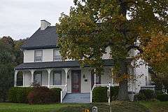
Joseph J. Oller House |
|
000000001996-06-28-0000June 28, 1996
(#96000707) |
138 West Main Street
39°45′26″N 77°34′53″W / 39.757222°N 77.581389°W / 39.757222; -77.581389 (Joseph J. Oller House) |
Waynesboro |
|
| 46 |
Red Run Lodge |
|
000000001996-02-16-0000February 16, 1996
(#96000083) |
Buchanan Trail East (Pennsylvania Route 16) near Rouzerville
39°44′13″N 77°31′03″W / 39.736944°N 77.5175°W / 39.736944; -77.5175 (Red Run Lodge) |
Washington Township |
|
| 47 |
Rock Hill Farm |
Upload image |
000000001999-07-28-0000July 28, 1999
(#99000880) |
12995 and 12755 Bain Road near Mercersburg
39°45′07″N 77°52′08″W / 39.751944°N 77.868889°W / 39.751944; -77.868889 (Rock Hill Farm) |
Montgomery Township |
|
| 48 |
Rocky Spring Presbyterian Church |
|
000000001994-05-13-0000May 13, 1994
(#94000430) |
Rocky Spring Road, approximately 0.5 miles (0.80 km) northwest of Funk Road
39°59′19″N 77°40′35″W / 39.988611°N 77.676389°W / 39.988611; -77.676389 (Rocky Spring Presbyterian Church) |
Letterkenny Township |
|
| 49 |
Royer-Nicodemus House and Farm |
|
000000001976-08-28-0000August 28, 1976
(#76001641) |
1010 East Main Street
39°44′35″N 77°33′44″W / 39.743056°N 77.562222°W / 39.743056; -77.562222 (Royer-Nicodemus House and Farm) |
Waynesboro |
|
| 50 |
Skinner Tavern |
|
000000002005-07-27-0000July 27, 2005
(#05000757) |
13361 Upper Strasburg Road
40°04′07″N 77°45′53″W / 40.068611°N 77.764722°W / 40.068611; -77.764722 (Skinner Tavern) |
Letterkenny Township |
|
| 51 |
Spring Grove Farm and Distillery |
Upload image |
000000001979-08-10-0000August 10, 1979
(#79002229) |
Northwest of Greencastle on Williamsport Pike
39°45′33″N 77°45′31″W / 39.759167°N 77.758611°W / 39.759167; -77.758611 (Spring Grove Farm and Distillery) |
Antrim Township |
|
| 52 |
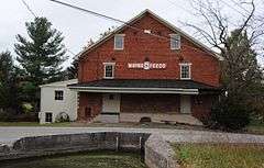
Springdale Mills |
|
000000001975-09-18-0000September 18, 1975
(#75001642) |
Southeast of Waynesboro off Pennsylvania Route 16 on Amsterdam Road
39°44′05″N 77°32′56″W / 39.734722°N 77.548889°W / 39.734722; -77.548889 (Springdale Mills) |
Washington Township |
|
| 53 |
Stover-Winger Farm |
|
000000001979-08-24-0000August 24, 1979
(#79002230) |
Leitersburg Road near Greencastle
39°46′44″N 77°43′12″W / 39.778889°N 77.72°W / 39.778889; -77.72 (Stover-Winger Farm) |
Antrim Township |
|
| 54 |
Townhouse Row |
|
000000001978-12-18-0000December 18, 1978
(#78002401) |
57–85 North Main Street
39°56′20″N 77°39′40″W / 39.938889°N 77.661111°W / 39.938889; -77.661111 (Townhouse Row) |
Chambersburg |
|
| 55 |
Waynesboro Armory |
|
000000001989-12-22-0000December 22, 1989
(#89002080) |
410 North Grant Street near Waynesboro
39°45′56″N 77°34′45″W / 39.765556°N 77.579167°W / 39.765556; -77.579167 (Waynesboro Armory) |
Waynesboro |
|
| 56 |
Welty's Mill Bridge |
|
000000001983-01-06-0000January 6, 1983
(#83002246) |
South of Waynesboro on Pennsylvania Route 997
39°44′16″N 77°34′20″W / 39.737778°N 77.572222°W / 39.737778; -77.572222 (Welty's Mill Bridge) |
Washington Township |
|
| 57 |
White House Inn |
|
000000001986-02-27-0000February 27, 1986
(#86000304) |
10111 Lincoln Way West
39°54′13″N 77°51′15″W / 39.903611°N 77.854167°W / 39.903611; -77.854167 (White House Inn) |
Peters Township |
|
| 58 |
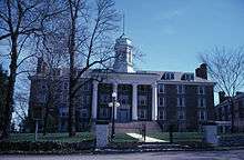
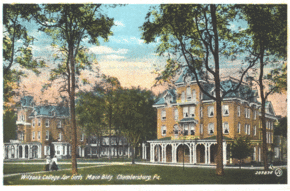
Wilson College |
|
000000001995-07-21-0000July 21, 1995
(#95000888) |
1015 Philadelphia Avenue
39°57′02″N 77°39′20″W / 39.950556°N 77.655556°W / 39.950556; -77.655556 (Wilson College) |
Chambersburg |
|
| 59 |
Woodland |
|
000000001973-09-20-0000September 20, 1973
(#73001633) |
Southwest of St. Thomas on Pennsylvania Route 416
39°53′50″N 77°50′03″W / 39.897222°N 77.834167°W / 39.897222; -77.834167 (Woodland) |
St. Thomas Township |
|
| 60 |
Col. John Work House |
Upload image |
000000001979-11-20-0000November 20, 1979
(#79002234) |
Southeast of Mercersburg
39°47′48″N 77°56′27″W / 39.796667°N 77.940833°W / 39.796667; -77.940833 (Col. John Work House) |
Montgomery Township |
|
| 61 |
Yeakle's Mill Bridge |
|
000000001988-11-14-0000November 14, 1988
(#88002169) |
Legislative Route 28042 over Little Cove Creek
39°44′06″N 78°02′15″W / 39.735°N 78.0375°W / 39.735; -78.0375 (Yeakle's Mill Bridge) |
Warren Township |
|
| 62 |
Zion Reformed Church |
|
000000001979-12-17-0000December 17, 1979
(#79002228) |
South Main and West Liberty Streets
39°55′58″N 77°39′45″W / 39.932778°N 77.662500°W / 39.932778; -77.662500 (Zion Reformed Church) |
Chambersburg |
|


.jpg)
.jpg)

