| [3] |
Name on the Register |
Image |
Date listed[4] |
Location |
District[5] |
Description |
|---|
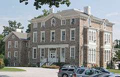
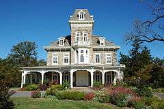
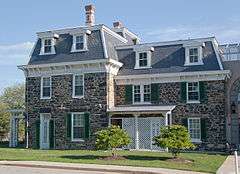
| 1 |
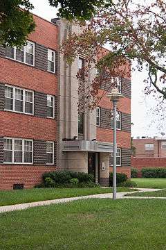
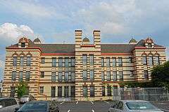
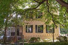
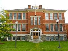
Louisa May Alcott School |
|
000000001990-03-29-0000March 29, 1990
(#90000544) |
2702 Keyworth Ave.
39°19′58″N 76°39′49″W / 39.332778°N 76.663611°W / 39.332778; -76.663611 (Louisa May Alcott School) |
Northwest |
|
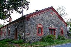
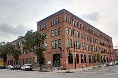
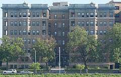
| 2 |
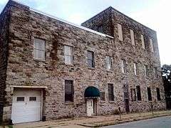
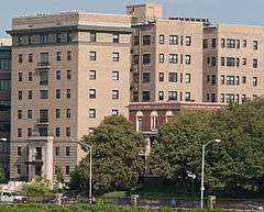
American Ice Company Baltimore Plant No. 2 |
|
000000002002-12-27-0000December 27, 2002
(#02001589) |
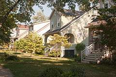
330 W. 23rd St.
39°18′55″N 76°37′19″W / 39.315278°N 76.621944°W / 39.315278; -76.621944 (American Ice Company Baltimore Plant No. 2) |
North |
|
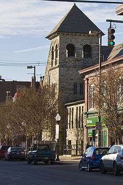
| 3 |
Auchentoroly Terrace Historic District |
Upload image |
000000002015-09-17-0000September 17, 2015
(#15000604) |
Roughly bounded by Auchentoroly Terrace, Reisterstown Rd., Liberty Heights & Fulton Aves.
39°19′03″N 76°38′57″W / 39.3176°N 76.6492°W / 39.3176; -76.6492 (Auchentoroly Terrace Historic District) |
Northwest |
|
| 4 |
Bellona-Gittings Historic District |
|
000000002008-12-24-0000December 24, 2008
(#08001217) |
Bounded by E. Lake, Melrose, and Gittings Aves. and York, Charles, Charlesbrooke, and Overbrook Rds.
39°22′09″N 76°37′21″W / 39.369133°N 76.622497°W / 39.369133; -76.622497 (Bellona-Gittings Historic District) |
North |
|
| 5 |
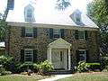
Brick Hill |
|
000000001988-07-01-0000July 1, 1988
(#88000743) |
Seneca St., Oakington St., and Parkden Ave.
39°19′49″N 76°38′38″W / 39.330278°N 76.643889°W / 39.330278; -76.643889 (Brick Hill) |
North |
|
| 6 |
Cedar Grove |
|
000000001996-11-15-0000November 15, 1996
(#96001349) |
301 Kendall Rd.
39°20′43″N 76°37′46″W / 39.345278°N 76.629444°W / 39.345278; -76.629444 (Cedar Grove) |
North |
|
| 7 |
Cedarcroft Historic District |
|
000000002003-12-24-0000December 24, 2003
(#03001332) |
Bounded by Gittings Ave., York Rd., E. Lake Ave., and Bellona Ave.
39°22′17″N 76°36′52″W / 39.371389°N 76.614444°W / 39.371389; -76.614444 (Cedarcroft Historic District) |
North |
|
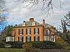
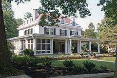
| 8 |
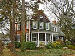
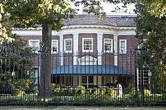
Charlcote House |
|
000000001988-10-17-0000October 17, 1988
(#88001858) |
15 Charlcote Pl.
39°20′37″N 76°37′08″W / 39.343611°N 76.618889°W / 39.343611; -76.618889 (Charlcote House) |
North |
|
| 9 |
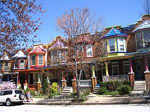
Charles Village-Abell Historic District |
|
000000001983-12-15-0000December 15, 1983
(#83003629) |
Roughly bounded by University Parkway, Guilford Ave., and 25th, Mace, Charles, and Barclay Sts.
39°19′27″N 76°36′55″W / 39.324167°N 76.615278°W / 39.324167; -76.615278 (Charles Village-Abell Historic District) |
North |
See also Charles Village and Abell
|
| 10 |
Cylburn House and Park District |
|
000000001972-05-04-0000May 4, 1972
(#72001493) |
4915 Green Spring Ave.
39°21′09″N 76°39′10″W / 39.3525°N 76.652778°W / 39.3525; -76.652778 (Cylburn House and Park District) |
North |
|
| 11 |
Dickeyville Historic District |
|
000000001972-07-12-0000July 12, 1972
(#72001494) |
Both sides of Forest Park Ave. in Gwynn's Falls area
39°19′00″N 76°42′18″W / 39.316667°N 76.705°W / 39.316667; -76.705 (Dickeyville Historic District) |
Northwest |
|
| 12 |
Druid Hill Park Historic District |
|
000000001973-05-22-0000May 22, 1973
(#73002183) |
Druid Hill Park
39°19′23″N 76°38′41″W / 39.323056°N 76.644722°W / 39.323056; -76.644722 (Druid Hill Park Historic District) |
North |
|
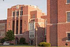
| 13 |
Eastern High School |
|
000000002000-08-16-0000August 16, 2000
(#00000870) |
1101 E. 33rd St.
39°19′40″N 76°36′08″W / 39.327778°N 76.602222°W / 39.327778; -76.602222 (Eastern High School) |
North |
|
| 14 |
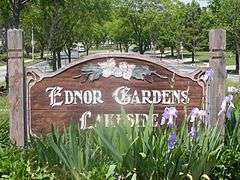
Ednor Gardens Historic District |
|
000000002004-03-30-0000March 30, 2004
(#03001373) |
Roughly bounded by Ellerslie Ave., 36th St., The Alameda, Andover Rd. and Chestnut Hill Ave.
39°20′09″N 76°36′01″W / 39.335833°N 76.600278°W / 39.335833; -76.600278 (Ednor Gardens Historic District) |
North |
|
| 15 |
Evergreen House |
|
000000001983-01-17-0000January 17, 1983
(#83002932) |
4545 N. Charles St.
39°20′54″N 76°37′16″W / 39.348333°N 76.621111°W / 39.348333; -76.621111 (Evergreen House) |
North |
|
| 16 |
Evergreen on the Falls |
|
000000001975-07-30-0000July 30, 1975
(#75002095) |
3300 Falls Rd.
39°19′37″N 76°38′06″W / 39.326944°N 76.635°W / 39.326944; -76.635 (Evergreen on the Falls) |
North |
|
| 17 |
First Church of Christ, Scientist |
|
000000001982-12-27-0000December 27, 1982
(#82001584) |
102 W. University Parkway
39°20′06″N 76°37′16″W / 39.335°N 76.621111°W / 39.335; -76.621111 (First Church of Christ, Scientist) |
North |
|
| 18 |
Gallagher Mansion and Outbuilding |
|
000000001983-09-15-0000September 15, 1983
(#83002934) |
431-435 Notre Dame Lane
39°21′05″N 76°36′39″W / 39.351389°N 76.610833°W / 39.351389; -76.610833 (Gallagher Mansion and Outbuilding) |
North |
|
| 19 |
Grace-Hampden Methodist Episcopal Church |
|
000000002001-08-02-0000August 2, 2001
(#01000809) |
1014 W. 36th St.
39°19′52″N 76°38′01″W / 39.33124°N 76.63362°W / 39.33124; -76.63362 (Grace-Hampden Methodist Episcopal Church) |
North |
|
| 20 |
Greater Homeland Historic District |
|
000000002001-12-28-0000December 28, 2001
(#01001377) |
Roughly bounded by Charles St. Homeland Ave., York Rd., and Melrose Ave.
39°21′34″N 76°37′08″W / 39.359444°N 76.618889°W / 39.359444; -76.618889 (Greater Homeland Historic District) |
North |
|
| 21 |
Guilford Historic District |
|
000000002001-07-19-0000July 19, 2001
(#01000745) |
Roughly bounded by N. Charles St., Warrenton Rd., Linkwood Rd., Cold Spring Ln., York Rd., Southway, University Parkway, and Bishops Rd.
39°20′31″N 76°37′00″W / 39.341944°N 76.616667°W / 39.341944; -76.616667 (Guilford Historic District) |
North |
|
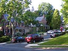
| 22 |
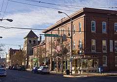
Hampden Historic District |
|
000000002004-12-29-0000December 29, 2004
(#04001405) |
Roughly bounded by Jones Falls, W. 40th St. and Wyman Park
39°19′57″N 76°37′57″W / 39.3325°N 76.6325°W / 39.3325; -76.6325 (Hampden Historic District) |
North |
|
| 23 |
Highfield House |
|
000000002007-09-12-0000September 12, 2007
(#07000942) |
4000 N. Charles St.
39°20′18″N 76°37′08″W / 39.338333°N 76.618889°W / 39.338333; -76.618889 (Highfield House) |
North |
|
| 24 |
Hochschild, Kohn Belvedere and Hess Shoes |
|
000000002003-12-18-0000December 18, 2003
(#03001296) |
5911 York Rd. and 510 Belvedere Ave.
39°21′57″N 76°36′35″W / 39.365833°N 76.609722°W / 39.365833; -76.609722 (Hochschild, Kohn Belvedere and Hess Shoes) |
North |
|
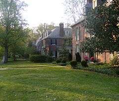
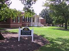
| 25 |
Homewood |
|
000000001971-09-10-0000September 10, 1971
(#71001033) |
N. Charles and 34th Sts.
39°19′46″N 76°37′09″W / 39.329444°N 76.619167°W / 39.329444; -76.619167 (Homewood) |
North |
|
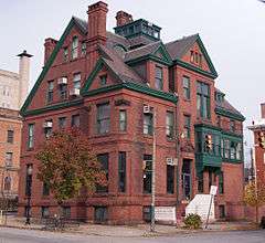
| 26 |
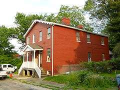
James E. Hooper House |
|
000000001982-03-15-0000March 15, 1982
(#82004746) |
100 E. 23rd St.
39°18′56″N 76°36′56″W / 39.315556°N 76.615556°W / 39.315556; -76.615556 (James E. Hooper House) |
North |
|
| 27 |
Howard Park P.S. 218 |
|
000000002000-09-27-0000September 27, 2000
(#00001084) |
4801 Liberty Heights Ave.
39°19′53″N 76°41′54″W / 39.331389°N 76.698333°W / 39.331389; -76.698333 (Howard Park P.S. 218) |
Northwest |
|
| 28 |
Lake Drive Apartments |
|
000000002001-12-28-0000December 28, 2001
(#01001368) |
903 Druid Park Lake Dr.
39°19′00″N 76°38′13″W / 39.316667°N 76.636944°W / 39.316667; -76.636944 (Lake Drive Apartments) |
North |
|
| 29 |
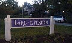
Lake-Evesham Historic District |
|
000000002003-12-23-0000December 23, 2003
(#03001323) |
Roughly bounded by East Lake Ave., York Rd., Evesham Ave., and Bellona Ave.
39°22′06″N 76°36′49″W / 39.368333°N 76.613611°W / 39.368333; -76.613611 (Lake-Evesham Historic District) |
North |
|
| 30 |
Lake Roland Historic District |
Upload image |
000000001992-10-15-0000October 15, 1992
(#92001285) |
Robert E. Lee Memorial Park
39°23′13″N 76°38′49″W / 39.386944°N 76.646944°W / 39.386944; -76.646944 (Lake Roland Historic District) |
North |
|
| 31 |
Lombard Street Bridge |
Upload image |
000000001972-09-27-0000September 27, 1972
(#75002093) |
Over Gwynns Falls off Wetheredsville Rd.
39°19′00″N 76°42′01″W / 39.316667°N 76.700278°W / 39.316667; -76.700278 (Lombard Street Bridge) |
Northwest |
dismantled and placed into storage in 1975.[6]
|
| 32 |
Londontown Manufacturing Company, Inc. |
|
000000001973-01-12-0000January 12, 1973
(#73002188) |
3600 Clipper Mill Rd.
39°19′53″N 76°38′34″W / 39.331389°N 76.642778°W / 39.331389; -76.642778 (Londontown Manufacturing Company, Inc.) |
North |
|
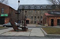
| 33 |
Lovely Lane Methodist Church |
|
000000001973-05-25-0000May 25, 1973
(#73002189) |
2200 St. Paul St.
39°18′52″N 76°36′57″W / 39.314444°N 76.615833°W / 39.314444; -76.615833 (Lovely Lane Methodist Church) |
North |
|
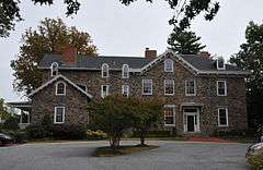
| 34 |
Elmer V. McCollum House |
Upload image |
000000001976-01-07-0000January 7, 1976
(#76002182) |
2301 Monticello Rd.
39°18′49″N 76°41′06″W / 39.313611°N 76.685°W / 39.313611; -76.685 (Elmer V. McCollum House) |
Northwest |
|
| 35 |
H.F. Miller & Son Tin Box and Can Manufacturing Plant |
|
000000002003-12-10-0000December 10, 2003
(#03001268) |
2601 N. Howard St.
39°19′10″N 76°37′12″W / 39.319444°N 76.62°W / 39.319444; -76.62 (H.F. Miller & Son Tin Box and Can Manufacturing Plant) |
North |
|
| 36 |
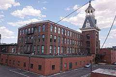
Mount Vernon Mill No. 1 |
|
000000002001-04-19-0000April 19, 2001
(#01000388) |
3000 Falls Rd.
39°19′23″N 76°37′52″W / 39.323056°N 76.631111°W / 39.323056; -76.631111 (Mount Vernon Mill No. 1) |
North |
|
| 37 |
Mount Washington Mill Historic District |
|
000000001990-05-04-0000May 4, 1990
(#90000727) |
1405-1407 Forge Ave.; also 1330-1340 Smith Ave.
39°22′05″N 76°39′01″W / 39.36818°N 76.65025°W / 39.36818; -76.65025 (Mount Washington Mill Historic District) |
North |
Smith Ave. addresses represent a boundary increase.
|
| 38 |
Northern District Police Station |
|
000000002001-12-28-0000December 28, 2001
(#01001372) |
3355 Keswick Rd.
39°19′42″N 76°37′39″W / 39.328333°N 76.6275°W / 39.328333; -76.6275 (Northern District Police Station) |
North |
|
| 39 |
Northwood Historic District |
|
000000001998-06-15-0000June 15, 1998
(#98000596) |
Loch Raven Boulevard, The Almeda, and Cold Spring Ln.
39°20′26″N 76°35′48″W / 39.340556°N 76.596667°W / 39.340556; -76.596667 (Northwood Historic District) |
North |
|
| 40 |
Oakenshawe Historic District |
|
000000002003-12-18-0000December 18, 2003
(#03001293) |
Roughly bounded by York Rd., University Parkway, Calvert St., and Southway
39°19′55″N 76°36′48″W / 39.331944°N 76.613333°W / 39.331944; -76.613333 (Oakenshawe Historic District) |
North |
|
| 41 |
Old Goucher College Buildings |
|
000000001978-08-25-0000August 25, 1978
(#78003143) |
Roughly bounded by 24th, N. Calvert, and 23rd Sts., and Maryland Ave.
39°18′57″N 76°37′02″W / 39.315833°N 76.617222°W / 39.315833; -76.617222 (Old Goucher College Buildings) |
North |
|
| 42 |
Park Circle Historic District |
|
000000002008-12-04-0000December 4, 2008
(#08001124) |
Roughly bounded by Overview Ave., Shirley Ave., Cottage Ave., and Henry G. Parks Jr. Circle
39°19′40″N 76°39′36″W / 39.327642°N 76.660042°W / 39.327642; -76.660042 (Park Circle Historic District) |
Northwest |
|
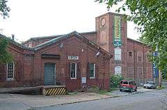
| 43 |
Poole and Hunt Company Buildings |
|
000000001973-07-02-0000July 2, 1973
(#73002194) |
3500 Clipper Rd.
39°19′53″N 76°38′45″W / 39.331389°N 76.645833°W / 39.331389; -76.645833 (Poole and Hunt Company Buildings) |
North |
|
| 44 |
Radnor-Winston Historic District |
|
000000002003-12-29-0000December 29, 2003
(#03001327) |
Roughly bounded by Notre Dame Ln., College of Notre Dame, Radnor Ave. and York Rd.
39°21′04″N 76°36′45″W / 39.351111°N 76.6125°W / 39.351111; -76.6125 (Radnor-Winston Historic District) |
North |
|
| 45 |
Riviera Apartments |
|
000000001999-08-12-0000August 12, 1999
(#99000985) |
901 Druid Park Lake Dr.
39°19′07″N 76°38′11″W / 39.318611°N 76.636389°W / 39.318611; -76.636389 (Riviera Apartments) |
North |
|
| 46 |
Roland Park Historic District |
|
000000001974-12-23-0000December 23, 1974
(#74002213) |
Irregular pattern between Belvedere Ave., Falls Rd., 39th St., and Stoney Run
39°20′57″N 76°38′05″W / 39.349167°N 76.634722°W / 39.349167; -76.634722 (Roland Park Historic District) |
North |
|
| 47 |
Ruscombe |
|
000000002007-12-20-0000December 20, 2007
(#07001033) |
4901 Springarden Dr.
39°20′59″N 76°39′30″W / 39.349722°N 76.658333°W / 39.349722; -76.658333 (Ruscombe) |
North |
|
| 48 |
St. John's Protestant Episcopal Church |
|
000000001974-03-27-0000March 27, 1974
(#74002214) |
3009 Greenmount Ave.
39°19′31″N 76°36′32″W / 39.325278°N 76.608889°W / 39.325278; -76.608889 (St. John's Protestant Episcopal Church) |
North |
|
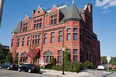
| 49 |
Samester Parkway Apartments |
|
000000001998-09-09-0000September 9, 1998
(#98001157) |
7000-7022 Park Heights Ave.
39°21′58″N 76°42′23″W / 39.366111°N 76.706389°W / 39.366111; -76.706389 (Samester Parkway Apartments) |
Northwest |
|
| 50 |
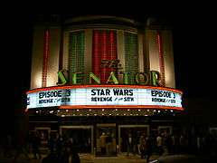
Senator Theatre |
|
000000001989-08-24-0000August 24, 1989
(#89001153) |
5904-5906 York Rd.
39°21′49″N 76°36′39″W / 39.363611°N 76.610833°W / 39.363611; -76.610833 (Senator Theatre) |
North |
|
| 51 |
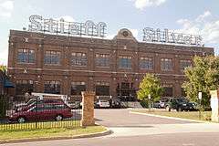
Stieff Silver Company Factory |
|
000000002000-06-30-0000June 30, 2000
(#00000744) |
800 Wyman Park Dr.
39°19′08″N 76°37′42″W / 39.318889°N 76.628333°W / 39.318889; -76.628333 (Stieff Silver Company Factory) |
North |
|
| 52 |
Stone Hill Historic District |
|
000000002001-12-26-0000December 26, 2001
(#01001370) |
Pacific, Puritan, Bay, Field, and Worth Sts.
39°19′24″N 76°37′46″W / 39.323333°N 76.629444°W / 39.323333; -76.629444 (Stone Hill Historic District) |
North |
|
| 53 |
Tivoli |
|
000000001980-10-09-0000October 9, 1980
(#80001791) |
1301 Woodbourne Ave.
39°21′12″N 76°35′33″W / 39.353333°N 76.5925°W / 39.353333; -76.5925 (Tivoli) |
North |
|
| 54 |
Tuscany-Canterbury Historic District |
|
000000002001-10-28-0000October 28, 2001
(#01001182) |
Roughly bounded by Charles St., University Parkway, Stony Run, and Warrenton Rd.
39°20′16″N 76°37′18″W / 39.337778°N 76.621667°W / 39.337778; -76.621667 (Tuscany-Canterbury Historic District) |
North |
|
| 55 |
Waverly Main Street Historic District |
Upload image |
000000002013-12-31-0000December 31, 2013
(#13001020) |
Roughly bounded by E. 29th & E. 35th Sts., Old York Rd., Greenmount Ave.
39°19′42″N 76°36′32″W / 39.328417°N 76.608916°W / 39.328417; -76.608916 (Waverly Main Street Historic District) |
Northwest |
|
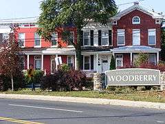
| 56 |
Woodberry Historic District |
|
000000002003-12-29-0000December 29, 2003
(#03001326) |
Roughly Clipper Ave, Druid Park Dr., and Girard, Hooper, Keystone, Malden, Parkdale, and Rockrose Aves.
39°20′05″N 76°38′52″W / 39.334722°N 76.647778°W / 39.334722; -76.647778 (Woodberry Historic District) |
North |
|

.jpg)
_1.jpg)
_01.JPG)