National Register of Historic Places listings in St. Louis County, Minnesota

This is a list of the National Register of Historic Places listings in Saint Louis County, Minnesota. It is intended to be a complete list of the properties and districts on the National Register of Historic Places in Saint Louis County, Minnesota, United States. The locations of National Register properties and districts for which the latitude and longitude coordinates are included below, may be seen in an online map.[1]
There are 123 properties and districts listed on the National Register in the county, including three National Historic Landmarks. A supplementary list includes two additional sites that were formerly on the National Register.
Many of Saint Louis County's listings are associated with the city of Duluth's role as the westernmost port on the Great Lakes, shared with Superior, Wisconsin. The iron ore of the Mesabi Range and the Vermilion Range led to the development of the cities of Chisholm, Hibbing, Virginia, and Ely. Three of the iron mines are National Historic Landmarks: Hull-Rust-Mahoning Open Pit Iron Mine, Mountain Iron Mine, and the underground Soudan Iron Mine.
- This National Park Service list is complete through NPS recent listings posted December 2, 2016.[2]
Current listings
| [3] | Name on the Register[4] | Image | Date listed[5] | Location | City or town | Description |
|---|---|---|---|---|---|---|
| 1 | Aerial Lift Bridge | |
(#73002174) |
Lake Avenue 46°46′44″N 92°05′34″W / 46.77897°N 92.092896°W |
Duluth | 1905 transporter bridge, modified into a vertical-lift bridge in 1930.[6] |
| 2 | Elias and Lisi Aho Historic Farmstead | Upload image | (#90000499) |
off Township Road 358 47°39′06″N 92°09′35″W / 47.651679°N 92.159683°W |
Embarrass vicinity | Immigrant farmstead built 1902–1907 in traditional Finnish style.[7] |
| 3 | Alango School | |
(#80004338) |
County Roads 22 and 25 47°46′25″N 92°47′35″W / 47.773548°N 92.793027°W |
Cook vicinity | 1927 brick and stucco school.[7] |
| 4 | Andrew G. Anderson House | 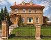 |
(#80004348) |
1001 E. Howard Street 47°25′40″N 92°55′46″W / 47.427848°N 92.929546°W |
Hibbing | 1920 Georgian Revival house of a founder of the bus company that became Greyhound Lines.[7] |
| 5 | Androy Hotel |  |
(#86001290) |
592 E. Howard Street 47°25′38″N 92°56′10″W / 47.427214°N 92.936233°W |
Hibbing | 1921 brick and stone Renaissance Revival hotel commissioned by the Oliver Iron Mining Company.[7] |
| 6 | Archeological Site 21SL35 |  |
(#87002165) |
Voyageurs National Park |
International Falls vicinity | Pre-Columbian habitation site.[7] |
| 7 | Archeological Site 21SL55 | |
(#88000989) |
Voyageurs National Park |
International Falls vicinity | Campsite used 700–1500 CE.[7] |
| 8 | Archeological Site 21SL141 | |
(#87002164) |
Voyageurs National Park |
International Falls vicinity | Habitation site occupied c. 300–1900 CE.[7] |
| 9 | Archeological Site No. 21SL73 | |
(#88003130) |
Voyageurs National Park |
International Falls vicinity | Seasonal campsite used 100 BCE–1500 CE.[7] |
| 10 | Archeological Site No. 21SL82 | |
(#88000067) |
Voyageurs National Park |
International Falls vicinity | Campsite used c. 3000 BCE–1900 CE.[7] |
| 11 | B'nai Abraham Synagogue | 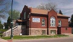 |
(#80004356) |
328 S. 5th Street 47°31′07″N 92°32′11″W / 47.518516°N 92.536367°W |
Virginia | 1909 brick synagogue.[7] |
| 12 | W. Bailey House | 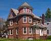 |
(#80004347) |
705 Pierce Street 47°27′47″N 92°32′04″W / 47.462999°N 92.534527°W |
Eveleth | 1905 dyed-cement Queen Anne house.[7] |
| 13 | W.T. Bailey House |  |
(#80004357) |
816 S. 5th Avenue 47°30′59″N 92°32′17″W / 47.516306°N 92.538089°W |
Virginia | c. 1921 Mission Revival house of a lumberman.[7] |
| 14 | Bridge No. 5757 | 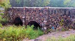 |
(#98000720) |
State Highway 23 (MN 23) over Mission Creek at Fond du Lac neighborhood 46°39′38″N 92°16′32″W / 46.660479°N 92.275608°W |
Duluth | 1937 National Park Service rustic/Gothic Revival arch bridge, similar to 1930s federal relief construction but built by a private contractor.[8] |
| 15 | Bridge No. L-6007 | 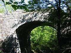 |
(#89001826) |
Skyline Parkway over Stewart Creek at Smithville neighborhood 46°42′13″N 92°13′41″W / 46.703532°N 92.228047°W |
Duluth | c. 1925 stone arch bridge.[7] |
| 16 | Bruce Mine Headframe | 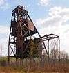 |
(#78003124) |
off U.S. Highway 169 47°28′38″N 92°51′54″W / 47.477126°N 92.865087°W |
Chisholm | 1926 steel headframe.[7] |
| 17 | Buhl Public Library | 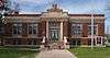 |
(#83004605) |
Jones Avenue at Frantz Street 47°29′45″N 92°46′34″W / 47.495893°N 92.776108°W |
Buhl | 1918 brick and stone Classical Revival library.[7] |
| 18 | Buhl Village Hall |  |
(#83000944) |
Jones Avenue at 4th Street 47°29′44″N 92°46′40″W / 47.495531°N 92.777765°W |
Buhl | 1913 brick and stone Beaux-Arts town hall.[7] |
| 19 | Bull-of-the-Woods Logging Scow | |
(#99000189) |
Address Restricted |
Morse Township | Wreck of a c. 1893 timber rafting steam scow.[7] |
| 20 | Burntside Lodge | 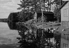 |
(#88000896) |
off County Road 88 47°55′28″N 91°57′08″W / 47.924309°N 91.95231°W |
Ely | Rustic log resort complex built 1914–1937, the first full-fledged resort in the region.[7] |
| 21 | Emmett Butler House | 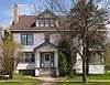 |
(#80004349) |
2530 3rd Avenue W. 47°25′14″N 92°56′39″W / 47.420582°N 92.944202°W |
Hibbing | 1916 Colonial Revival house of a co-founder of a mining technology company.[7] |
| 22 | Chester Terrace | 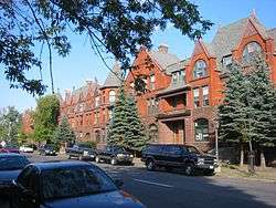 |
(#80004341) |
1210–1232 E. 1st Street 46°47′58″N 92°05′00″W / 46.799472°N 92.083395°W |
Duluth | 1890 brick and stone Romanesque Revival rowhouse designed by Oliver G. Traphagen and Francis W. Fitzpatrick.[7] |
| 23 | Chisholm Commercial Historic District | Upload image | (#16000512) |
W. Lake St. between Central Ave. N. & S. & 4th Ave., NW. & SW., the E. side of Central Ave. N. & S. between 1st St. NE. 47°29′21″N 92°52′55″W / 47.489175°N 92.882008°W |
Chisholm | |
| 24 | Church of St. John the Baptist (Catholic) | .jpg) |
(#80004362) |
309 S. 3rd Avenue 47°31′15″N 92°32′09″W / 47.520744°N 92.535921°W |
Virginia | 1924 brick Gothic Revival church built for a Polish immigrant congregation.[7] |
| 25 | Church of St. Joseph (Catholic) | .jpg) |
(#02000940) |
7897 Elmer Road 47°05′01″N 92°46′37″W / 47.083683°N 92.777047°W |
Meadowlands vicinity | 1913 frame church built for Eastern-European Americans recruited to settle area following logging operations.[7] |
| 26 | Church of the Holy Family (Catholic) | 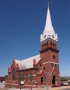 |
(#80004345) |
307 Adams Avenue 47°27′45″N 92°32′18″W / 47.462625°N 92.538368°W |
Eveleth | 1909 brick and stone Gothic Revival church built for a Slovenian American congregation.[7] |
| 27 | Civilian Conservation Corps Camp S-52 | 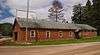 |
(#89000158) |
off U.S. Highway 53 48°06′05″N 92°50′39″W / 48.101389°N 92.844167°W |
Orr vicinity | 1933 frame buildings of a Civilian Conservation Corps forestry camp.[7] |
| 28 | Coates House |  |
(#80004358) |
817 S. 5th Avenue 47°30′58″N 92°32′20″W / 47.516226°N 92.538807°W |
Virginia | c. 1912 frame house.[7] |
| 29 | Chester and Clara Congdon Estate | 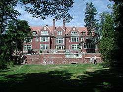 |
(#91001057) |
3300 London Road 46°48′55″N 92°03′06″W / 46.815167°N 92.051793°W |
Duluth | Better known as Glensheen, a 1909 Jacobean Revival mansion designed by Clarence H. Johnston, Sr. for Chester Adgate Congdon.[9] Now a house museum operated by the University of Minnesota Duluth.[10] |
| 30 | Delvic Building |  |
(#80004350) |
1st Avenue and Howard Street 47°25′38″N 92°56′30″W / 47.427131°N 92.941788°W |
Hibbing | 1922 brick commercial building.[7] |
| 31 | DeWitt-Seitz Building | 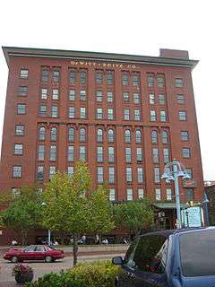 |
(#85001999) |
394 Lake Avenue S. 46°46′55″N 92°05′40″W / 46.781941°N 92.094526°W |
Duluth | 1909 brick warehouse built on Duluth's waterfront.[7] |
| 32 | Duluth Central High School | 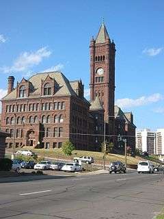 |
(#72001488) |
Lake Avenue and 2nd Street 46°47′21″N 92°06′01″W / 46.789029°N 92.100226°W |
Duluth | 1892 brownstone Richardsonian Romanesque school with clocktower.[7] |
| 33 | Duluth and Iron Range Railroad Company Passenger Station | 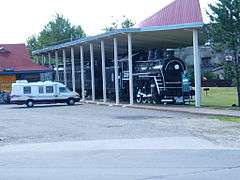 |
(#13000380) |
404 Pine Street 47°48′16″N 92°16′45″W / 47.80442°N 92.2791°W |
Tower | 1915 railway station that spurred the resort and tourism industry on Lake Vermilion in the decades before highway access. Nomination includes a section of rail and several train cars.[11] Now the Tower–Soudan Historical Society History Center.[12] |
| 34 | Duluth Armory | 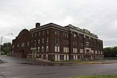 |
(#11000324) |
1301–1305 London Road 46°47′56″N 92°04′50″W / 46.799015°N 92.080651°W |
Duluth | 1915 National Guard and naval militia armory, also served as Duluth's largest concert venue until 1966.[13] |
| 35 | Duluth Civic Center Historic District | 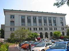 |
(#86003097) |
5th Avenue West and 1st Street 46°47′00″N 92°06′23″W / 46.783333°N 92.106389°W |
Duluth | Classical Revival government buildings designed by Daniel Burnham.[7] |
| 36 | Duluth Commercial Historic District |  |
(#06000455) |
Superior and 1st Streets between 4th Avenue West and 4th Avenue East 46°47′14″N 92°05′56″W / 46.787264°N 92.098764°W |
Duluth | 20-block commercial district dating to the late 19th and early 20th centuries.[14] |
| 37 | Duluth Harbor North Pier Light | .jpg) |
(#16000340) |
In L. Superior at E. end of Duluth Ship Canal N. pier 46°46′51″N 92°05′18″W / 46.780912°N 92.088272°W |
Duluth | |
| 38 | Duluth Harbor South Breakwater Outer Light | .jpg) |
(#16000341) |
In L. Superior at E. end of Duluth Ship Canal S. Breakwater 46°46′48″N 92°05′16″W / 46.780082°N 92.087778°W |
Duluth | |
| 39 | Duluth Masonic Temple | 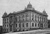 |
(#15000215) |
4 W. 2nd St. 46°47′17″N 92°06′01″W / 46.787929°N 92.100304°W |
Duluth | 1905 Masonic Temple, the longstanding focal point of Duluth's most influential fraternal organization. Further noted for containing Minnesota's largest operable collection of hand-painted stage backdrops.[15] |
| 40 | Duluth Missabe and Iron Range Depot (Endion) | 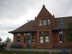 |
(#75002088) |
100 Lake Place 46°47′11″N 92°05′42″W / 46.78632°N 92.095082°W |
Duluth | Small 1899 Richardsonian Romanesque passenger depot of brick and sandstone.[7] |
| 41 | Duluth Public Library | 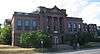 |
(#78003125) |
101 W. 2nd Street 46°47′14″N 92°06′08″W / 46.787311°N 92.102262°W |
Duluth | 1902 brick and sandstone Classical Revival Carnegie library.[7] |
| 42 | Duluth South Breakwater Inner (Duluth Range Rear) Lighthouse | 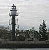 |
(#83000945) |
South Breakwater 46°46′43″N 92°05′31″W / 46.778698°N 92.091992°W |
Duluth | 1901 steel lighthouse on the Duluth Ship Canal.[7] |
| 43 | Duluth State Normal School Historic District | 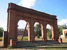 |
(#85002757) |
E. 5th Street 46°48′45″N 92°04′35″W / 46.812466°N 92.076427°W |
Duluth | 1898 teacher training campus, with 3 buildings designed by Clarence H. Johnston, Sr.[7] |
| 44 | Duluth Union Depot | 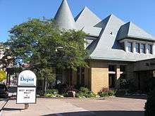 |
(#71001028) |
5th Avenue W. and Michigan Street 46°46′53″N 92°06′15″W / 46.781335°N 92.104059°W |
Duluth | 1892 stone Châteauesque passenger depot designed by Peabody and Stearns.[7] Now houses a variety of cultural institutions.[16] |
| 45 | Duluth, Winnipeg, and Pacific Depot | 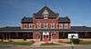 |
(#80004364) |
600 Chestnut Street 47°31′23″N 92°32′28″W / 47.523128°N 92.541119°W |
Virginia | 1913 brick and stone depot.[7] |
| 46 | East Howard Street Commercial Historic District | 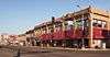 |
(#93000255) |
101–510 E. Howard Street 47°25′39″N 92°56′21″W / 47.427445°N 92.939186°W |
Hibbing | 1921 commercial district.[7] |
| 47 | Ely Community Center | Upload image | (#16000280) |
30 S. 1st Ave. East 47°54′06″N 91°51′56″W / 47.901750°N 91.865507°W |
Ely | |
| 48 | Ely State Theater | 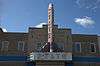 |
(#15000440) |
234 E. Sheridan St. 47°54′11″N 91°51′46″W / 47.903°N 91.862889°W |
Ely | 1936 Streamline Moderne theater, epitomizing the small-town commissions of leading regional theater designers Liebenberg & Kaplan.[17] |
| 49 | Endion School | 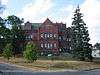 |
(#83000946) |
1801 E. 1st Street 46°48′19″N 92°04′37″W / 46.805298°N 92.076911°W |
Duluth | 1890 brick and stone Richardsonian Romanesque school.[7] |
| 50 | Eveleth Manual Training School | 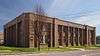 |
(#80004343) |
Roosevelt Avenue 47°27′51″N 92°32′00″W / 47.464159°N 92.533261°W |
Eveleth | 1914 Moderne iron industry trade school, the first vocational school in Minnesota.[7] |
| 51 | Eveleth Recreation Building | 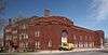 |
(#80004344) |
Garfield Street and Adams Avenue 47°27′59″N 92°32′20″W / 47.466437°N 92.538882°W |
Eveleth | 1918 gymnasium converted in 1930 into a shirt factory to provide employment opportunities for women on the Iron Range.[18] |
| 52 | Finnish Sauna | 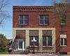 |
(#80004360) |
105 S. 1st Street 47°31′21″N 92°31′54″W / 47.522497°N 92.531662°W |
Virginia | c. 1912 public bathhouse built for a Finnish immigrant community.[7] |
| 53 | Fire House No. 1 | 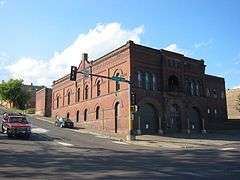 |
(#75002089) |
Northwest corner of 1st Avenue E. and 3rd Street 46°47′25″N 92°06′01″W / 46.790169°N 92.100331°W |
Duluth | 1889 brick Richardsonian Romanesque fire station designed by Oliver G. Traphagen and Francis W. Fitzpatrick.[7] Boundary expanded to include the adjacent 1889 stable/shop building.[19] |
| 54 | First National Bank of Gilbert | 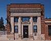 |
(#12000415) |
2 N. Broadway 47°29′15″N 92°28′00″W / 47.487557°N 92.466694°W |
Gilbert | 1920 Classical Revival bank that worked to strengthen the region's agricultural sector.[20] |
| 55 | Fitger Brewing Company | 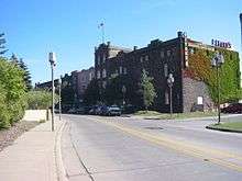 |
(#84001690) |
600 E. Superior Street 46°47′33″N 92°05′26″W / 46.792502°N 92.090535°W |
Duluth | Richardsonian Romanesque brewery complex built 1886–1930.[7] |
| 56 | Flint Creek Farm Historic District | 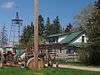 |
(#89000139) |
State Highway 1 47°51′45″N 92°48′36″W / 47.862492°N 92.809914°W |
Cook vicinity | Farm established by two lumbermen to raise provisions for winter logging camps, active 1915–1933.[7] |
| 57 | Jun Fujita Cabin | 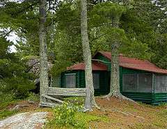 |
(#96001351) |
Wendt Island, Voyageurs National Park 48°32′59″N 92°52′11″W / 48.549828°N 92.869838°W |
Ranier vicinity | 1928 rustic cabin of Japanese American photographer and poet Jun Fujita. Also a rare surviving example of the early recreational development of the Boundary Waters.[21] |
| 58 | Gregorius and Mary Hanka Historic Farmstead | Upload image | (#90000500) |
off Township Road 6544 47°41′24″N 92°12′10″W / 47.689878°N 92.202826°W |
Embarrass Township | Immigrant farmstead built 1910–1915 in traditional Finnish style.[7] |
| 59 | Hartley Building | 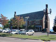 |
(#89002127) |
740 E. Superior Street 46°47′39″N 92°05′18″W / 46.794246°N 92.088314°W |
Duluth | 1914 brick and stone Jacobean Revival office building designed by Bertram Goodhue.[7] |
| 60 | Height of Land Portage | Upload image | (#92000842) |
off County Road 138 in Embarrass, White, and Pike Townships 47°36′49″N 92°18′06″W / 47.613611°N 92.301667°W |
Embarrass vicinity | Portage in use c. 1630s–1870s.[7] |
| 61 | Hibbing City Hall | 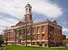 |
(#81000683) |
21st Street E. and 4th Avenue 47°25′36″N 92°56′14″W / 47.426685°N 92.937282°W |
Hibbing | 1922 brick Georgian Revival city hall.[7] |
| 62 | Hibbing Disposal Plant | Upload image | (#91001022) |
1300 E. 23rd Street 47°25′30″N 92°54′56″W / 47.425017°N 92.915545°W |
Hibbing | 1941 concrete Moderne sanitation complex built by the Public Works Administration.[7] |
| 63 | Hibbing High School | 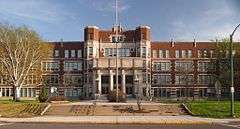 |
(#80004351) |
21st Street at 8th Avenue 47°25′32″N 92°55′57″W / 47.425658°N 92.932529°W |
Hibbing | 1924 brick and stone Jacobean Revival school |
| 64 | Matt and Emma Hill Historic Farmstead | Upload image | (#90000768) |
off Township Road 303 47°39′21″N 92°19′56″W / 47.655881°N 92.332143°W |
Embarrass vicinity | Immigrant farmstead built 1897–1920 in traditional Finnish style.[7] |
| 65 | Hotel Glode | 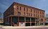 |
(#80004346) |
222 Adams Avenue 47°27′44″N 92°32′16″W / 47.462349°N 92.53767°W |
Eveleth | 1904 brick hotel, once the leading accommodations on the Mesabi Range.[7] |
| 66 | Hull–Rust–Mahoning Open Pit Iron Mine |  |
(#66000904) |
3rd Avenue E. 47°27′10″N 92°57′40″W / 47.452778°N 92.961111°W |
Hibbing | World's largest open-pit mine, active 1895–present.[22] |
| 67 | William Ingersoll Estate | 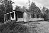 |
(#11000360) |
Ingersoll's Island in Voyageurs National Park 48°21′16″N 92°28′23″W / 48.354351°N 92.473104°W |
Crane Lake vicinity | 1920s island summer home complex, whose 1928 main cabin is a rare surviving E. F. Hodgson Company prefabricated kit house.[23] |
| 68 | Irving School | 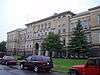 |
(#92001611) |
101 N. 56th Avenue W. 46°44′07″N 92°10′07″W / 46.73539°N 92.16855°W |
Duluth | 1895 brick and stone Renaissance Revival school, Duluth's first source of vocational training.[7] |
| 69 | Jukola Boardinghouse | 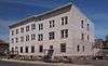 |
(#82004710) |
201 N. 3rd Avenue 47°31′29″N 92°32′05″W / 47.524772°N 92.534666°W |
Virginia | 1912 frame housing for miners.[7] |
| 70 | Kabetogama Ranger Station District | Upload image | (#93000479) |
Southwestern shore of Kabetogama Lake in Voyageurs National Park 48°26′43″N 93°01′47″W / 48.445278°N 93.029722°W |
Ray vicinity | Complex built 1933–1941 for the Minnesota Division of Forestry by the Civilian Conservation Corps, an example of federal work relief projects during the Great Depression and National Park Service rustic architecture.[24] |
| 71 | Kettle Falls Historic District | 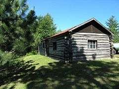 |
(#78000376) |
Kettle Channel in Voyageurs National Park 48°30′05″N 92°38′25″W / 48.501389°N 92.640278°W |
Island View vicinity | Ancient portage site and 1914 dam complex.[7] |
| 72 | Kettle Falls Hotel | 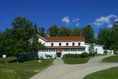 |
(#76000210) |
Kettle Channel in Voyageurs National Park 48°30′11″N 92°38′24″W / 48.502925°N 92.639862°W |
Island View vicinity | Remote 1913 frame hotel, only accessible by water. Reopened as the only lodging within Voyageurs National Park.[25] |
| 73 | Kitchi Gammi Club | 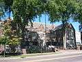 |
(#75002090) |
831 E. Superior Street 46°47′43″N 92°05′16″W / 46.795397°N 92.087772°W |
Duluth | 1913 Georgian/Gothic Revival private clubhouse designed by Bertram Goodhue.[26] |
| 74 | LeMoine Building |  |
(#89000140) |
off County Road 74 47°58′06″N 92°48′37″W / 47.968383°N 92.810247°W |
Gheen (vicinity of Orr) | 1913 false-fronted frame store with living quarters.[7] |
| 75 | Charles Lenont House |  |
(#80004359) |
202 N. 5th Avenue 47°31′27″N 92°32′21″W / 47.524232°N 92.539076°W |
Virginia | 1900 brick Queen Anne house.[7] |
| 76 | Lester River Bridge-Bridge No. 5772 |  |
(#02000934) |
London Road over the Lester River 46°50′12″N 92°00′22″W / 46.836677°N 92.006196°W |
Duluth | 1925 concrete Classical Revival arch bridge with stone facing.[7] |
| 77 | Adolph Levin Cottage | Upload image | (#11000361) |
Kabetogama Narrows near Ash River Maintenance Dock 48°26′05″N 92°51′22″W / 48.434653°N 92.855993°W |
Kabetogama Lake vicinity | 1937 Rustic summer home.[27] |
| 78 | Lincoln Branch Library |  |
(#12001175) |
2229 W. 2nd Street 46°46′00″N 92°07′44″W / 46.766698°N 92.129019°W |
Duluth | 1917 Carnegie library reflecting the evolving emphasis of the Carnegie Foundation and Duluth Public Library on branch libraries and providing services in working-class neighborhoods.[28] |
| 79 | Lincoln School Building | 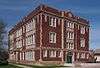 |
(#78003130) |
3rd Avenue at 1st Street N. 47°31′28″N 92°32′04″W / 47.524359°N 92.534403°W |
Virginia | 1922 brick and stone Jacobean Revival school.[7] |
| 80 | Listening Point | Upload image | (#07001316) |
3128 Listening Point Road 47°54′11″N 92°01′01″W / 47.903182°N 92.017083°W |
Ely vicinity | 1956 wilderness retreat of conservationist Sigurd F. Olson.[29] |
| 81 | E.J. Longyear First Diamond Drill Site | Upload image | (#77001526) |
off County Highway 110 47°33′25″N 92°07′04″W / 47.556944°N 92.117778°W |
Hoyt Lakes | 1890 site of first exploration diamond drilling on the Iron Range. Now an Iron Range Historical Society park.[30] |
| 82 | Mike and Mary Matson Historic Farmstead | Upload image | (#90000769) |
off County Highway 21 47°40′42″N 92°12′16″W / 47.678216°N 92.204537°W |
Embarrass Township | c. 1900 immigrant farmstead built in traditional Finnish style.[7] |
| 83 | May Flower (shipwreck) | Upload image | (#12000560) |
2.25 miles south of Lester River in Lake Superior 46°48′12″N 92°00′40″W / 46.803248°N 92.011061°W |
Lester Park vicinity | Wreck of an 1887 scow schooner lost in 1891, an important example of a fairly common but little documented type of Great Lakes merchant vessel.[31] |
| 84 | Minnesota Point Lighthouse | 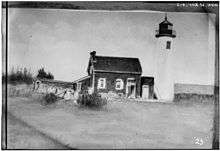 |
(#74002206) |
Minnesota Point – Park Point 46°42′36″N 92°01′33″W / 46.710023°N 92.025848°W |
Duluth | Ruins of 1858 brick lighthouse.[7] |
| 85 | Mitchell-Tappan House |  |
(#80004352) |
2145 4th Avenue 47°25′31″N 92°56′18″W / 47.425178°N 92.938253°W |
Hibbing | 1898 Queen Anne house built for the Oliver Iron Mining Company's superintendent.[7] Now a bed and breakfast.[32] |
| 86 | Bergetta Moe Bakery |  |
(#76002175) |
716 E. Superior Street 46°47′36″N 92°05′22″W / 46.793413°N 92.08936°W |
Duluth | c. 1875 frame shop with living quarters, dating to early development of Duluth.[7] |
| 87 | Monson's Hoist Bay Resort | Upload image | (#11000362) |
Hoist Bay 48°25′05″N 92°44′55″W / 48.417969°N 92.748733°W |
Namakan Lake vicinity | Middle class resort active 1939–1973.[33] |
| 88 | Mountain Iron Mine |  |
(#68000052) |
north of Mountain Iron 47°32′20″N 92°37′25″W / 47.538889°N 92.623611°W |
Mountain Iron | First mine on the Mesabi Range, established 1892.[34] |
| 89 | Munger Terrace | 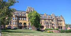 |
(#76002176) |
405 Mesaba Avenue 46°47′08″N 92°06′33″W / 46.785663°N 92.109198°W |
Duluth | 1892 Châteauesque rowhouse designed by Oliver G. Traphagen and Francis W. Fitzpatrick.[7] |
| 90 | Erick and Kristina Nelimark Sauna | Upload image | (#90000770) |
junction of Township Roads 21 and 615 47°39′46″N 92°11′45″W / 47.662778°N 92.195833°W |
Embarrass | c. 1930 traditional log Finnish sauna.[7] Part of the Nelimark Homestead Museum. |
| 91 | Northland | Upload image | (#78003129) |
off U.S. Highway 2 46°44′45″N 92°13′34″W / 46.745833°N 92.226111°W |
Proctor | 1916 private train car of the Duluth, Missabe and Northern Railway president.[7] |
| 92 | Orr Roadside Parking Area | 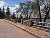 |
(#02000937) |
U.S. Highway 53 at First Avenue 48°03′33″N 92°49′50″W / 48.05918°N 92.830685°W |
Orr | National Park Service rustic wayside built 1935–1938 by the Civilian Conservation Corps.[7] |
| 93 | Pioneer Mine Buildings and "A" Headframe | 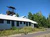 |
(#78003127) |
off Pioneer Road 47°54′43″N 91°51′38″W / 47.911909°N 91.860659°W |
Ely | 1889 complex of Ely's first underground mine.[7] Now houses the Ely Arts & Heritage Center.[35] |
| 94 | Anna and Mikko Pyhala Farm | Upload image | (#03000521) |
4745 Salo Road 47°39′46″N 92°11′11″W / 47.662725°N 92.186403°W |
Embarrass | Immigrant farmstead built 1895–1931 in traditional Finnish style.[36] |
| 95 | Robert Wallace (bulk carrier) shipwreck site | |
(#09000828) |
Address restricted |
Palmers | 1882 wooden freight steamer sunk in 1902.[37] |
| 96 | Sacred Heart Cathedral, Sacred Heart School and Christian Brothers Home | 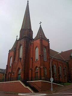 |
(#86001382) |
206 and 211 W. Fourth Street Boundary increase (listed May 19, 2005, refnum 05000446): 315 N. 2nd Avenue W. 46°47′15″N 92°06′19″W / 46.787525°N 92.105293°W |
Duluth | 1896 brick Gothic Revival cathedral, 1904 school, and 1907 house.[38] |
| 97 | St. Louis County 4-H Club Camp | Upload image | (#85000456) |
100 Pine Lane 47°28′27″N 92°20′47″W / 47.474167°N 92.346389°W |
Gilbert vicinity | 1934 camp built by the Civilian Conservation Corps and Works Progress Administration for an award-winning 4-H club.[7] |
| 98 | St. Louis County District Courthouse |  |
(#92000798) |
300 S. 5th Avenue 47°31′15″N 92°32′16″W / 47.520833°N 92.537778°W |
Virginia | 1910 brick Beaux-Arts courthouse.[7] |
| 99 | St. Mark's African Methodist Episcopal Church | 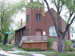 |
(#91000439) |
530 N. 5th Avenue E. 46°47′45″N 92°05′53″W / 46.79575°N 92.098188°W |
Duluth | 1913 brick Gothic Revival church of Duluth's first African American congregation.[7] |
| 100 | Saints Peter and Paul Church-Ukrainian Catholic | 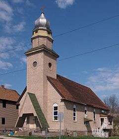 |
(#80004340) |
530 Central Avenue 47°29′01″N 92°52′44″W / 47.483514°N 92.878852°W |
Chisholm | 1916 onion-domed brick church of a Ukrainian immigrant congregation.[7] |
| 101 | Alex Seitaniemi Housebarn | Upload image | (#90000771) |
off Township Road 797 47°42′25″N 92°08′16″W / 47.707042°N 92.137911°W |
Embarrass vicinity | Rare example of a housebarn, built c. 1907–1913.[7] |
| 102 | Sons of Italy Hall | 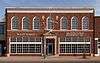 |
(#80004353) |
704 E. Howard Street 47°25′39″N 92°56′01″W / 47.427369°N 92.933604°W |
Hibbing | 1930 brick Renaissance Revival hall of an Italian immigrant club.[7] |
| 103 | Soudan Iron Mine | 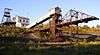 |
(#66000905) |
Soudan Underground Mine State Park 47°49′10″N 92°14′32″W / 47.819336°N 92.242101°W |
Tower | The state's oldest and deepest iron mine, active 1884–1962, ushering in Minnesota's importance in iron ore production. Now a state park.[39] |
| 104 | I.W. Stevens Lakeside Cottage | Upload image | (#11000363) |
Williams Island 48°26′35″N 92°44′20″W / 48.443159°N 92.7389°W |
Namakan Lake vicinity | 1932 cabin modified from a logging company shack.[40] |
| 105 | Stuntz Bay Boathouse Historic District | 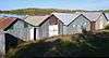 |
(#07000460) |
at the northern end of Stuntz Bay Road 47°49′34″N 92°14′11″W / 47.826025°N 92.236286°W |
Tower vicinity | Row of 20th-century metal boathouses offered as a perk to U.S. Steel employees.[41] |
| 106 | Tanner's Hospital | 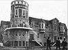 |
(#80004342) |
204 E. Camp Street 47°54′14″N 91°51′49″W / 47.90398°N 91.863725°W |
Ely | 1901 Queen Anne hospital dating to mining boom era.[7] |
| 107 | Waino Tanttari Field Hay Barn | Upload image | (#90000773) |
end of Township Road 585 47°42′39″N 92°09′42″W / 47.710833°N 92.161667°W |
Embarrass vicinity | 1935 hay barn built in traditional Finnish style.[7] |
| 108 | Thomas Wilson (Whaleback Freighter) Shipwreck | 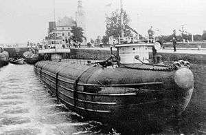 |
(#92000844) |
7/8 of a mile outside the Duluth Harbor entrance.[42] 46°47′00″N 92°04′10″W / 46.783333°N 92.069444°W |
Duluth vicinity | 1892 freight steamer sunk in Duluth Harbor in 1902. Wreck is one of the best surviving examples of whaleback design.[43] |
| 109 | Tower Fire Hall | Upload image | (#80004355) |
Main Street 47°48′18″N 92°16′30″W / 47.805007°N 92.274937°W |
Tower | c. 1895 brick Queen Anne fire station.[7] |
| 110 | Oliver G. Traphagen House | 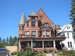 |
(#75002091) |
1509–1511 E. Superior Street 46°48′06″N 92°04′46″W / 46.80173°N 92.079388°W |
Duluth | 1892 stone Richardsonian Romanesque duplex designed by Oliver G. Traphagen.[7] |
| 111 | United States Army Corps of Engineers Duluth Vessel Yard | 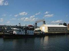 |
(#95001163) |
intersection of 9th Street S. and Minnesota Ave. 46°46′32″N 92°05′34″W / 46.775556°N 92.092778°W |
Duluth | 1904 support complex for federal dredging and maintenance of Duluth Harbor.[7] |
| 112 | US Fisheries Station, Duluth | 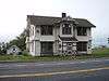 |
(#78003126) |
6008 London Road 46°50′10″N 92°00′26″W / 46.836134°N 92.007236°W |
Duluth | 1880s Shingle and Stick style federal fish hatchery complex.[7] |
| 113 | USS Essex Shipwreck Site | .jpg) |
(#94000342) |
Lake Superior 46°42′46″N 92°01′43″W / 46.712706°N 92.028608°W |
Duluth | Remains of a U.S Navy steam sloop active 1876–1903, scrapped and burned to the waterline in 1931. Only surviving remnants of a vessel by influential shipbuilder Donald McKay.[44] |
| 114 | Valon Tuote Raittiusseura | 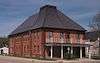 |
(#79003199) |
125 3rd Street N. 47°31′34″N 92°31′58″W / 47.52612°N 92.532826°W |
Virginia | c. 1906 brick meeting hall of a Finnish temperance society.[7] |
| 115 | Virginia Brewery | 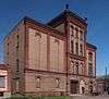 |
(#80004363) |
305 S. 7th Avenue 47°31′16″N 92°32′34″W / 47.521117°N 92.542697°W |
Virginia | 1905 Richardsonian Romanesque brewery of polychrome brick.[7] |
| 116 | Virginia City Hall |  |
(#04000539) |
327 1st Street S. 47°31′21″N 92°32′11″W / 47.52253°N 92.536324°W |
Virginia | 1923 brick and stone Colonial/Georgian Revival city hall.[45] |
| 117 | Virginia Commercial Historic District | 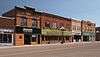 |
(#97000020) |
Chestnut Street between 1st and 6th Avenues 47°31′23″N 92°32′09″W / 47.523189°N 92.535884°W |
Virginia | Early-20th-century brick business district where much Mesabi and Vermilion Range commerce was conducted.[7] |
| 118 | Virginia-Rainy Lake Lumber Company Manager's Residence |  |
(#80004361) |
402 and 404 S. 5th Avenue 47°31′13″N 92°32′18″W / 47.520204°N 92.538223°W |
Virginia | 1910 frame Jacobean/Tudor Revival housing for lumber mill manager.[7] |
| 119 | Virginia-Rainy Lake Lumber Company Office | 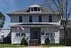 |
(#80004365) |
731 3rd Street S. 47°31′14″N 92°32′38″W / 47.52061°N 92.543925°W |
Virginia | c. 1907 headquarters of region's leading pine logging company.[7] |
| 120 | Virginia Recreation Building | 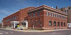 |
(#82004711) |
305 1st Street S. 47°31′21″N 92°32′08″W / 47.522533°N 92.535444°W |
Virginia | 1923 brick Georgian Revival community center.[7] |
| 121 | Western Bohemian Fraternal Union Hall | 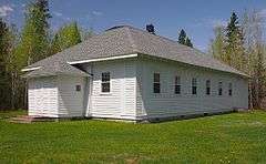 |
(#86002123) |
County Road 29 47°02′53″N 92°44′46″W / 47.048056°N 92.74611°W |
Meadowlands vicinity | 1925 frame meeting hall for Czech American groups.[7] |
| 122 | WILLIAM A. IRVIN (freighter) | 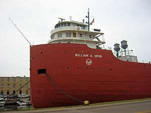 |
(#89000858) |
Minnesota Slip in Duluth Harbor 46°46′58″N 92°05′50″W / 46.782801°N 92.097273°W |
Duluth | U.S. Steel's 1937 flagship Great Lakes freighter with luxury passenger facilities. Now a museum ship.[46] |
| 123 | Wirth Building |  |
(#91000896) |
13 W. Superior Street 46°47′12″N 92°05′56″W / 46.786662°N 92.098925°W |
Duluth | 1886 brownstone Richardsonian Romanesque commercial building designed by Oliver G. Traphagen and George Wirth.[7] |
| 124 | YWCA of Duluth |  |
(#11000325) |
202 W. 2nd Street 46°47′10″N 92°06′10″W / 46.7860°N 92.102739°W |
Duluth | 1908 headquarters of the Duluth YWCA, associated with local civic development through its social welfare efforts.[47] |
Former listings
| [3] | Name on the Register | Image | Date listed | Date removed | Location | City or town | Summary |
|---|---|---|---|---|---|---|---|
| 1 | John Harris Hearding Grammar and High School and John A. Johnson Grammar School | Upload image | (#80004354) | intersection of 4th Avenue N. and First Street W. |
Aurora | 1912 and 1914 public schools.[7] Demolished in 2001.[48] | |
| 2 | Otto Johnson House | Upload image | (#80004354) | 202 3rd Avenue |
Mountain Iron | Whimsical 1912 cottage, statuary, and landscaping of folk artist Otto Johnson. Fell into disrepair and demolished by later owner in 1997.[49] |
See also
- List of National Historic Landmarks in Minnesota
- National Register of Historic Places listings in Minnesota
- National Register of Historic Places listings in Voyageurs National Park
References
- ↑ The latitude and longitude information provided in this table was derived originally from the National Register Information System, which has been found to be fairly accurate for about 99% of listings. For about 1% of NRIS original coordinates, experience has shown that one or both coordinates are typos or otherwise extremely far off; some corrections may have been made. A more subtle problem causes many locations to be off by up to 150 yards, depending on location in the country: most NRIS coordinates were derived from tracing out latitude and longitudes off of USGS topographical quadrant maps created under the North American Datum of 1927, which differs from the current, highly accurate WGS84 GPS system used by most on-line maps. Chicago is about right, but NRIS longitudes in Washington are higher by about 4.5 seconds, and are lower by about 2.0 seconds in Maine. Latitudes differ by about 1.0 second in Florida. Some locations in this table may have been corrected to current GPS standards.
- ↑ "National Register of Historic Places: Weekly List Actions". National Park Service, United States Department of the Interior. Retrieved on December 2, 2016.
- 1 2 Numbers represent an ordering by significant words. Various colorings, defined here, differentiate National Historic Landmarks and historic districts from other NRHP buildings, structures, sites or objects.
- ↑ National Park Service (2008-04-24). "National Register Information System". National Register of Historic Places. National Park Service.
- ↑ The eight-digit number below each date is the number assigned to each location in the National Register Information System database, which can be viewed by clicking the number.
- ↑ "Aerial Lift Bridge". A Minnesota Sampler. Minnesota Historical Society. Retrieved 2012-10-06.
- 1 2 3 4 5 6 7 8 9 10 11 12 13 14 15 16 17 18 19 20 21 22 23 24 25 26 27 28 29 30 31 32 33 34 35 36 37 38 39 40 41 42 43 44 45 46 47 48 49 50 51 52 53 54 55 56 57 58 59 60 61 62 63 64 65 66 67 68 69 70 71 72 73 74 75 76 77 78 79 80 81 82 83 84 85 86 Nord, Mary Ann (2003). The National Register of Historic Places in Minnesota. Minnesota Historical Society. ISBN 0-87351-448-3.
- ↑ "Fond du Lac Culvert (Bridge 5757)" (PDF). MnDOT Roadside Historic Development Structures Inventory. Minnesota Department of Transportation. Retrieved 2012-10-06.
- ↑ Hanson, Krista Finstad (2007). Minnesota Open House: A Guide to Historic House Museums. St. Paul, Minn.: Minnesota Historical Society Press. ISBN 978-0-87351-577-1.
- ↑ "Glensheen: The Historic Congdon Estate". University of Minnesota Duluth. Retrieved 2012-10-09.
- ↑ Zahn, Thomas R.; Bethany Gladhill (2013-01-09). "National Register of Historic Places Registration Form: Duluth and Iron Range Railroad Company Passenger Station" (PDF). National Park Service. Retrieved 2014-01-16.
- ↑ "Historical Tower-Soudan". Retrieved 2014-01-16.
- ↑ "National Register of Historic Places Registration Form: Duluth Armory" (PDF). National Park Service. Retrieved 2012-10-09.
- ↑ "Duluth Commercial Historic District". Minnesota National Register Properties Database. Minnesota Historical Society. 2009. Retrieved 2012-10-09.
- ↑ Anderson, Rolf T. (2014-12-03). "National Register of Historic Places Registration Form: Duluth Masonic Temple" (PDF). National Park Service. Retrieved 2015-12-08.
- ↑ "Duluth Depot". St. Louis County Heritage and Arts Center. Retrieved 2012-10-09.
- ↑ Roise, Charlene (2015-03-09). "National Register of Historic Places Registration Form: Ely State Theater" (PDF). National Park Service. Retrieved 2015-08-02.
- ↑ "Eveleth Recreation Building". Iron Range Region. Minnesota Historical Society. Retrieved 2012-10-09.
- ↑ Fraser, Clayton B. (2011-05-31). "National Register of Historic Places Registration Form: Engine House No. 1" (PDF). National Park Service. Retrieved 2013-11-09.
- ↑ "National Register of Historic Places Registration Form: First National Bank of Gilbert" (PDF). National Park Service. Retrieved 2012-10-09.
- ↑ Hurley, John (1994-08-15). "National Register of Historic Places Registration Form: Fujita, Jun Cabin" (PDF). National Park Service. Retrieved 2013-03-16.
- ↑ "Hull Rust Mahoning Mine View". Iron Trail. Iron Trail Convention & Visitors Bureau. Retrieved 2012-10-10.
- ↑ "Ingersoll Seasonal Estate-Main Cabin". List of Classified Structures. National Park Service. Retrieved 2014-07-21.
- ↑ Franklin, Rachel (1993-01-14). "National Register of Historic Places Registration Form: Kabetogama Ranger Station District" (PDF). National Park Service. Retrieved 2013-03-18.
- ↑ "Kettle Falls". Voyageurs National Park. National Park Service. 2012-10-09. Retrieved 2012-10-10.
- ↑ "Kitchi Gammi Club". Getaways Through the Years. Minnesota Historical Society. Retrieved 2012-10-10.
- ↑ "Levin Cabin". List of Classified Structures. National Park Service. Retrieved 2012-10-10.
- ↑ Sommer, Barbara W.; Debra Kellner (2012). "National Register of Historic Places Registration Form: Lincoln Branch Library" (PDF). National Park Service. Retrieved 2013-05-12.
- ↑ "Listening Point". Minnesota National Register Properties Database. Minnesota Historical Society. 2009. Retrieved 2012-10-10.
- ↑ "Off-Premise Attractions [sic]". Iron Range Historical Society. Retrieved 2012-10-10.
- ↑ Meverden, Keith; Tamara Thomsen (January 2012). "National Register of Historic Places Registration Form: May Flower - Shipwreck" (PDF). National Park Service. Retrieved 2013-11-10.
- ↑ "Welcome to the Mitchell-Tappan House". Retrieved 2014-06-19.
- ↑ "Destinations/Visitor Info: Points of Interest in the Park". Voyageurs National Park Association. Retrieved 2012-10-11.
- ↑ "Mountain Iron Mine". National Historic Landmarks Program. National Park Service. Retrieved 2012-10-11.
- ↑ "Ely Arts & Heritage Center". Ely Greenstone Public Art. Retrieved 2013-06-10.
- ↑ "Pyhala, Anna and Mikko, Farm". Minnesota National Register Properties Database. Minnesota Historical Society. 2009. Retrieved 2012-10-11.
- ↑ Daniel, Stephen B. (2008). Shipwrecks along Lake Superior's North Shore: A Diver's Guide. St. Paul, Minn.: Minnesota Historical Society Press. pp. 61–62. ISBN 9780873516181.
- ↑ "Sacred Heart Cathedral, Cathedral School and Christian Brothers Home". Minnesota National Register Properties Database. Minnesota Historical Society. 2009. Retrieved 2012-10-11.
- ↑ "Soudan Iron Mine". National Historic Landmarks Program. National Park Service. Retrieved 2012-08-26.
- ↑ "I.W. Stevens' Pine Cove Resort House". List of Classified Structures. National Park Service. Retrieved 2012-10-19.
- ↑ "Soudan Underground Mine State Park Management Plan" (PDF). Minnesota Department of Natural Resources, Division of Parks and Recreation. January 2002: 41–43. Retrieved 2012-10-19.
- ↑ Location given in Kohl, Cris (2001). The Great Lakes Diving Guide. West Chicago, Ill.: Seawolf Communications, Inc. NRIS lists site as "address restricted".
- ↑ "Thomas Wilson". Lake Superior Shipwrecks. Minnesota Historical Society. Retrieved 2012-08-28.
- ↑ "U.S.S. Essex". Lake Superior Shipwrecks. Minnesota Historical Society. Retrieved 2012-08-28.
- ↑ "Virginia City Hall". Minnesota National Register Properties Database. Minnesota Historical Society. 2009. Retrieved 2012-10-19.
- ↑ "S.S. William A. Irvin". Duluth Entertainment Convention Center. 2010. Retrieved 2012-10-19.
- ↑ Lucas, Amy M.; Carole S. Zellie (2010-11-17). "National Register of Historic Places Registration Form: Young Women's Christian Association of Duluth (YWCA)" (PDF). National Park Service. Retrieved 2013-09-11.
- ↑ "Historic Johnson School razed in Aurora". Duluth News-Tribune. Duluth, Minn. 2001-06-27. p. 1B.
- ↑ El-Hai, Jack (2000). Lost Minnesota: Stories of Vanished Places. Minneapolis: University of Minnesota Press. p. 120. ISBN 0816635153.
External links
| Wikimedia Commons has media related to National Register of Historic Places in St. Louis County, Minnesota. |
- Minnesota National Register Properties Database—Minnesota Historical Society
| Topics | |
|---|---|
| Lists by states |
|
| Lists by insular areas | |
| Lists by associated states | |
| Other areas | |
| |