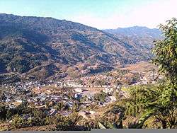
Palin, Arunachal Pradesh
| Palin | |
|---|---|
| City | |
|
A view of Palin | |
 Palin  Palin | |
| Coordinates: 27°42′14″N 93°41′28″E / 27.70389°N 93.69101°ECoordinates: 27°42′14″N 93°41′28″E / 27.70389°N 93.69101°E | |
| Country | India |
| State | Arunachal Pradesh |
| District | Kra Daadi district |
| Elevation | 1,080 m (3,540 ft) |
| Population (2011) | |
| • Total | 11,251 |
| Languages | |
| • Official | English |
| Time zone | IST (UTC+5:30) |
| Vehicle registration | AR-15 |
Palin is a small hill station town and the headquarter of Kra Daadi district in Arunachal Pradesh. It is inhabited by Nyishi tribe of Arunachal Pradesh. Located at latitude of 28.15285 and a longitude 94.12288, it has a population of 5816 according to 2001 census. Name of current MLA (August-2016) of Palin constituency is Takam Tagar (Pario).
Geography
Palin is located at 27°42′14″N 93°41′28″E / 27.70389°N 93.69101°E.[1] It has an average elevation of 1080 metres (3540 feet).
 |
Nyapin | Tali | Daporijo |  |
| |
Raga | |||
| ||||
| | ||||
| Seppa, Sagalee | Yazali, Itanagar | Ziro |
Climate
Palin has a subtropical highland climate (Cwb in the Koeppen climate classification). Summers are warm with very high rainfall; winters are mild with moderate rainfall. It is very hilly with high geographical terrain. Most of the time it is covered by clouds. The area is windy in nature.
| Climate data for Palin | |||||||||||||
|---|---|---|---|---|---|---|---|---|---|---|---|---|---|
| Month | Jan | Feb | Mar | Apr | May | Jun | Jul | Aug | Sep | Oct | Nov | Dec | Year |
| Average high °C (°F) | 15 (59) |
15 (59) |
17 (63) |
20 (68) |
20 (68) |
23 (73) |
22 (72) |
24 (75) |
23 (73) |
22 (72) |
19 (66) |
16 (61) |
19.7 (67.4) |
| Average low °C (°F) | 8 (46) |
9 (48) |
13 (55) |
15 (59) |
16 (61) |
20 (68) |
18 (64) |
19 (66) |
18 (64) |
17 (63) |
12 (54) |
8 (46) |
14.4 (57.8) |
| Average precipitation mm (inches) | 30 (1.18) |
54 (2.13) |
57 (2.24) |
96 (3.78) |
210 (8.27) |
405 (15.94) |
510 (20.08) |
360 (14.17) |
411 (16.18) |
114 (4.49) |
15 (0.59) |
27 (1.06) |
2,289 (90.11) |
| Source: World Weather Online | |||||||||||||
Culture
Palin and its adjoining areas are mainly populated by people of the Nyishi tribe.
Holy Rosary Church: Consecrated by the Bishop of Itanagar, this Christian catholic church reflects the extensive Christian influence.[2]
Places of interest
Holy Rosay Catholic Church is one of largest Catholic churches in the state.[3][4] It is located at the hilltop in the town.
Palin river one of the tributaries of River Subansiri flows through this town.The river is ideal for river rafting,fishing and for picnics.
From here tourist places like Ziro, Parshuram Kund(in Lohit), Malinithan (in Siang), Bhishmak Nagar (in Dibang Valley) are also easily accessible by roads.
Festivals
Nyokum, an agricultural festival of the Nyishis, is the main festival celebrated in the town. Beside Nyokum, people also celebrate Christmas, Diwali and Dusherra.
Demographics
As of 2001 India census,[5] Palin has a population of 5816. The Nyishis are the indigenous inhabitants of the area.
Communication
Palin is situated in the western side of Arunachal Pradesh. From the capital city Itanagar it is The District Highway connects Palin to rest of the state. Regular Bus and Tata sumo services are available from Itanagar, Ziro.
See also
- New Palin, a town in the Kurung Kumey district
- Yazali,Arunachal Pradesh
References
- ↑ Falling Rain Genomics, Inc - Itanagar
- ↑ "Tourism in Arunachal Pradesh". Arunachalpradesh.nic.in. Retrieved 2012-08-20.
- ↑ "Tourism in Arunachal Pradesh". Arunachalpradesh.nic.in. Retrieved 2012-08-20.
- ↑ "Arunachal Tourism". Arunachal Tourism. 1911-12-04. Retrieved 2012-08-20.
- ↑ "Census of India 2001: Data from the 2001 Census, including cities, villages and towns (Provisional)". Census Commission of India. Archived from the original on 2004-06-16. Retrieved 2008-11-01.
External links
| Wikimedia Commons has media related to Palin, Arunachal Pradesh. |
- PALIN by India travel portal
- 1962 Border War between India and China(Henderson brook report)
- Contact List for all Important Government Officials in Itanagar Includes Police, Telephone, Electricity and more
