Placer, Surigao del Norte
| Placer | |
|---|---|
| Municipality | |
|
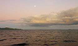
Cagbantoy Beach | |
 Map of Surigao del Norte with Placer highlighted | |
.svg.png) Placer Location within the Philippines | |
| Coordinates: 09°39′N 125°36′E / 9.650°N 125.600°ECoordinates: 09°39′N 125°36′E / 9.650°N 125.600°E | |
| Country | Philippines |
| Region | Caraga (Region XIII) |
| Province | Surigao del Norte |
| Congr. district | 2nd district of Surigao del Norte |
| Established | 1850 |
| Barangays | 20 |
| Government[1] | |
| • Mayor | Patiño |
| Area[2] | |
| • Total | 61.29 km2 (23.66 sq mi) |
| Population (2010)[3] | |
| • Total | 24,600 |
| • Density | 400/km2 (1,000/sq mi) |
| Time zone | PST (UTC+8) |
| ZIP code | 8405 |
| Dialing code | 86 |
Placer is a fourth class municipality in the province of Surigao del Norte, Philippines. According to the 2010 census, it has a population of 24,600 people.[3]
World War II
After the Japanese obtained the surrender of American and Filipino troops on Mindanao in May and June 1942, Placer, along with much of Mindanao, remained free of Japanese occupation. In late September 1943 Japanese troops landed and occupied Placer. Their goals seemed to be to fill drums with oil from a storage tank there for their use and to search for lumber. About 300 to 400 Japanese troops were in town. Some began moving south toward Claver. On October 10 guerrillas under American leadership attacked with 135 men from both the north and south to dislodge the Japanese from Placer. This attack failed, leaving the town in Japanese hands.[4]
Barangays
Placer is politically subdivided into 20 barangays.[2] In 1956, the sitios of Sta. Cruz, Anislagan, Alangalang, Soyoc, and Pananay-an were converted into barrios, while barrio Macalaya was divided into Upper and Lower Macalaya.[5]
- Amoslog
- Anislagan
- Bad-as [contains the intersection of the Pan-Philippine Highway (or National Highway) & the Surigao-Davao Coastal Road]
- Boyongan
- Bugas-bugas
- Central (Población)
- Ellaperal (Nonok)
- Ipil (Pob.)
- Lakandula
- Mabini
- Macalaya
- Magsaysay (Población)
- Magupange
- Pananay-an
- Panhutongan
- San Isidro
- Sani-sani
- Santa Cruz
- Suyoc
- Tagbongabong
Demographics
| Population census of Placer | ||
|---|---|---|
| Year | Pop. | ±% p.a. |
| 1990 | 18,478 | — |
| 1995 | 20,712 | +2.16% |
| 2000 | 21,542 | +0.85% |
| 2007 | 22,743 | +0.75% |
| 2010 | 24,600 | +2.90% |
| Source: National Statistics Office[3][6] | ||
References
- ↑ "Official City/Municipal 2013 Election Results". Intramuros, Manila, Philippines: Commission on Elections (COMELEC). 1 July 2013. Retrieved 29 August 2013.
- 1 2 "Province: Surigao del Norte". PSGC Interactive. Makati City, Philippines: National Statistical Coordination Board. Retrieved 29 August 2013.
- 1 2 3 "Total Population by Province, City, Municipality and Barangay: as of May 1, 2010" (PDF). 2010 Census of Population and Housing. National Statistics Office. Retrieved 29 August 2013.
- ↑ Virginia Hansen Holmes, Guerrilla Daughter (Kent, Ohio: Kent State U. Press, 2009), pp. 108-9.
- ↑ "An Act Converting into Barrios Certain Sitios in the Province of Surigao, and Dividing the Barrio of Macalaya into Two Barrios, Municipality of Placer, in the Same Province". LawPH.com. Retrieved 2011-04-12.
- ↑ "Province of Surigao Del Norte". Municipality Population Data. LWUA Research Division. Retrieved 29 August 2013.
External links
- Philippine Standard Geographic Code
- Philippine Census Information
- Local Governance Performance Management System
 |
Sison | Tagana-an | | |
| |
Hinatuan Passage (Dinagat Sound) | |||
| ||||
| | ||||
| Mainit | Tubod | Bacuag |
Surigao City (capital) | |
| Municipalities | |
| Component city | |