Port-Louis, Guadeloupe
| Port-Louis | |
|---|---|
|
A road in Port-Louis | |
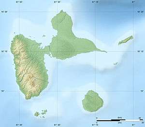
 Location of the commune (in red) within Guadeloupe | |
| Coordinates: 16°25′00″N 61°32′00″W / 16.4167°N 61.5333°WCoordinates: 16°25′00″N 61°32′00″W / 16.4167°N 61.5333°W | |
| Country | France |
| Overseas region and department | Guadeloupe |
| Arrondissement | Pointe-à-Pitre |
| Canton | Anse-Bertrand |
| Government | |
| • Mayor | Jean Barfleur |
| Area1 | 44.24 km2 (17.08 sq mi) |
| Population (2013)2 | 5,825 |
| • Density | 130/km2 (340/sq mi) |
| INSEE/Postal code | 97122 / 97117 |
|
1 French Land Register data, which excludes lakes, ponds, glaciers > 1 km² (0.386 sq mi or 247 acres) and river estuaries. 2 Population without double counting: residents of multiple communes (e.g., students and military personnel) only counted once. | |
 Guadeloupe | |
| Location |
Port-Louis Guadeloupe France |
|---|---|
| Coordinates | 16°25′05.4″N 61°32′01.1″W / 16.418167°N 61.533639°W |
| Foundation | concrete basement |
| Construction | concrete skeletal tower |
| Tower shape | square prism skeletal tower with closed lower part, balcony and light |
| Markings / pattern | yellow torwe with black horizontal band |
| Height | 10 metres (33 ft) |
| Focal height | 10 metres (33 ft) |
| Light source | mains power |
| Range | 11 nautical miles (20 km; 13 mi) |
| Characteristic | Q (9) W 15s. |
| Admiralty number | J5716 |
| NGA number | 14836[1] [2] |
Port-Louis is a commune in the department of Guadeloupe, on the northwest of Grande-Terre.
Geography
Some settlements are depending of the commune of Port-Louis, such as:
See also
References
- ↑ Port-Louis The Lighthouse Directory. University of North Carolina at Chapel Hill. Retrieved 30 August 2016
- ↑ List of Lights, Buoys and Fog Signals Atlantic Coast. Retrieved 30 August 2016
| Wikimedia Commons has media related to Port-Louis (Guadeloupe). |
This article is issued from Wikipedia - version of the 9/8/2016. The text is available under the Creative Commons Attribution/Share Alike but additional terms may apply for the media files.