Portugal–Spain border
| Portugal–Spain border | |
|---|---|
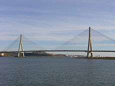
 Guadiana International Bridge, connecting Portugal & Spain | |
| Characteristics | |
| Entities |
|
| History | |
| Established | 1143 |
| The victory of king Afonso I of Portugal over his cousin king Alfonso VII of León at the Battle of Valdevez, forced the Kingdom of León to recognise Portugal as a country, thus establishing the northern borders of Portugal. | |
| Treaties | |
The Portugal–Spain border is the international boundary between Portugal and Spain. Referred to as "la Raya" in Spanish and "A Raia" in Portuguese (the stripe), the current demarcation is almost identical to that defined in 1297 by the Treaty of Alcañices. It is one of the oldest borders in the world. The Portugal–Spain border is 1,214 km (754 mi) long and considered the longest uninterrupted border within the European Union. The border is not defined between the Caia river and Ribeira de Cuncos, because of the disputed status of Olivenza, which has been disputed between the two countries for two hundred years.
A microstate existed previously on the border called Couto Misto.
Bordering districts and provinces


Districts on the Portuguese side of the border from North to South:
Provinces on the Spanish side of the border from North to South:
- Province of Pontevedra (
 Galicia)
 - Province of Ourense (
 Galicia)
 - Province of Zamora (
 Castile and León)
 - Province of Salamanca (
 Castile and León)
 - Province of Cáceres (
 Extremadura)
 - Province of Badajoz (
 Extremadura)
 - Province of Huelva (
 Andalusia)
Maritime borders
Portugal's maritime borders, also known as the Exclusive economic zone of Portugal is currently disputed by Spain in the Savage Islands area.
Important treaties
- Treaty of Zamora (1143) - The victory of king Afonso I of Portugal over his cousin king Alfonso VII of León at the Battle of Valdevez, forced the Kingdom of León to recognise Portugal as a country, thus establishing the northern borders of Portugal.
- Treaty of Badajoz (1267) - Signed by king Alfonso X of Castile and King Afonso III of Portugal, establishing the Guadiana as roughly the southern border.
- Treaty of Alcañices (1297) - Signed by King Denis of Portugal (grandson of king Alfonso X of Castile) and King Ferdinand IV of Castile, Olivença is ceded to Portugal.
- Treaty of Badajoz (1801) - Olivença is ceded to Spain.
- Congress of Vienna (1815) - Spain promises to return Olivença to Portugal, leaving this area of the border disputed ever since.
- Treaty of Lisbon (1864) - This abolished the Couto Misto microstate.
- Convention of Limits (1926)
Border crossings
Bridges across the border include the Guadiana International Bridge and the Lower Guadiana International bridge.
A zipline across the border exists between Sanlucar de Guadiana in Spain and Alcoutim in Portugal; it is the first and currently only zip line over an international border.[1]