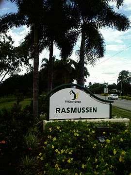
Rasmussen, Queensland
| Rasmussen Townsville, Queensland | |||||||||||||
|---|---|---|---|---|---|---|---|---|---|---|---|---|---|
 | |||||||||||||
| Population | 4,161 (?) | ||||||||||||
| Postcode(s) | 4815 | ||||||||||||
| LGA(s) | City of Townsville | ||||||||||||
| State electorate(s) | Thuringowa | ||||||||||||
| Federal Division(s) | Herbert | ||||||||||||
| |||||||||||||
Rasmussen is a suburb in the City of Townsville in Queensland, Australia. It is the second suburb on Riverway Drive and is between the suburbs of Condon and Kelso; like all the suburbs in the Upper Ross and Riverway area it is named after early settlers.
Rasmussen is named after the Rasmussen family (Jorgen Rasmussen). The family had a dairy farm on the Ross River.
The area is flat and is bounded on the east by the Ross River. [1]
Rasmussen State School is located on Allambie Lane, Rasmussen,[2] and has 485 enrolled students.[3]
Rasmussen Neighbourhood Police Beat is located at 66 Meryl Street.[4]
References
- ↑ "Townsville Rasmussen". Edmund Rice Network Oceania. 2010-05-26. Retrieved 2010-08-11.
- ↑ "Rasmussen State School - Contact Us". 2002. Retrieved 2010-08-11.
- ↑ "Rasmussen State School, in Rasmussen". Retrieved 2010-08-11.
- ↑ "Rasmussen Neighbourhood Police Beat". State of Queensland (Queensland Police Service). 2006-08-04. Retrieved 2010-08-11.
- "Thuringowa past and present", by Diane Vance
External links
Coordinates: 19°20′59″S 146°42′59″E / 19.34972°S 146.71639°E
This article is issued from Wikipedia - version of the 7/29/2015. The text is available under the Creative Commons Attribution/Share Alike but additional terms may apply for the media files.