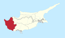
Theletra
| Theletra Θελέτρα | |
|---|---|
 Theletra Location in Cyprus | |
| Coordinates: 34°54′42″N 32°26′51″E / 34.91167°N 32.44750°ECoordinates: 34°54′42″N 32°26′51″E / 34.91167°N 32.44750°E | |
| Country |
|
| District | Paphos District |
| Elevation | 1,906 ft (581 m) |
| Population (2001)[1] | |
| • Total | 177 |
| Time zone | EET (UTC+2) |
| • Summer (DST) | EEST (UTC+3) |
| Postal code | 6330 |
Theletra (Greek: Θελέτρα) is a village in the Paphos District of Cyprus, located 3 km east of Kathikas.
The village is accessible from the road that goes to Polis Chrysochou, after Stroumbi Village 500 meters to the left.
There is an old village of Theletra and the new village. The old village was abandoned because of a huge earthquake that made the nearby hills to fall. The exact date is not verified.
References
This article is issued from Wikipedia - version of the 11/8/2015. The text is available under the Creative Commons Attribution/Share Alike but additional terms may apply for the media files.
