Tynong, Victoria
| Tynong Victoria | |||||||||||||
|---|---|---|---|---|---|---|---|---|---|---|---|---|---|
 Tynong | |||||||||||||
| Coordinates | 38°05′00″S 145°37′00″E / 38.083333°S 145.616667°ECoordinates: 38°05′00″S 145°37′00″E / 38.083333°S 145.616667°E | ||||||||||||
| Population | 683 (2011 census)[1] | ||||||||||||
| Postcode(s) | 3813 | ||||||||||||
| Elevation | 135 m (443 ft) | ||||||||||||
| Location | |||||||||||||
| LGA(s) | Shire of Cardinia | ||||||||||||
| State electorate(s) | Narracan | ||||||||||||
| Federal Division(s) | McMillan | ||||||||||||
| |||||||||||||
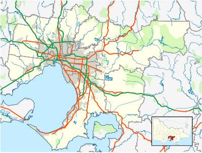
Tynong is a town in Gippsland, Victoria, Australia, 66 km south-east of Melbourne's central business district. Its local government area is the Shire of Cardinia. At the 2011 census, Tynong had a population of 683.[1]
Tynong was settled in the early 1880s and the Post Office opened on 1 November 1882.[2]
Places of interest include Gumbuya Park, Mill Valley Ranch and Tynong railway station.
Tynong is notable for the granodiorite quarried from the area for the construction of the Melbourne Shrine of Remembrance.
References
- 1 2 "2011 Census QuickStats: Tynong". Australia Bureau of Statistics. Retrieved 18 December 2012.
- ↑ Premier Postal History, Post Office List, retrieved 2008-04-11
External links
This article is issued from Wikipedia - version of the 1/5/2015. The text is available under the Creative Commons Attribution/Share Alike but additional terms may apply for the media files.