Viðareiði
| Viðareiði Viderejde | |
|---|---|
| Municipality and village | |
|
| |
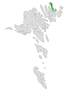
 Location of Viðareiðis kommuna in the Faroe Islands | |
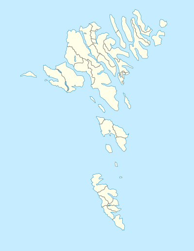
 Viðareiði Location in the Faroe Islands | |
| Coordinates: 62°21′35″N 6°31′58″W / 62.35972°N 6.53278°W | |
| State |
|
| Constituent country |
|
| Island | Viðoy |
| Population (1 January 2006) | |
| • Total | 346 |
| Time zone | GMT |
| • Summer (DST) | WEST (UTC+1) |
| Postal code | FO 750 |
| Climate | Cfc |
Viðareiði (pronounced [ˈviːjaɹaijɪ], literally: Wood-Isthmus, Danish: Viderejde) is the northernmost settlement in the Faroe Islands and lies on the Island of Viðoy, which belongs to the Norðoyar Region.
Geography
It lies on an isthmus with high mountains to both the north and south.
The community is linked overland by a dam and tunnel system to the regional center of Klaksvík on Borðoy. The road to Viðareiði goes along the west coast of Viðoy, through the town, and then along the island's east coast to the uninhabited Miðdalur Valley with its typical small waterfall.

To the north, Mount Villingdalsfjall rises over 844 meters (2,769 ft) from the water. It is the highest mountain in the North Islands and the third-largest in the entire Faroese archipelago. The north coast is marked by Cape Enniberg, the second highest sea cliff in Europe at 754 meters (2,474 ft). Looking to the west from Viðareiði, one has a view of the mighty northern peaks of Borðoy and Kunoy. Turning around, one can see through the crag and tails of the isthmus to the eastern Island of Fugloy. Finally, to the south of the town, the 751 meters (2,464 ft) high cone-shaped mountain of Malinsfjall can be seen during good weather. Viðareiði is a departure point for a vast area of hiking. In the community, there is not only a small grocery store, but also the Hotel Norð with its restaurant that serves traditional cuisine.
History
In the 17th century, the old church was destroyed in a storm. It is said that a part of the cemetery was washed away by the sea and that coffins from the cemetery were recovered in Hvannasund and reburied in Viðareiði.
The current church was built in 1892. The church silver is a gift from the British government, thanking the Viðareiði's citizens for the rescue of the Brig Marwood, which was shipwrecked near Viðareiði during a winter storm in 1847.
See also
References
- The information in this article is based on that in its German equivalent.
- Faroeislands.dk: Vidareidi
External links
| Wikimedia Commons has media related to Viðareiði. |
Coordinates: 62°21′35″N 6°32′58″W / 62.35972°N 6.54944°W
