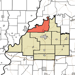
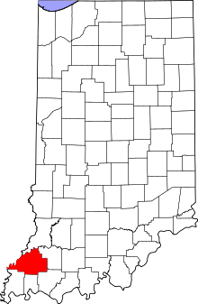
White River Township, Gibson County, Indiana
| White River Township Gibson County | |
|---|---|
| Township | |
 Location within Gibson County | |
| Coordinates: 38°26′10″N 87°36′37″W / 38.43611°N 87.61028°WCoordinates: 38°26′10″N 87°36′37″W / 38.43611°N 87.61028°W | |
| Country | United States |
| State | Indiana |
| County | Gibson |
| Township Seat | Hazleton |
| School District | North Gibson School Corporation |
| Named for | White River |
| Government | |
| • Type | Indiana township |
| • Trustee | Kim Minkler |
| Area | |
| • Total | 49.04 sq mi (127.0 km2) |
| • Land | 47.4 sq mi (123 km2) |
| • Water | 1.63 sq mi (4.2 km2) |
| Elevation[1] | 400 ft (122 m) |
| Population (2010) | |
| • Total | 1,689 |
| • Density | 35.6/sq mi (13.7/km2) |
| Time zone | CST (UTC-6) |
| • Summer (DST) | CDT (UTC-5) |
| ZIP codes | 47649, 47666, 47670 |
| Area code(s) | 812 |
| FIPS code | 18-83888[2] |
| GNIS feature ID | 454053 |
White River Township is one of ten townships in Gibson County, Indiana. As of the 2010 census, its population was 1,689 and it contained 817 housing units.[3] Hazleton is the township seat.
It took its name from the White River.[4]
Geography
According to the 2010 census, the township has a total area of 49.04 square miles (127.0 km2), of which 47.4 square miles (123 km2) (or 96.66%) is land and 1.63 square miles (4.2 km2) (or 3.32%) is water.[3]
Cities and towns
Unincorporated towns
(This list is based on USGS data and may include former settlements.)
Adjacent townships
- Washington Township (east)
- Patoka Township (south)
- Montgomery Township (southwest)
- Decker Township (northwest)
- Johnson Township (northeast)
- Mt. Carmel Precinct (west)
Cemeteries
The township contains eight cemeteries: Barnett, Decker Chapel, Field, Humphrey, Milburn, Morrison, Robb and Trippet.
Major highways
Airports and landing strips
- Hull Airport
Education
White River Township is served by the North Gibson School Corporation and like neighboring Washington Township also has no schools of its own since the early 1970s.
References
- ↑ "US Board on Geographic Names". United States Geological Survey. 2007-10-25. Retrieved 2008-01-31.
- ↑ "American FactFinder". United States Census Bureau. Retrieved 2008-01-31.
- 1 2 "Population, Housing Units, Area, and Density: 2010 - County -- County Subdivision and Place -- 2010 Census Summary File 1". United States Census. Retrieved 2013-05-10.
- ↑ History of Gibson County, Indiana: With Illustrations Descriptive of Its Scenery, and Biographical Sketches of Some of Its Prominent Men and Pioneers. Jas. T. Tartt & Co. 1884. p. 182.
