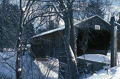
Whittier Bridge
|
Whittier Bridge | |
|
The bridge in 1970 | |
  | |
| Location | Old NH 25 (Covered Bridge Road), Ossipee, New Hampshire |
|---|---|
| Coordinates | 43°49′20″N 71°12′43″W / 43.82222°N 71.21194°WCoordinates: 43°49′20″N 71°12′43″W / 43.82222°N 71.21194°W |
| Area | 0.1 acres (0.040 ha) |
| Built | 1870 |
| Architectural style | Paddleford Truss |
| NRHP Reference # | 84002558[1] |
| Added to NRHP | March 15, 1984 |
The Whittier Bridge is a historic wooden covered bridge in Ossipee, New Hampshire. The bridge carried an old alignment of New Hampshire Route 25 (now Nudd Road and Old Covered Bridge Road) over the Bearcamp River. The fourth bridge at the same location, this single-span Paddleford truss bridge was built in 1870, and rests on granite abutments. The bridge is 137'7" long, with a clear span of 114'. Its roadway is 14'10" wide, with a vertical clearance of 12'10".[2] Laminated arches were added to strengthen it in the late 19th century, and it was given a major restoration in 1983.[3]
The bridge was listed on the National Register of Historic Places in 1984.[1] It was closed to vehicular traffic in 1989,[2] and has been removed from its footings for restoration.
See also
- List of New Hampshire covered bridges
- List of bridges on the National Register of Historic Places in New Hampshire
- National Register of Historic Places listings in Carroll County, New Hampshire
References
- 1 2 National Park Service (2009-03-13). "National Register Information System". National Register of Historic Places. National Park Service.
- 1 2 "Whittier Bridge". New Hampshire DHR. Retrieved 2014-05-21.
- ↑ "NRHP nomination for Whittier Bridge" (PDF). National Park Service. Retrieved 2014-05-21.

