| [3] |
Name on the Register[4] |
Image |
Date listed[5] |
Location |
City or town |
Description |
|---|
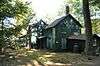
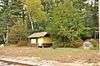
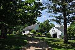
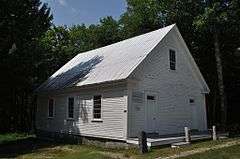
| 1 |
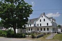
Abenaki Indian Shop and Camp |
|
000000001991-02-28-0000February 28, 1991
(#91000218) |
Intervale Crossroad, 1 mi (1.6 km) east of NH 16
44°04′28″N 71°08′11″W / 44.074444°N 71.136389°W / 44.074444; -71.136389 (Abenaki Indian Shop and Camp) |
Conway |
Now a town park.
|
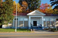
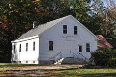
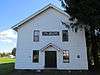
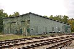
| 2 |
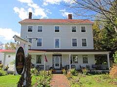
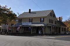
Bartlett Roundhouse |
|
000000002015-09-29-0000September 29, 2015
(#15000664) |
S. of US 302 between Pine St. & Albany Ave.
44°04′36″N 71°17′15″W / 44.07674°N 71.28738°W / 44.07674; -71.28738 (Bartlett Roundhouse) |
Bartlett |
|
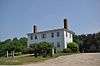
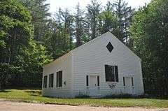
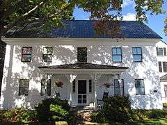
| 3 |
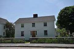
Beede Farm |
|
000000002012-08-15-0000August 15, 2012
(#12000502) |
178 Mill Bridge Rd.
43°47′38″N 71°28′40″W / 43.793763°N 71.477690°W / 43.793763; -71.477690 (Beede Farm) |
Sandwich |
Part of the Squam Multiple Property Submission (MPS)
|
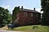
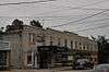
| 4 |
Bolduc Block |
|
000000002016-09-20-0000September 20, 2016
(#16000642) |
36 Main St.
43°58′44″N 71°07′12″W / 43.978797°N 71.119946°W / 43.978797; -71.119946 (Bolduc Block) |
Conway |
|
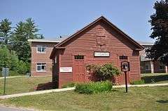
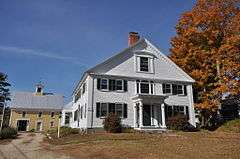
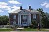
| 5 |
Brewster Memorial Hall |
|
000000001983-09-08-0000September 8, 1983
(#83001129) |
S. Main and Union Sts.
43°35′05″N 71°12′37″W / 43.584722°N 71.210278°W / 43.584722; -71.210278 (Brewster Memorial Hall) |
Wolfeboro |
|
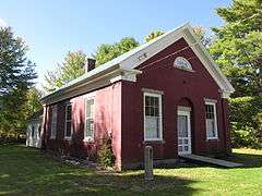
| 6 |
Brookfield Town Hall |
|
000000001985-06-06-0000June 6, 1985
(#85001189) |
NH 109
43°33′37″N 71°04′04″W / 43.560278°N 71.067778°W / 43.560278; -71.067778 (Brookfield Town Hall) |
Brookfield |
|
| 7 |
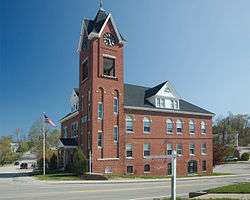
Carroll County Court House |
|
000000002007-09-12-0000September 12, 2007
(#07000949) |
20 Courthouse Square
43°41′06″N 71°07′04″W / 43.685°N 71.117778°W / 43.685; -71.117778 (Carroll County Court House) |
Ossipee |
|
| 8 |
Center Sandwich Historic District |
|
000000001983-12-22-0000December 22, 1983
(#83003997) |
Roughly bounded by Skinner, Grove, Church, Maple and Main Sts., and Creamery Brook and Quimby Field Rds.
43°48′29″N 71°26′22″W / 43.808056°N 71.439444°W / 43.808056; -71.439444 (Center Sandwich Historic District) |
Sandwich |
|
| 9 |
Chocorua Lake Basin Historic District |
|
000000002005-06-09-0000June 9, 2005
(#05000569) |
Parts of NH 16, Chocorua Lake Rd., Philbrick Neighborhood, Fowles, and Washington Hill Roads and Loring, MacGregor, and Bolles Rd
43°54′01″N 71°14′13″W / 43.900331°N 71.236933°W / 43.900331; -71.236933 (Chocorua Lake Basin Historic District) |
Tamworth |
|
| 10 |
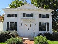
Cook Memorial Library |
|
000000001980-06-25-0000June 25, 1980
(#80000269) |
Main St.
43°51′34″N 71°15′57″W / 43.859444°N 71.265833°W / 43.859444; -71.265833 (Cook Memorial Library) |
Tamworth |
|
| 11 |
Cotton Mountain Community Church |
|
000000001985-03-07-0000March 7, 1985
(#85000475) |
Stoneham Rd.
43°36′52″N 71°05′11″W / 43.614444°N 71.086389°W / 43.614444; -71.086389 (Cotton Mountain Community Church) |
Wolfeboro |
|
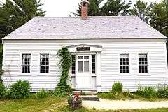
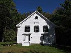
| 12 |
District No. 2 Schoolhouse |
|
000000001980-10-03-0000October 3, 1980
(#80000270) |
NH 153
43°34′28″N 71°02′04″W / 43.574444°N 71.034444°W / 43.574444; -71.034444 (District No. 2 Schoolhouse) |
Wakefield |
|
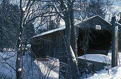
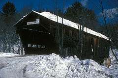
| 13 |
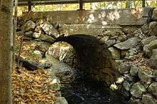
Durgin Bridge |
|
000000001983-09-22-0000September 22, 1983
(#83001130) |
Durgin Bridge Rd.
43°51′21″N 71°21′53″W / 43.855833°N 71.364722°W / 43.855833; -71.364722 (Durgin Bridge) |
Sandwich |
Over Cold River
|
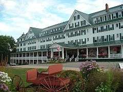
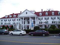
| 14 |
Eagle Mountain House |
|
000000001990-12-06-0000December 6, 1990
(#90001848) |
Carter Notch Rd. north of its junction with NH 16A
44°09′23″N 71°11′10″W / 44.156389°N 71.186111°W / 44.156389; -71.186111 (Eagle Mountain House) |
Jackson |
|
| 15 |
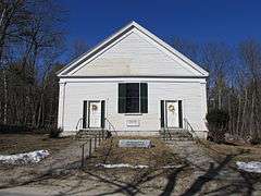
Early Settlers Meeting House |
|
000000001995-06-12-0000June 12, 1995
(#95000680) |
Junction of Granite and Foggs Ridge Rds.
43°40′44″N 71°01′44″W / 43.678889°N 71.028889°W / 43.678889; -71.028889 (Early Settlers Meeting House) |
Leighton Corner |
|
| 16 |
Eastern Slope Inn |
|
000000001982-08-10-0000August 10, 1982
(#82004994) |
Main St.
44°03′16″N 71°07′49″W / 44.054444°N 71.130278°W / 44.054444; -71.130278 (Eastern Slope Inn) |
North Conway |
|
| 17 |
William K. Eastman House |
|
000000002001-06-06-0000June 6, 2001
(#01000629) |
100 Main St.
43°58′43″N 71°07′23″W / 43.978611°N 71.123056°W / 43.978611; -71.123056 (William K. Eastman House) |
Conway |
|
| 18 |
First Free Will Baptist Church |
|
000000001984-03-15-0000March 15, 1984
(#84002518) |
Granite Rd.
43°40′15″N 71°00′30″W / 43.670833°N 71.008333°W / 43.670833; -71.008333 (First Free Will Baptist Church) |
Ossipee |
|
| 19 |
Freese's Tavern |
|
000000001982-04-29-0000April 29, 1982
(#82001668) |
Main St.
43°45′17″N 71°23′50″W / 43.754722°N 71.397222°W / 43.754722; -71.397222 (Freese's Tavern) |
Moultonborough |
Now known as the Old Country Store
|
| 20 |
Great Falls Manufacturing Company Newichawannock Canal Historic District |
|
000000002014-08-06-0000August 6, 2014
(#14000460) |
Between Great East Lake and Horn Pond
43°34′10″N 70°58′16″W / 43.5694°N 70.971144°W / 43.5694; -70.971144 (Great Falls Manufacturing Company Newichawannock Canal Historic District) |
Wakefield |
Extends into Acton in York County, Maine
|
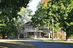
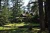
| 21 |
Green Pastures |
Upload image |
000000002016-04-05-0000April 5, 2016
(#16000145) |
Address restricted
|
Sandwich |
|
| 22 |
Hansen's Annex |
|
000000001983-09-22-0000September 22, 1983
(#83001131) |
Main St.
43°48′26″N 71°26′21″W / 43.807222°N 71.439167°W / 43.807222; -71.439167 (Hansen's Annex) |
Center Sandwich |
|
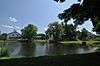
| 23 |
Jackson Falls National Register Historic District |
|
000000002003-03-12-0000March 12, 2003
(#03000110) |
Approximately parts of Jackson Village Rd. and Five Mile Circuit Rd.
44°08′52″N 71°10′51″W / 44.147778°N 71.180833°W / 44.147778; -71.180833 (Jackson Falls National Register Historic District) |
Jackson |
|
| 24 |
Bradbury Jewell House |
|
000000001986-08-27-0000August 27, 1986
(#86002792) |
154 Ferncroft Rd.
43°54′37″N 71°21′43″W / 43.910278°N 71.361944°W / 43.910278; -71.361944 (Bradbury Jewell House) |
Sandwich |
|
| 25 |
Joy Farm |
|
000000001971-11-11-0000November 11, 1971
(#71000048) |
Salter Hill Rd.
43°54′56″N 71°11′01″W / 43.915556°N 71.183611°W / 43.915556; -71.183611 (Joy Farm) |
Madison |
Home of poet e. e. cummings
|
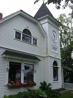
| 26 |
Libby Museum |
|
000000001998-06-29-0000June 29, 1998
(#98000690) |
Junction of NH 109 and Lang Pond Rd.
43°36′51″N 71°15′32″W / 43.614167°N 71.258889°W / 43.614167; -71.258889 (Libby Museum) |
Wolfeboro |
|
| 27 |
Lord's Hill Historic District |
|
000000001985-09-12-0000September 12, 1985
(#85002162) |
NH 153
43°45′49″N 70°59′51″W / 43.763611°N 70.9975°W / 43.763611; -70.9975 (Lord's Hill Historic District) |
Effingham |
|
| 28 |
Lower Corner Historic District |
|
000000001986-12-01-0000December 1, 1986
(#86003380) |
NH 109
43°47′32″N 71°24′49″W / 43.792222°N 71.413611°W / 43.792222; -71.413611 (Lower Corner Historic District) |
Sandwich |
|
| 29 |
Madison School, District No. 1 |
|
000000001980-12-11-0000December 11, 1980
(#80000271) |
NH 113
43°53′47″N 71°09′12″W / 43.896389°N 71.153333°W / 43.896389; -71.153333 (Madison School, District No. 1) |
Madison |
|
| 30 |
Moultonborough Town House |
|
000000001989-12-01-0000December 1, 1989
(#89002057) |
NH 25, 0.3 miles (0.48 km) southwest of NH 109
43°45′07″N 71°24′01″W / 43.751944°N 71.400278°W / 43.751944; -71.400278 (Moultonborough Town House) |
Moultonborough |
Now a local history museum
|
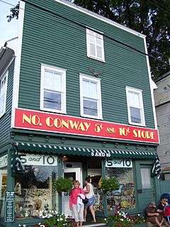
| 31 |
North Conway 5 and 10 Cent Store |
|
000000002004-01-05-0000January 5, 2004
(#03001282) |
2683 Main St.
44°03′10″N 71°07′40″W / 44.052778°N 71.127778°W / 44.052778; -71.127778 (North Conway 5 and 10 Cent Store) |
North Conway |
|
| 32 |
North Conway Depot and Railroad Yard |
|
000000001979-08-10-0000August 10, 1979
(#79003792) |
Norcross Circle
44°03′06″N 71°07′44″W / 44.051667°N 71.128889°W / 44.051667; -71.128889 (North Conway Depot and Railroad Yard) |
North Conway |
|
| 33 |
North Sandwich Meeting House |
|
000000001986-06-05-0000June 5, 1986
(#86001230) |
Quaker-Whiteface Rd.
43°51′41″N 71°21′58″W / 43.861389°N 71.366111°W / 43.861389; -71.366111 (North Sandwich Meeting House) |
Sandwich |
|
| 34 |
Pointfield |
|
000000002014-10-08-0000October 8, 2014
(#14000842) |
14 Sabine Point Road
43°46′42″N 71°28′42″W / 43.7782°N 71.4782°W / 43.7782; -71.4782 (Pointfield) |
Sandwich |
Part of the Squam MPS
|
| 35 |
Pratt Family Camps |
|
000000002012-08-15-0000August 15, 2012
(#12000503) |
Address Restricted
|
Moultonborough |
Part of the Squam MPS
|
| 36 |
Capt. Enoch Remick House |
|
000000001996-06-03-0000June 3, 1996
(#96000616) |
4 Great Hill Rd.
43°51′38″N 71°16′15″W / 43.860556°N 71.270833°W / 43.860556; -71.270833 (Capt. Enoch Remick House) |
Tamworth |
Now a local farm museum
|
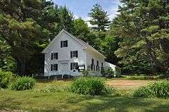
| 37 |
Russell-Colbath House |
|
000000001987-04-23-0000April 23, 1987
(#86003416) |
Kancamagus Highway
43°59′47″N 71°20′25″W / 43.996389°N 71.340278°W / 43.996389; -71.340278 (Russell-Colbath House) |
Albany |
|
| 38 |
St. John's Church, Rectory, and Parish Hall |
|
000000001984-06-07-0000June 7, 1984
(#84002519) |
High St.
43°33′27″N 71°01′45″W / 43.5575°N 71.029167°W / 43.5575; -71.029167 (St. John's Church, Rectory, and Parish Hall) |
Wakefield |
|
| 39 |
Swallow Boathouse |
|
000000001980-08-26-0000August 26, 1980
(#80000272) |
South of Moultonborough
43°41′44″N 71°24′23″W / 43.695556°N 71.406389°W / 43.695556; -71.406389 (Swallow Boathouse) |
Moultonborough |
|
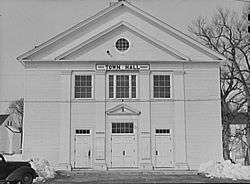
| 40 |
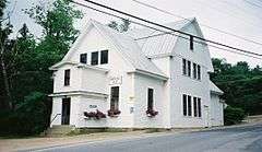
Town Hall |
|
000000001980-05-15-0000May 15, 1980
(#80000273) |
Maple St.
43°48′27″N 71°26′18″W / 43.8075°N 71.438333°W / 43.8075; -71.438333 (Town Hall) |
Center Sandwich |
|
| 41 |
Tuftonboro United Methodist Church |
|
000000001997-06-16-0000June 16, 1997
(#97000505) |
Northern side of NH 171, east of its junction with Durgan Rd.
43°41′45″N 71°13′16″W / 43.695833°N 71.221111°W / 43.695833; -71.221111 (Tuftonboro United Methodist Church) |
Tuftonboro |
|
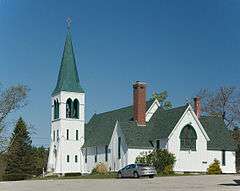
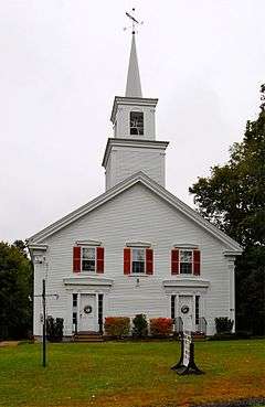
| 42 |
Union Church |
|
000000001982-04-29-0000April 29, 1982
(#82001669) |
S. Main St.
43°33′47″N 71°10′38″W / 43.563056°N 71.177222°W / 43.563056; -71.177222 (Union Church) |
South Wolfeboro |
|
| 43 |
Union Hotel |
|
000000001989-12-01-0000December 1, 1989
(#89002055) |
Main St. at Chapel St.
43°29′32″N 71°01′29″W / 43.492222°N 71.024722°W / 43.492222; -71.024722 (Union Hotel) |
Wakefield |
|
| 44 |
Wakefield House |
|
000000001983-06-23-0000June 23, 1983
(#83001133) |
NH 153
43°34′05″N 71°01′44″W / 43.568056°N 71.028889°W / 43.568056; -71.028889 (Wakefield House) |
Wakefield |
Now known as the Wakefield Inn
|
| 45 |
Wakefield Public Library |
|
000000001983-09-08-0000September 8, 1983
(#83001132) |
Mountain Laurel Rd.
43°34′09″N 71°01′48″W / 43.569167°N 71.03°W / 43.569167; -71.03 (Wakefield Public Library) |
Wakefield |
|
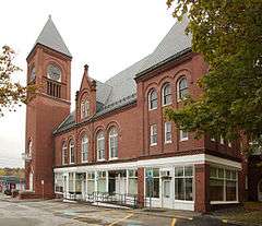
| 46 |
Wakefield Town Hall and Opera House |
|
000000002007-06-12-0000June 12, 2007
(#07000550) |
2 High St.
43°33′14″N 71°01′50″W / 43.553889°N 71.030556°W / 43.553889; -71.030556 (Wakefield Town Hall and Opera House) |
Wakefield |
|
| 47 |
Wakefield Village Historic District |
|
000000001984-03-15-0000March 15, 1984
(#84002521) |
Off NH 153
43°34′07″N 71°01′46″W / 43.568611°N 71.029444°W / 43.568611; -71.029444 (Wakefield Village Historic District) |
Wakefield |
|
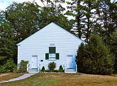
| 48 |
White Meetinghouse |
|
000000001980-05-15-0000May 15, 1980
(#80000274) |
South of Eaton Center on Towle Hill Rd.
43°51′31″N 71°04′30″W / 43.858611°N 71.075°W / 43.858611; -71.075 (White Meetinghouse) |
Eaton |
|
| 49 |
Whittier Bridge |
|
000000001984-03-15-0000March 15, 1984
(#84002558) |
Old NH 25
43°49′20″N 71°12′43″W / 43.822222°N 71.211944°W / 43.822222; -71.211944 (Whittier Bridge) |
West Ossipee |
Over Bearcamp River
|
| 50 |
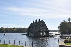
Windermere |
|
000000001979-11-14-0000November 14, 1979
(#79000195) |
Southwest of Moultonborough on Long Island
43°38′04″N 71°20′36″W / 43.634444°N 71.343333°W / 43.634444; -71.343333 (Windermere) |
Moultonborough |
|
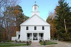
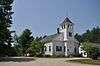
| 51 |
Wolfeboro Centre Community Church |
|
000000001984-03-15-0000March 15, 1984
(#84002564) |
NH 109
43°37′09″N 71°10′15″W / 43.619167°N 71.170833°W / 43.619167; -71.170833 (Wolfeboro Centre Community Church) |
Wolfeboro Center |
|

.jpg)