Franklin Square Historic District (Baltimore, Maryland)
|
Franklin Square Historic District | |
|
Franklin Square School | |
   | |
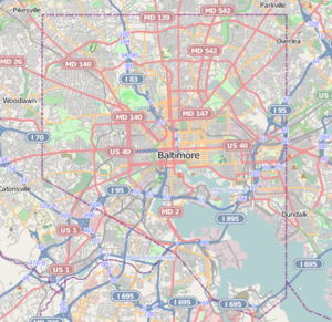
| Location | Bounded by Mulberry, N. Carey, W. Baltimore, and Monroe Sts., Baltimore, Maryland |
|---|---|
| Coordinates | 39°17′29″N 76°38′36″W / 39.29139°N 76.64333°WCoordinates: 39°17′29″N 76°38′36″W / 39.29139°N 76.64333°W |
| Area | 95 acres (38 ha) |
| Built | 1859 |
| NRHP Reference # | 82001585[1] |
| Added to NRHP | December 10, 1982 |
Franklin Square Historic District is a national historic district in Baltimore, Maryland, United States. It is a 19th-century rowhouse neighborhood developed along a strict grid street pattern. A one square block, two and a half acre public park, Franklin Square, is a focal point for the area and the most elaborate rowhousing surrounds the square. The district contains approximately 1,300 buildings of which approximately 1,250 contribute to the significance of the historic district.[2]
It was added to the National Register of Historic Places in 1982.[1]
References
- 1 2 National Park Service (2010-07-09). "National Register Information System". National Register of Historic Places. National Park Service.
- ↑ Fred B. Shoken (December 1981). "National Register of Historic Places Registration: Franklin Square Historic District" (PDF). Maryland Historical Trust. Retrieved 2016-04-01.
External links
- Franklin Square Historic District, Baltimore City, including photo from 1981, at Maryland Historical Trust
- Boundary Map of the Franklin Square Historic District, Baltimore City, at Maryland Historical Trust
- Friends of West Baltimore Squares
- Historic American Buildings Survey (HABS) No. MD-412, "Franklin Square (Twin Houses), 100 block North Calhoun Street, west side, Baltimore, Independent City, MD", 1 photo
This article is issued from Wikipedia - version of the 11/27/2016. The text is available under the Creative Commons Attribution/Share Alike but additional terms may apply for the media files.

