| [3] |
Name on the Register[4] |
Image |
Date listed[5] |
Location |
City or town |
Description |
|---|
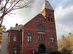
| 1 |
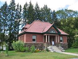
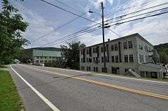
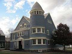
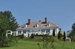
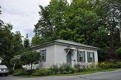
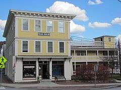
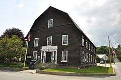
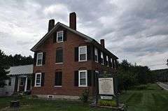
Abbott Memorial Library |
|
000000002015-01-06-0000January 6, 2015
(#14001141) |
15 Library St.
43°39′54″N 72°32′21″W / 43.6651°N 72.5393°W / 43.6651; -72.5393 (Abbott Memorial Library) |
Pomfret |
|
| 2 |
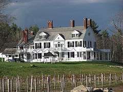
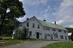
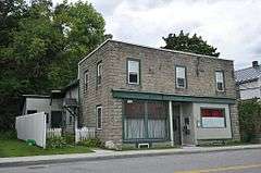
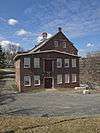
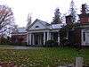
Aiken Stand Complex |
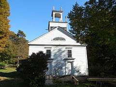
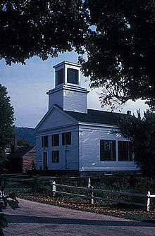
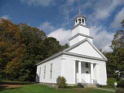
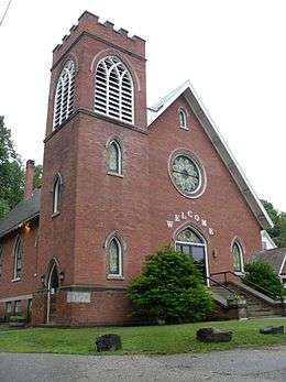
|
000000001983-01-27-0000January 27, 1983
(#83003229) |
Jct Royalton Turnpike and Sayer Rd.
43°43′59″N 72°35′25″W / 43.7331°N 72.5904°W / 43.7331; -72.5904 (Aiken Stand Complex) |
Barnard |
|
| 3 |
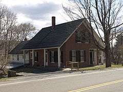
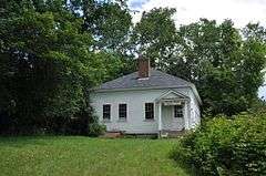
Ascutney Mill Dam Historic District |
|
000000002007-01-09-0000January 9, 2007
(#06001236) |
55 and 57 Ascutney St.
43°28′45″N 72°23′44″W / 43.479167°N 72.395556°W / 43.479167; -72.395556 (Ascutney Mill Dam Historic District) |
Windsor |
|
| 4 |
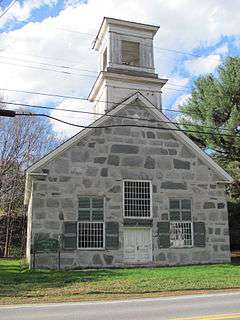
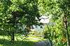
Ascutney State Park |
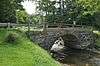
|
000000002002-06-14-0000June 14, 2002
(#02000664) |
1826 Back Mountain Rd.
43°26′34″N 72°26′08″W / 43.442778°N 72.435556°W / 43.442778; -72.435556 (Ascutney State Park) |
Windsor |
part of the Historic Park Landscapes in National and State Parks Multiple Property Submission (MPS)
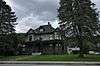
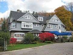
|
| 5 |
Atherton Farmstead |
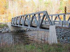
|
000000002002-03-01-0000March 1, 2002
(#02000119) |
31 Greenbush Rd.
43°24′52″N 72°32′49″W / 43.414444°N 72.546944°W / 43.414444; -72.546944 (Atherton Farmstead) |
Cavendish |
part of the Agricultural Resources of Vermont MPS
|
| 6 |
Beaver Meadow School |
|
000000002013-06-07-0000June 7, 2013
(#13000374) |
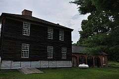
246 Chapel Hill Rd.
43°45′50″N 72°22′19″W / 43.763967°N 72.371839°W / 43.763967; -72.371839 (Beaver Meadow School) |
Norwich |
Part of the Educational Resources of Vermont MPS
|
| 7 |
Beaver Meadow Union Chapel |
|
000000001995-03-09-0000March 9, 1995
(#95000185) |
Northern side of Beaver Meadow Road
43°45′52″N 72°22′27″W / 43.764444°N 72.374167°W / 43.764444; -72.374167 (Beaver Meadow Union Chapel) |
Norwich |
|
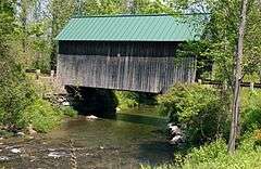
| 8 |
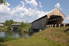
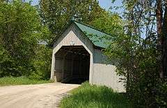
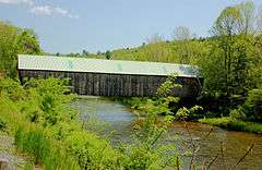
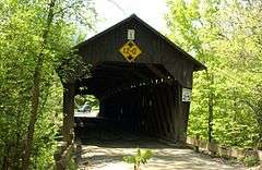
Best's Covered Bridge |
|
000000001973-07-02-0000July 2, 1973
(#73000210) |
About 8 mi (13 km) west of Windsor off Vermont Route 44
43°27′19″N 72°30′58″W / 43.455278°N 72.516111°W / 43.455278; -72.516111 (Best's Covered Bridge) |
West Windsor |
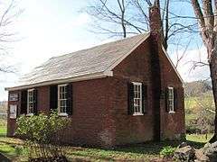
|
| 9 |
Bethel Village Historic District |
|
000000001976-09-03-0000September 3, 1976
(#76000199) |
Both sides of S. Main, Main, N. Main, and Church Sts.
• Boundary increase (listed 000000001990-05-24-0000May 24, 1990): Vermont Route 107 across the White River and north to the Central Vermont Railway tracks
43°49′51″N 72°38′02″W / 43.830833°N 72.633889°W / 43.830833; -72.633889 (Bethel Village Historic District) |
Bethel |
|
| 10 |
Black River Academy |
|
000000001972-11-15-0000November 15, 1972
(#72000108) |
High St.
43°23′47″N 72°41′45″W / 43.396389°N 72.695833°W / 43.396389; -72.695833 (Black River Academy) |
Ludlow |
|
| 11 |
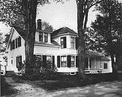
Augustus and Laura Blaisdell House |
|
000000002014-01-29-0000January 29, 2014
(#13001132) |
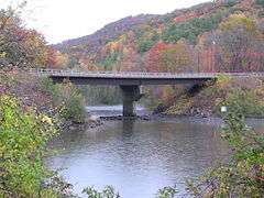
517 Depot St.
43°16′02″N 72°35′24″W / 43.267265°N 72.590057°W / 43.267265; -72.590057 (Augustus and Laura Blaisdell House) |
Chester |
|
| 12 |
Bowers Covered Bridge |
|
000000001973-08-28-0000August 28, 1973
(#73000211) |
Bible Hill Road over Mill Creek
43°27′42″N 72°29′29″W / 43.461667°N 72.491389°W / 43.461667; -72.491389 (Bowers Covered Bridge) |
West Windsor |
Washed off abutments by Hurricane Irene; rebuilt in 2012.
|
| 13 |
Theron Boyd Homestead |
|
000000001993-05-20-0000May 20, 1993
(#93000381) |
Town Highway 6
43°39′08″N 72°26′46″W / 43.652107°N 72.446156°W / 43.652107; -72.446156 (Theron Boyd Homestead) |
Hartford |
part of the Agricultural Resources of Vermont MPS
|
| 14 |
Bridge 15 |
|
000000002008-08-19-0000August 19, 2008
(#08000792) |
F.A.S. Highway 177
43°46′55″N 72°27′36″W / 43.781944°N 72.46°W / 43.781944; -72.46 (Bridge 15) |
Sharon |
part of the Metal Truss, Masonry, and Concrete Bridges in Vermont MPS
|
| 15 |
Bridgewater Corners Bridge |
|
000000001992-10-29-0000October 29, 1992
(#92001525) |
Vermont Route 100A over the Ottauquechee River
43°35′12″N 72°39′25″W / 43.586667°N 72.656944°W / 43.586667; -72.656944 (Bridgewater Corners Bridge) |
Bridgewater |
part of the Metal Truss, Masonry, and Concrete Bridges in Vermont MPS
|
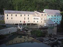
| 16 |
Bridgewater Woolen Mill |
|
000000001976-07-06-0000July 6, 1976
(#76002240) |
U.S. Route 4
43°35′13″N 72°37′16″W / 43.586944°N 72.621111°W / 43.586944; -72.621111 (Bridgewater Woolen Mill) |
Bridgewater |
|
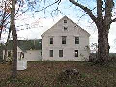
| 17 |
Brook Farm |
|
000000001993-07-22-0000July 22, 1993
(#93000676) |
Twenty Mile Stream Rd. northwest of Cavendish
43°26′30″N 72°39′20″W / 43.441667°N 72.655556°W / 43.441667; -72.655556 (Brook Farm) |
Cavendish |
part of the Agricultural Resources of Vermont MPS
|
| 18 |
Twing Buckman House |
|
000000001996-04-04-0000April 4, 1996
(#96000385) |
U.S. Route 5, approximately 0.25 miles (0.40 km) north of Chase Island
43°28′14″N 72°23′26″W / 43.470556°N 72.390556°W / 43.470556; -72.390556 (Twing Buckman House) |
Windsor |
|
| 19 |
Cavendish Universalist Church |
|
000000001973-04-24-0000April 24, 1973
(#73000252) |
Vermont Route 131
43°23′05″N 72°36′22″W / 43.384722°N 72.606111°W / 43.384722; -72.606111 (Cavendish Universalist Church) |
Cavendish |
|
| 20 |
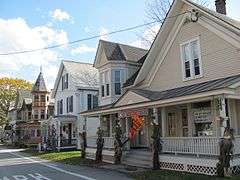
Chester Village Historic District |
|
000000001985-08-08-0000August 8, 1985
(#85001739) |
Roughly bounded by Lovers Lane Brook, Maple St., the Williams River, Middle Branch, and Lovers Lane
43°15′54″N 72°36′04″W / 43.265°N 72.601111°W / 43.265; -72.601111 (Chester Village Historic District) |
Chester |
|
| 21 |
Christian Street Rural Historic District |
|
000000002003-12-05-0000December 5, 2003
(#03001248) |
Christian St., Hemlock Ridge Dr., and Jericho St.
43°41′29″N 72°19′12″W / 43.691421°N 72.31991°W / 43.691421; -72.31991 (Christian Street Rural Historic District) |
Hartford |
|
| 22 |
Congregational Church of Ludlow |
|
000000002004-01-28-0000January 28, 2004
(#03001541) |
48 Pleasant St.
43°23′43″N 72°41′49″W / 43.395247°N 72.697050°W / 43.395247; -72.697050 (Congregational Church of Ludlow) |
Ludlow |
part of the Religious Buildings, Sites and Structures in Vermont MPS
|
| 23 |
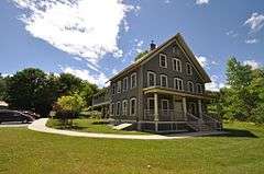
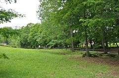
Coolidge State Park |
|
000000002002-03-29-0000March 29, 2002
(#02000281) |
855 Coolidge State Park Rd.
43°33′08″N 72°41′39″W / 43.552222°N 72.694167°W / 43.552222; -72.694167 (Coolidge State Park) |
Plymouth |
part of the Historic Park Landscapes in National and State Parks MPS
|
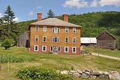
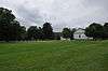
| 24 |
Calvin Coolidge Homestead District |
|
000000001966-10-15-0000October 15, 1966
(#66000794) |
Off Vermont Route 100A
43°32′14″N 72°43′28″W / 43.537222°N 72.724444°W / 43.537222; -72.724444 (Calvin Coolidge Homestead District) |
Plymouth Notch |
President Calvin Coolidge's birthplace and family home.
|
| 25 |
Cornish-Windsor Covered Bridge |
|
000000001976-11-21-0000November 21, 1976
(#76000135) |
West of Cornish City
43°28′26″N 72°23′01″W / 43.473889°N 72.383611°W / 43.473889; -72.383611 (Cornish-Windsor Covered Bridge) |
Windsor |
Extends into Cornish in Sullivan County, New Hampshire
|
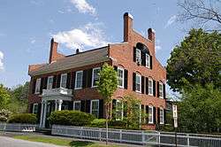
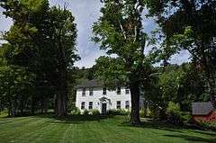
| 26 |
Rev. George Daman House |
|
000000001989-06-22-0000June 22, 1989
(#89000759) |
Wyman Ln.
43°36′29″N 72°33′42″W / 43.608056°N 72.561667°W / 43.608056; -72.561667 (Rev. George Daman House) |
Woodstock |
|
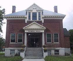
| 27 |
Damon Hall |
|
000000001988-06-02-0000June 2, 1988
(#88000654) |
U.S. Route 5 and Vermont Route 12
43°32′29″N 72°24′01″W / 43.541389°N 72.400278°W / 43.541389; -72.400278 (Damon Hall) |
Hartland |
|
| 28 |
Dewey House |
|
000000001999-08-27-0000August 27, 1999
(#99001051) |
173 Deweys Mills Rd.
43°38′30″N 72°24′19″W / 43.641667°N 72.405278°W / 43.641667; -72.405278 (Dewey House) |
Hartford |
|
| 29 |
Ezekiel Emerson Farm |
|
000000002001-11-29-0000November 29, 2001
(#01001284) |
Vermont Route 73
43°51′23″N 72°49′21″W / 43.856389°N 72.8225°W / 43.856389; -72.8225 (Ezekiel Emerson Farm) |
Rochester |
part of the Agricultural Resources of Vermont MPS
|
| 30 |
Eureka Schoolhouse |
|
000000001971-03-11-0000March 11, 1971
(#71000074) |
470 Charlestown Rd.
43°16′12″N 72°26′52″W / 43.270101°N 72.447868°W / 43.270101; -72.447868 (Eureka Schoolhouse) |
Goulds Mill |
|
| 31 |
Joseph Fessenden House |
|
000000002002-09-06-0000September 6, 2002
(#02000953) |
58 Bridge St.
43°48′54″N 72°32′50″W / 43.815°N 72.547222°W / 43.815; -72.547222 (Joseph Fessenden House) |
Royalton |
|
| 32 |
Fletcher-Fullerton Farm |
|
000000002004-11-04-0000November 4, 2004
(#04001215) |
1390 Fletcher Schoolhouse Road
43°34′08″N 72°33′35″W / 43.568889°N 72.559722°W / 43.568889; -72.559722 (Fletcher-Fullerton Farm) |
Woodstock |
part of the Agricultural Resources of Vermont MPS
|
| 33 |
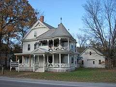
Fowler-Steele House |
|
000000001982-06-17-0000June 17, 1982
(#82001710) |
N. Main St.
43°29′24″N 72°23′10″W / 43.49°N 72.386111°W / 43.49; -72.386111 (Fowler-Steele House) |
Windsor |
|
| 34 |
Fox Stand |
|
000000002015-07-23-0000July 23, 2015
(#15000477) |
5615 VT 14
43°49′24″N 72°33′52″W / 43.8234°N 72.5645°W / 43.8234; -72.5645 (Fox Stand) |
Royalton |
|
| 35 |
Gate of the Hills |
|
000000001991-11-18-0000November 18, 1991
(#91001648) |
Junction of North and Royalton Hill Rds.
43°49′15″N 72°37′50″W / 43.820833°N 72.630556°W / 43.820833; -72.630556 (Gate of the Hills) |
Bethel |
|
| 36 |
Daniel Gay House |
|
000000001978-01-09-0000January 9, 1978
(#78000252) |
Vermont Route 107
43°46′42″N 72°41′53″W / 43.778360°N 72.697923°W / 43.778360; -72.697923 (Daniel Gay House) |
Stockbridge |
Now the Belcher Library
|
| 37 |
Gilead Brook Bridge |
|
000000001990-10-11-0000October 11, 1990
(#90001492) |
Vermont Route 12 over Gilead Brook
43°52′25″N 72°38′52″W / 43.873611°N 72.647778°W / 43.873611; -72.647778 (Gilead Brook Bridge) |
Bethel |
part of the Metal Truss, Masonry, and Concrete Bridges in Vermont MPS
|
| 38 |
Glimmerstone |
|
000000001978-11-14-0000November 14, 1978
(#78000253) |
Vermont Route 131
43°22′58″N 72°36′48″W / 43.382778°N 72.613333°W / 43.382778; -72.613333 (Glimmerstone) |
Cavendish |
|
| 39 |
Gould's Mill Bridge |
|
000000002006-02-01-0000February 1, 2006
(#05001589) |
Town Hwy. 66 (Paddock Rd.) over the Black River
43°16′22″N 72°27′16″W / 43.272778°N 72.454444°W / 43.272778; -72.454444 (Gould's Mill Bridge) |
Springfield |
part of the Metal Truss, Masonry, and Concrete Bridges in Vermont MPS
|
| 40 |
Greenwood House |
|
000000001985-10-31-0000October 31, 1985
(#85003442) |
Vermont Route 103
43°15′28″N 72°35′14″W / 43.257778°N 72.587222°W / 43.257778; -72.587222 (Greenwood House) |
Chester |
|
| 41 |
Harrington House |
|
000000001983-03-16-0000March 16, 1983
(#83003230) |
River St. and Vermont Route 107
43°49′17″N 72°37′56″W / 43.821389°N 72.632222°W / 43.821389; -72.632222 (Harrington House) |
Bethel |
|
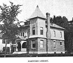
| 42 |
Hartford Library |
|
000000001994-12-09-0000December 9, 1994
(#94001447) |
1587 Maple St.
43°39′41″N 72°20′35″W / 43.661389°N 72.343056°W / 43.661389; -72.343056 (Hartford Library) |
Hartford |
|
| 43 |
Hartford Village Historic District |
|
000000001998-09-03-0000September 3, 1998
(#98001153) |
Roughly along Hartford Main, Summer and Christian Sts.
43°39′45″N 72°20′23″W / 43.6625°N 72.339722°W / 43.6625; -72.339722 (Hartford Village Historic District) |
Hartford |
|
| 44 |
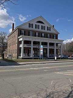
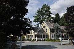
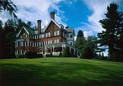
Hartness House |
|
000000001978-12-20-0000December 20, 1978
(#78000254) |
30 Orchard St.
43°18′05″N 72°28′39″W / 43.301380°N 72.477601°W / 43.301380; -72.477601 (Hartness House) |
Springfield |
|
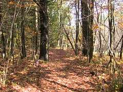
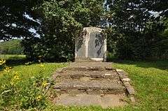
| 45 |
Historic Crown Point Road |
|
000000001974-12-02-0000December 2, 1974
(#74000270) |
Off Vermont Route 131
43°23′29″N 72°30′12″W / 43.391389°N 72.503333°W / 43.391389; -72.503333 (Historic Crown Point Road) |
Weathersfield |
The Crown Point Road spanned about a hundred miles when originally built.
|
| 46 |
Indian Stones |
|
000000001974-11-20-0000November 20, 1974
(#74000356) |
Vermont Route 106
43°26′47″N 72°32′07″W / 43.446389°N 72.535278°W / 43.446389; -72.535278 (Indian Stones) |
Reading |
|
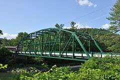
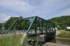
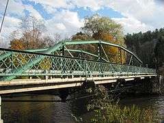
| 47 |
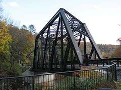
Iron Bridge at Howard Hill Road |
|
000000001982-09-09-0000September 9, 1982
(#82001711) |
Howard Hill Rd. and Vermont Route 131
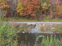
43°24′16″N 72°34′32″W / 43.404444°N 72.575556°W / 43.404444; -72.575556 (Iron Bridge at Howard Hill Road) |
Cavendish |
The original 1890 structure was replaced in 2007 by the bridge in photo.
|
| 48 |
Jeffrey House |
|
000000001974-06-13-0000June 13, 1974
(#74000271) |
North St.
43°16′44″N 72°35′51″E / 43.278884°N 72.597525°E / 43.278884; 72.597525 (Jeffrey House) |
Chester |
|
| 49 |
Jericho Rural Historic District |
|
000000002001-11-08-0000November 8, 2001
(#01001228) |
Jericho St., Jericho Rd., Wallace Rd., Sugartop Rd., Joshua Rd.
43°42′17″N 72°22′32″W / 43.704722°N 72.375556°W / 43.704722; -72.375556 (Jericho Rural Historic District) |
Hartford |
|
| 50 |
Wales N. Johnson House |
|
000000001995-11-07-0000November 7, 1995
(#95001258) |
43 Senior Ln.
43°36′44″N 72°33′00″W / 43.612222°N 72.55°W / 43.612222; -72.55 (Wales N. Johnson House) |
Woodstock |
Now the Jackson House Inn.
|
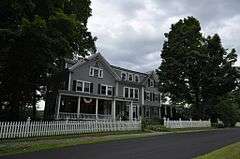
| 51 |
Juniper Hill Farm-Maxwell Evarts House |
|
000000001988-07-14-0000July 14, 1988
(#88001044) |
Juniper Hill Rd.
43°29′31″N 72°23′45″W / 43.491944°N 72.395833°W / 43.491944; -72.395833 (Juniper Hill Farm-Maxwell Evarts House) |
Windsor |
|
| 52 |
Kendron Brook Bridge |
|
000000001992-08-27-0000August 27, 1992
(#92001037) |
Town Highway 65 (Densmore Hill Road) over Kendron Brook
43°34′53″N 72°30′55″W / 43.581389°N 72.515278°W / 43.581389; -72.515278 (Kendron Brook Bridge) |
Woodstock |
part of the Metal Truss, Masonry, and Concrete Bridges in Vermont MPS
|
| 53 |
The King Farm |
|
000000001997-01-31-0000January 31, 1997
(#97000026) |
King Farm Rd., 0.5 miles (0.80 km) north of its junction with U.S. Route 4
43°37′23″N 72°32′41″W / 43.623056°N 72.544722°W / 43.623056; -72.544722 (The King Farm) |
Woodstock |
part of the Agricultural Resources of Vermont MPS
|
| 54 |
Lincoln Covered Bridge |
|
000000001973-08-28-0000August 28, 1973
(#73000212) |
Southwest of Woodstock off U.S. Route 4
43°36′02″N 72°34′10″W / 43.600556°N 72.569444°W / 43.600556; -72.569444 (Lincoln Covered Bridge) |
Woodstock |
|
| 55 |
Lockwood-Boynton House |
|
000000001982-05-04-0000May 4, 1982
(#82001712) |
1 School St.
43°19′59″N 72°31′36″W / 43.333056°N 72.526667°W / 43.333056; -72.526667 (Lockwood-Boynton House) |
North Springfield |
|
| 56 |
Locust Creek House Complex |
|
000000001982-12-10-0000December 10, 1982
(#82001766) |
Vermont Route 12
43°48′32″N 72°39′04″W / 43.808889°N 72.651111°W / 43.808889; -72.651111 (Locust Creek House Complex) |
Bethel |
|
| 57 |
Ludlow Graded School |
|
000000001979-11-29-0000November 29, 1979
(#79000276) |
High St.
43°23′48″N 72°41′52″W / 43.396667°N 72.697778°W / 43.396667; -72.697778 (Ludlow Graded School) |
Ludlow |
|
| 58 |
Ludlow Village Historic District |
|
000000002007-01-09-0000January 9, 2007
(#06001235) |
Main St., Depot St.
43°23′53″N 72°41′59″W / 43.398056°N 72.699722°W / 43.398056; -72.699722 (Ludlow Village Historic District) |
Ludlow |
|
| 59 |
Charles Marsh Law Office |
|
000000001994-12-09-0000December 9, 1994
(#94001449) |
72 Pleasant St.
43°37′36″N 72°30′23″W / 43.626667°N 72.506389°W / 43.626667; -72.506389 (Charles Marsh Law Office) |
Woodstock |
|
| 60 |
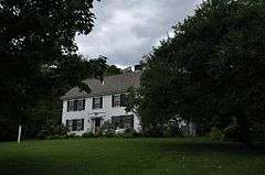
George Perkins Marsh Boyhood Home |
|
000000001967-06-11-0000June 11, 1967
(#67000023) |
54 Elm St.
43°37′51″N 72°31′11″W / 43.630833°N 72.519722°W / 43.630833; -72.519722 (George Perkins Marsh Boyhood Home) |
Woodstock |
Boyhood home of George Perkins Marsh, an American diplomat and philologist, an early environmentalist. Now in the Marsh-Billings-Rockefeller National Historical Park.
|
| 61 |
Joseph and Daniel Marsh House |
|
000000001998-09-03-0000September 3, 1998
(#98001149) |
1119 Quechee Main Street
43°38′55″N 72°24′27″W / 43.648525°N 72.407457°W / 43.648525; -72.407457 (Joseph and Daniel Marsh House) |
Hartford |
Now the Quechee Inn.
|
| 62 |
Marsh-Billings-Rockefeller National Historical Park |
|
000000001992-08-26-0000August 26, 1992
(#03000282) |
Vermont Route 12
43°38′00″N 72°31′16″W / 43.633333°N 72.521111°W / 43.633333; -72.521111 (Marsh-Billings-Rockefeller National Historical Park) |
Woodstock |
Updated listing August 15, 2016.
|
| 63 |
Martin's Mill Covered Bridge |
|
000000001973-08-28-0000August 28, 1973
(#73000213) |
South of Hartland off U.S. Route 5
43°31′56″N 72°23′47″W / 43.532222°N 72.396389°W / 43.532222; -72.396389 (Martin's Mill Covered Bridge) |
Hartland |
|
| 64 |
McKenstry Manor |
|
000000001978-12-01-0000December 1, 1978
(#78000255) |
North of Bethel on Vermont Route 12
43°52′00″N 72°39′11″W / 43.866667°N 72.653056°W / 43.866667; -72.653056 (McKenstry Manor) |
Bethel |
|
| 65 |
Owen Moon Farm |
|
000000001983-01-27-0000January 27, 1983
(#83003231) |
South of South Woodstock off Vermont Route 106
43°33′18″N 72°31′59″W / 43.555°N 72.533056°W / 43.555; -72.533056 (Owen Moon Farm) |
South Woodstock |
|
| 66 |
Gen. Lewis R. Morris House |
|
000000001992-06-25-0000June 25, 1992
(#92000813) |
456 Old Connecticut River Rd.
43°17′23″N 72°24′37″W / 43.289722°N 72.410278°W / 43.289722; -72.410278 (Gen. Lewis R. Morris House) |
Springfield |
part of the Agricultural Resources of Vermont MPS
|
| 67 |
NAMCO Block |
|
000000001991-11-14-0000November 14, 1991
(#91001615) |
1-17 Union St.
43°28′32″N 72°23′23″W / 43.475556°N 72.389722°W / 43.475556; -72.389722 (NAMCO Block) |
Windsor |
|
| 68 |
Norwich Village Historic District |
|
000000001991-01-03-0000January 3, 1991
(#90002116) |
Main St. from south of Elm St. to Turnpike Rd. and adjacent portions of Elm, Church, Mechanic, Hazen and Cliff Sts.
43°42′56″N 72°18′38″W / 43.715556°N 72.310556°W / 43.715556; -72.310556 (Norwich Village Historic District) |
Norwich |
|
| 69 |
Old Christ Church |
|
000000002008-03-06-0000March 6, 2008
(#08000159) |
Junction of Vermont Route 12 and Gilead Brook Rd.
43°52′30″N 72°38′51″W / 43.875°N 72.6475°W / 43.875; -72.6475 (Old Christ Church) |
Bethel |
part of the Religious Buildings, Sites and Structures in Vermont MPS
|
| 70 |
Old Constitution House |
|
000000001971-03-11-0000March 11, 1971
(#71000075) |
16 N. Main St.
43°29′03″N 72°23′08″W / 43.484167°N 72.385556°W / 43.484167; -72.385556 (Old Constitution House) |
Windsor |
|
| 71 |
Ottauquechee River Bridge |
|
000000001990-10-11-0000October 11, 1990
(#90001491) |
U.S. Route 5 over the Ottauquechee River
43°36′09″N 72°21′17″W / 43.6025°N 72.354722°W / 43.6025; -72.354722 (Ottauquechee River Bridge) |
Hartland |
part of the Metal Truss, Masonry, and Concrete Bridges in Vermont MPS
|
| 72 |
Parker Hill Rural Historic District |
|
000000001993-05-20-0000May 20, 1993
(#93000431) |
Parker Hill and Lower Parker Hill Rds.
43°13′25″N 72°28′46″W / 43.223611°N 72.479444°W / 43.223611; -72.479444 (Parker Hill Rural Historic District) |
Springfield |
also extends into Windham County
|
| 73 |
Aaron Jr. and Susan Parker Farm |
Upload image |
000000002014-09-24-0000September 24, 2014
(#14000405) |
1715 Brook Road
43°25′11″N 72°36′36″W / 43.4198°N 72.6101°W / 43.4198; -72.6101 (Aaron Jr. and Susan Parker Farm) |
Cavendish |
|
| 74 |
Plymouth Historic District |
|
000000001970-12-12-0000December 12, 1970
(#70000084) |
Vermont Route 100A
43°32′30″N 72°42′51″W / 43.541667°N 72.714167°W / 43.541667; -72.714167 (Plymouth Historic District) |
Plymouth |
|
| 75 |
Pollard Block |
|
000000002008-08-28-0000August 28, 2008
(#08000855) |
7 Depot St.
43°22′57″N 72°38′18″W / 43.382533°N 72.638342°W / 43.382533; -72.638342 (Pollard Block) |
Cavendish |
|
| 76 |
Progressive Market |
|
000000001995-07-10-0000July 10, 1995
(#95000814) |
63 S. Main St.
43°38′46″N 72°19′09″W / 43.646111°N 72.319167°W / 43.646111; -72.319167 (Progressive Market) |
Hartford |
|
| 77 |
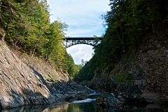
Quechee Gorge Bridge |
|
000000001990-10-11-0000October 11, 1990
(#90001490) |
U.S. Route 4 over Quechee Gorge
43°38′16″N 72°24′32″W / 43.637778°N 72.408889°W / 43.637778; -72.408889 (Quechee Gorge Bridge) |
Hartford |
part of the Metal Truss, Masonry, and Concrete Bridges in Vermont MPS
|
| 78 |
Quechee Historic Mill District |
|
000000001997-07-03-0000July 3, 1997
(#97000747) |
Roughly along High, Quechee Main, River, and School Sts., and River, Waterman Hill, Deweys Mill, and Cemetery Rds.
43°38′50″N 72°25′07″W / 43.647222°N 72.418611°W / 43.647222; -72.418611 (Quechee Historic Mill District) |
Hartford |
|
| 79 |
Isaac M. Raymond Farm |
|
000000001993-04-01-0000April 1, 1993
(#93000242) |
Junction of Woodstock Town Highways 95 and 18
43°38′57″N 72°33′59″W / 43.649079°N 72.566483°W / 43.649079; -72.566483 (Isaac M. Raymond Farm) |
Woodstock |
part of the Agricultural Resources of Vermont MPS; now called Uphill Farm.
|
| 80 |
Reading Town Hall |
|
000000001996-03-07-0000March 7, 1996
(#96000252) |
Junction of Vermont Route 106 and Pleasant St.
43°27′20″N 72°32′16″W / 43.455556°N 72.537778°W / 43.455556; -72.537778 (Reading Town Hall) |
Reading |
part of the Historic Government Buildings MPS
|
| 81 |
Robbins and Lawrence Armory and Machine Shop |
|
000000001966-11-13-0000November 13, 1966
(#66000796) |
S. Main St.
43°28′29″N 72°23′23″W / 43.4747°N 72.3897°W / 43.4747; -72.3897 (Robbins and Lawrence Armory and Machine Shop) |
Windsor |
Erected in 1846, an excellent example of 19th century American industrial architecture, and a site of the development of precision machinery.
|
| 82 |
Root School |
|
000000002013-06-10-0000June 10, 2013
(#13000375) |
987 Union Village Rd.
43°45′22″N 72°16′37″W / 43.756158°N 72.277042°W / 43.756158; -72.277042 (Root School) |
Norwich |
Part of the Educational Resources of Vermont MPS
|
| 83 |
Royalton Mill Complex |
|
000000001983-02-03-0000February 3, 1983
(#83003232) |
North of South Royalton on Town Rd. 12
43°49′54″N 72°30′56″W / 43.831667°N 72.515556°W / 43.831667; -72.515556 (Royalton Mill Complex) |
South Royalton |
|
| 84 |
Saddlebow Farm |
|
000000002002-11-14-0000November 14, 2002
(#02001345) |
2477 Gold Coast Rd.
43°36′54″N 72°37′19″W / 43.615°N 72.621944°W / 43.615; -72.621944 (Saddlebow Farm) |
Bridgewater |
|
| 85 |
St. Pauls's Episcopal Church |
|
000000002001-03-02-0000March 2, 2001
(#01000214) |
Junction of Bridge St. and Vermont Route 14
43°48′55″N 72°32′48″W / 43.815278°N 72.546667°W / 43.815278; -72.546667 (St. Pauls's Episcopal Church) |
Royalton |
part of the Religious Buildings, Sites and Structures in Vermont MPS
|
| 86 |
Simons' Inn |
Upload image |
000000001979-03-02-0000March 2, 1979
(#79000233) |
Southwest of Andover on Vermont Route 11
43°15′28″N 72°43′01″W / 43.257778°N 72.716944°W / 43.257778; -72.716944 (Simons' Inn) |
Andover |
|
| 87 |
Slayton-Morgan Historic District |
Upload image |
000000002010-06-24-0000June 24, 2010
(#91001944) |
Address Restricted
|
Woodstock |
|
| 88 |
South Reading Schoolhouse |
|
000000001983-02-03-0000February 3, 1983
(#83003233) |
Felchville-Tyson's Corner Rd.
43°28′34″N 72°35′41″W / 43.476111°N 72.594722°W / 43.476111; -72.594722 (South Reading Schoolhouse) |
South Reading |
|
| 89 |
South Royalton Historic District |
|
000000001976-09-03-0000September 3, 1976
(#76000200) |
East of Royalton on Vermont Route 14
43°49′17″N 72°31′15″W / 43.821389°N 72.520833°W / 43.821389; -72.520833 (South Royalton Historic District) |
South Royalton |
|
| 90 |
South Woodstock Village Historic District |
|
000000001982-08-12-0000August 12, 1982
(#82001713) |
Both sides of Vermont Route 106, Town Highway 61, and Church Hill Rd.
43°33′48″N 72°31′57″W / 43.563333°N 72.5325°W / 43.563333; -72.5325 (South Woodstock Village Historic District) |
Woodstock |
|
| 91 |
Southview Housing Historic District |
Upload image |
000000002007-11-08-0000November 8, 2007
(#07001171) |
1-107 Stanley Rd.
43°17′06″N 72°28′35″W / 43.285°N 72.476389°W / 43.285; -72.476389 (Southview Housing Historic District) |
Springfield |
|
| 92 |
Spaulding Bridge |
|
000000002006-01-11-0000January 11, 2006
(#05001522) |
Mill St.
43°22′57″N 72°36′31″W / 43.3825°N 72.608611°W / 43.3825; -72.608611 (Spaulding Bridge) |
Cavendish |
part of the Metal Truss, Masonry, and Concrete Bridges in Vermont MPS
|
| 93 |
Zachariah Spaulding Farm |
|
000000001993-11-04-0000November 4, 1993
(#93001175) |
Town Highway 38 south of the Ludlow town center
43°22′53″N 72°41′29″W / 43.381389°N 72.691389°W / 43.381389; -72.691389 (Zachariah Spaulding Farm) |
Ludlow |
part of the Agricultural Resources of Vermont MPS
|
| 94 |
Spencer Hollow School |
|
000000002012-09-17-0000September 17, 2012
(#12000803) |
50 Spencer Hollow Rd.
43°17′51″N 72°25′53″W / 43.297558°N 72.43149°W / 43.297558; -72.43149 (Spencer Hollow School) |
Springfield |
part of the Educational Resources of Vermont MPS
|
| 95 |
Springfield Downtown Historic District |
|
000000001983-08-11-0000August 11, 1983
(#83003234) |
Roughly bounded by the Black River and Mineral, Pearl, Main, and Valley Sts.
• Boundary increase (listed 000000001986-09-11-0000September 11, 1986): Roughly the Brookline Apartments on Wall St., Park St., and along the Black River
43°18′04″N 72°29′05″W / 43.301111°N 72.484722°W / 43.301111; -72.484722 (Springfield Downtown Historic District) |
Springfield |
|
| 96 |
Stellafane Observatory |
|
000000001977-11-07-0000November 7, 1977
(#77000107) |
South of North Springfield off Breezy Hill Rd.
43°16′41″N 72°31′10″W / 43.2781°N 72.5194°W / 43.2781; -72.5194 (Stellafane Observatory) |
North Springfield |
Contains original clubhouse of the Springfield Telescope Makers, Inc. (1924), and the first large optical telescope (1930) built and owned by that kind of amateur society.
|
| 97 |
Stockbridge Common Historic District |
|
000000001990-05-24-0000May 24, 1990
(#90000800) |
Area around Stockbridge Common, including Maplewood Cemetery
43°47′12″N 72°45′19″W / 43.786667°N 72.755278°W / 43.786667; -72.755278 (Stockbridge Common Historic District) |
Stockbridge |
|
| 98 |
Stockbridge Four Corners Bridge |
|
000000001991-11-14-0000November 14, 1991
(#91001611) |
Vermont Route 100 over the White River
43°46′56″N 72°45′30″W / 43.782222°N 72.758333°W / 43.782222; -72.758333 (Stockbridge Four Corners Bridge) |
Stockbridge |
Demolished 2009 and replaced by modern bridge.
|
| 99 |
Stone Village Historic District |
|
000000001974-05-17-0000May 17, 1974
(#74000329) |
Both sides of Vermont Route 103
43°16′24″N 72°35′35″W / 43.273333°N 72.593056°W / 43.273333; -72.593056 (Stone Village Historic District) |
Chester |
|
| 100 |
Jedediah Strong II House |
|
000000001974-08-13-0000August 13, 1974
(#74000272) |
Quechee Main St. and Dewey's Mills Rd.
43°38′44″N 72°24′02″W / 43.645556°N 72.400556°W / 43.645556; -72.400556 (Jedediah Strong II House) |
Hartford |
|
| 101 |
David Sumner House |
|
000000001989-03-02-0000March 2, 1989
(#89000027) |
U.S. Route 5
43°32′24″N 72°23′56″W / 43.54°N 72.398889°W / 43.54; -72.398889 (David Sumner House) |
Hartland |
|
| 102 |
Taftsville Covered Bridge |
|
000000001973-08-28-0000August 28, 1973
(#73000214) |
East of Woodstock off U.S. Route 4
43°38′23″N 72°28′05″W / 43.639722°N 72.468056°W / 43.639722; -72.468056 (Taftsville Covered Bridge) |
Woodstock |
|
| 103 |
Taftsville Historic District |
|
000000002001-08-02-0000August 2, 2001
(#01000824) |
Portions of U.S. Route 4, Upper River Rd., Quechee Main St., all Butternut Ln., Happy Valley Rd., Sugar Hill Rd.
43°37′46″N 72°28′26″W / 43.629444°N 72.473889°W / 43.629444; -72.473889 (Taftsville Historic District) |
Hartford |
|
| 104 |
Terraces Historic District |
|
000000002012-07-06-0000July 6, 2012
(#12000410) |
22-60 Mapelwood Terr., 2-364 Fairview Terr., 12-249 Hillcrest Terr., 82, 176 Forest Hills Ave.
43°39′01″N 72°19′30″W / 43.650306°N 72.325081°W / 43.650306; -72.325081 (Terraces Historic District) |
Hartford |
|
| 105 |
Upper Falls Covered Bridge |
|
000000001973-08-28-0000August 28, 1973
(#73000215) |
North of Perkinsville off Vermont Route 131
43°23′55″N 72°31′21″W / 43.398611°N 72.5225°W / 43.398611; -72.5225 (Upper Falls Covered Bridge) |
Perkinsville |
|
| 106 |
Weathersfield Center Historic District |
|
000000001980-06-30-0000June 30, 1980
(#80000345) |
Center Rd.
43°22′43″N 72°28′05″W / 43.378611°N 72.468056°W / 43.378611; -72.468056 (Weathersfield Center Historic District) |
Weathersfield Center |
|
| 107 |
West Hartford Bridge |
|
000000001992-10-29-0000October 29, 1992
(#92001524) |
Town Highway 14 at Vermont Route 14 over the White River
43°42′44″N 72°25′06″W / 43.712222°N 72.418333°W / 43.712222; -72.418333 (West Hartford Bridge) |
Hartford |
Truss bridge, replaced by modern bridge in 2006.
|
| 108 |
West Hartford Village Historic District |
|
000000002004-12-15-0000December 15, 2004
(#04001368) |
Vermont Route 14, Harper Savage Ln., Tigertown Rd., and Stetson Rd.
43°42′59″N 72°24′58″W / 43.716389°N 72.416111°W / 43.716389; -72.416111 (West Hartford Village Historic District) |
Hartford |
|
| 109 |
West Woodstock Bridge |
|
000000001992-08-27-0000August 27, 1992
(#92001038) |
Town Highway 50 over the Ottauquechee River
43°36′51″N 72°32′36″W / 43.614167°N 72.543333°W / 43.614167; -72.543333 (West Woodstock Bridge) |
West Woodstock |
part of the Metal Truss, Masonry, and Concrete Bridges in Vermont MPS
|
| 110 |
Weston Village Historic District |
|
000000001985-08-29-0000August 29, 1985
(#85001934) |
Main, Park, and School Sts., Lawrence Hill, Landgrove, and Trout Club Rds., Mill Lane, and Chester Mountain Rd.
43°17′30″N 72°47′40″W / 43.291667°N 72.794444°W / 43.291667; -72.794444 (Weston Village Historic District) |
Weston |
|
| 111 |
White River Junction Historic District |
|
000000001980-08-22-0000August 22, 1980
(#80000390) |
Railroad Row, Main, Currier, Bridge, and Gates Sts.
• Boundary increase (listed 000000002002-12-20-0000December 20, 2002, refnum 02001553): N. Main St., S. Main St. Bridge St., Gates St., and Church St.
43°38′53″N 72°19′09″W / 43.648056°N 72.319167°W / 43.648056; -72.319167 (White River Junction Historic District) |
Hartford |
|
| 112 |
Wilder Village Historic District |
|
000000001999-11-22-0000November 22, 1999
(#99001396) |
Portions of Norwich, Passumpsic, and Horseshoe Aves., Chestnut, Gillette, Fern, Hawthorn, Locust and Division Sts.
43°40′30″N 72°18′31″W / 43.675°N 72.308611°W / 43.675; -72.308611 (Wilder Village Historic District) |
Hartford |
|
| 113 |
John Wilder House |
|
000000001983-11-10-0000November 10, 1983
(#83004231) |
Lawrence Hill Rd.
43°17′32″N 72°47′43″W / 43.292222°N 72.795278°W / 43.292222; -72.795278 (John Wilder House) |
Weston |
|
| 114 |
Wilgus State Park |
|
000000002002-03-29-0000March 29, 2002
(#02000282) |
3985 U.S. Route 5
43°23′27″N 72°24′38″W / 43.390833°N 72.410556°W / 43.390833; -72.410556 (Wilgus State Park) |
Weathersfield |
part of the Historic Park Landscapes in National and State Parks MPS
|
| 115 |
Willard Covered Bridge |
|
000000001973-08-28-0000August 28, 1973
(#73000216) |
Mill Rd. across the Ottauquechee River
43°35′37″N 72°21′01″W / 43.593611°N 72.350278°W / 43.593611; -72.350278 (Willard Covered Bridge) |
Hartland |
|
| 116 |
Windsor House |
|
000000001971-12-29-0000December 29, 1971
(#71000060) |
N. Main St., north of the junction of Main and State Sts.
43°28′51″N 72°23′11″W / 43.480783°N 72.386369°W / 43.480783; -72.386369 (Windsor House) |
Windsor |
|
| 117 |
Windsor Village Historic District |
|
000000001975-04-23-0000April 23, 1975
(#75000212) |
Area centered around Main, Depot Ave., State St., and Court Sq.
• Boundary increase (listed 000000001997-07-25-0000July 25, 1997, refnum 97000828): Along Phelps Ct. and State St.
• Boundary increase (listed 000000002014-12-01-0000December 1, 2014, refnum 14001036):
Along Main & State Sts., Village Green, Depot Ave., Connecticut R., Paradise Park
43°28′50″N 72°23′13″W / 43.480556°N 72.386944°W / 43.480556; -72.386944 (Windsor Village Historic District) |
Windsor |
Second and third set of addresses represents boundary increases
|
| 118 |
Woodstock Village Historic District |
|
000000001973-01-22-0000January 22, 1973
(#73000274) |
Along the Ottauquechee River
43°37′33″N 72°30′59″W / 43.625833°N 72.516389°W / 43.625833; -72.516389 (Woodstock Village Historic District) |
Woodstock |
|
| 119 |
Woodstock Warren Through Truss Bridge |
|
000000001992-08-18-0000August 18, 1992
(#92000987) |
Town Highway 24 across the Ottauquechee River
43°36′01″N 72°35′22″W / 43.600278°N 72.589444°W / 43.600278; -72.589444 (Woodstock Warren Through Truss Bridge) |
Woodstock |
part of the Metal Truss, Masonry, and Concrete Bridges in Vermont MPS. The bridge was swept away by Hurricane Irene in August of 2011. |


.jpg)