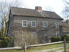
| [2] |
Name on the Register |
Image |
Date listed[3] |
Location |
City or town |
Description |
|---|
| 1 |
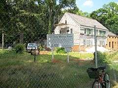
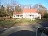
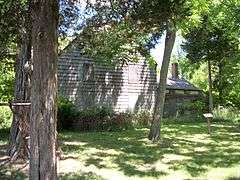
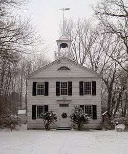
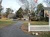
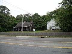
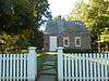
Bald Hill Schoolhouse |
|
000000001988-07-21-0000July 21, 1988
(#88001018) |
Horseblock Road
40°50′06″N 73°02′34″W / 40.835°N 73.042778°W / 40.835; -73.042778 (Bald Hill Schoolhouse) |
Farmingville |
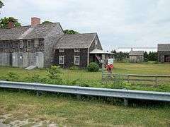
|
| 2 |
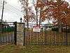
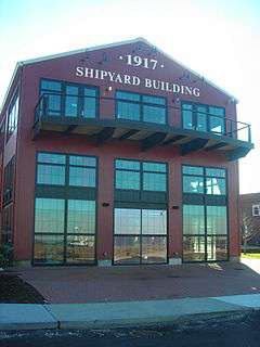
Bayles Shipyard |
|
000000002000-06-02-0000June 2, 2000
(#00000580) |
101 East Broadway
40°56′54″N 73°04′05″W / 40.948333°N 73.068056°W / 40.948333; -73.068056 (Bayles Shipyard) |
Port Jefferson |
|
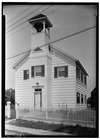
| 3 |
Bellport Academy |
Upload image |
000000001980-07-04-0000July 4, 1980
(#02001452) |
24 Academy Lane
40°45′14″N 72°56′16″W / 40.754008°N 72.937831°W / 40.754008; -72.937831 (Bellport Academy) |
Bellport |
|
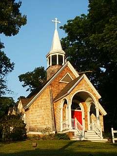
| 4 |
Bellport Village Historic District |
|
000000001980-07-04-0000July 4, 1980
(#02001451) |
Roughly bounded by South Country Road, Bellport Lane, Brown's Lane, Brewster Lane, and Bell Street
40°45′30″N 72°56′12″W / 40.758297°N 72.936794°W / 40.758297; -72.936794 (Bellport Village Historic District) |
Bellport |
|
| 4.5 |
Benner–Foos–Ceparano Estate |
Upload image |
000000002016-08-22-0000August 22, 2016
(#16000557) |
99 Van Brunt Manor & 6 Osprey Lane
Coordinates missing |
Poquott |
Shingle Style 1890s estate is only Lamb & Rich design with bowed plan. Transitioned from vacation home to full-time residence over the 20th century; one of the few North Shore estates in its original form.
|
| 5 |
Mary Louise Booth Girlhood House |
|
000000002015-01-27-0000January 27, 2015
(#14001219) |
E. Main St.
40°50′12″N 72°54′57″W / 40.8367°N 72.9157°W / 40.8367; -72.9157 (Mary Louise Booth Girlhood House) |
Yaphank |
Childhood home of Mary Louise Booth, 19th-century newspaper editor and French translator. See these links, and this one too.
|
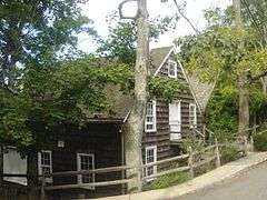
| 6 |
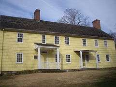
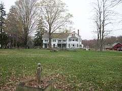
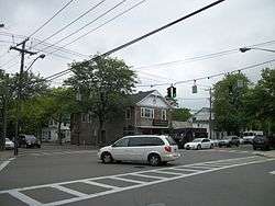
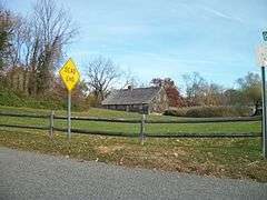
Brewster House |
|
000000002008-02-28-0000February 28, 2008
(#08000109) |
Junction of NY 25A & Runs Road
40°56′43″N 73°06′11″W / 40.945278°N 73.103056°W / 40.945278; -73.103056 (Brewster House) |
East Setauket |
|
| 7 |
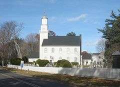
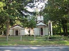
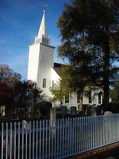
Caroline Church and Cemetery |
|
000000001991-09-09-0000September 9, 1991
(#91001148) |
Junction of Dyke and Bates Roads
40°56′49″N 73°06′46″W / 40.946944°N 73.112778°W / 40.946944; -73.112778 (Caroline Church and Cemetery) |
Setauket |
|
| 8 |
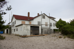
Carrington House |
|
000000002014-01-08-0000January 8, 2014
(#13001057) |
Lewis Walk (at eastern terminus of Ocean Walk)
40°39′43″N 73°04′39″W / 40.661898°N 73.077606°W / 40.661898; -73.077606 (Carrington House) |
Cherry Grove |
Early 20th-century beach bungalow was home to theater director Frank Carrington and an early center of gay life on Fire Island; Truman Capote wrote Breakfast at Tiffany's during a stay there.
|
| 9 |
Cherry Grove Community House and Theatre |
|
000000002013-06-04-0000June 4, 2013
(#13000373) |
180 Bayview Walk
40°39′36″N 73°05′26″W / 40.660072°N 73.090566°W / 40.660072; -73.090566 (Cherry Grove Community House and Theatre) |
Cherry Grove |
|
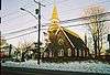
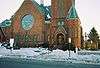
| 10 |
Congregational Church of Patchogue |
|
000000001993-04-01-0000April 1, 1993
(#93000279) |
95 East Main Street
40°45′57″N 73°00′47″W / 40.765833°N 73.013056°W / 40.765833; -73.013056 (Congregational Church of Patchogue) |
Patchogue |
|
| 11 |
Davis Town Meeting House |
|
000000002001-08-15-0000August 15, 2001
(#01000850) |
Junction of Middle Country Road and Coram-Mt. Sinai Road
40°52′54″N 72°59′01″W / 40.881667°N 72.983611°W / 40.881667; -72.983611 (Davis Town Meeting House) |
Coram |
|
| 12 |
ELVIRA (sloop) |
Upload image |
000000002012-05-23-0000May 23, 2012
(#12000288) |
Newey Lane
40°46′17″N 72°53′54″W / 40.771292°N 72.898284°W / 40.771292; -72.898284 (ELVIRA (sloop)) |
Brookhaven |
|
| 13 |
First Congregational Church of New Village |
|
000000002002-04-11-0000April 11, 2002
(#02000361) |
North side of Middle Country Road, West of Elliot Avenue
40°51′35″N 73°06′37″W / 40.859722°N 73.110278°W / 40.859722; -73.110278 (First Congregational Church of New Village) |
Lake Grove |
|
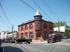
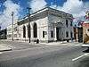
| 14 |
First National Bank of Port Jefferson |
|
000000002005-10-05-0000October 5, 2005
(#05001134) |
Main and East Main Streets
40°56′43″N 73°04′06″W / 40.945278°N 73.068333°W / 40.945278; -73.068333 (First National Bank of Port Jefferson) |
Port Jefferson |
|
| 15 |
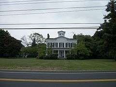
William Floyd House |
|
000000001980-10-15-0000October 15, 1980
(#71000066) |
20 Washington Avenue
40°46′09″N 72°49′21″W / 40.7692°N 72.8225°W / 40.7692; -72.8225 (William Floyd House) |
Mastic Beach |
|
| 16 |
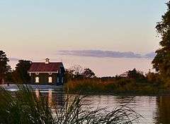
Gamecock Cottage |
|
000000002007-08-30-0000August 30, 2007
(#07000886) |
Shipman's Point, South end of West Meadow Beach
40°55′40″N 73°08′50″W / 40.927778°N 73.147222°W / 40.927778; -73.147222 (Gamecock Cottage) |
Stony Brook |
|
| 17 |
Noah Hallock House |
|
000000002013-12-11-0000December 11, 2013
(#13000913) |
172 Hallock Landing Rd.
40°57′43″N 72°56′19″W / 40.961954°N 72.938476°W / 40.961954; -72.938476 (Noah Hallock House) |
Rocky Point |
Seaside frame cottage of early settler
|
| 18 |
Hawkins Homestead |
|
000000001988-06-09-0000June 9, 1988
(#88000727) |
165 Christian Avenue
40°55′45″N 73°08′19″W / 40.929167°N 73.138611°W / 40.929167; -73.138611 (Hawkins Homestead) |
Stony Brook |
|
| 19 |
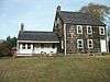
Robert Hawkins Homestead |
|
000000001986-04-10-0000April 10, 1986
(#86000702) |
Yaphank Avenue
40°49′04″N 72°55′04″W / 40.817778°N 72.917778°W / 40.817778; -72.917778 (Robert Hawkins Homestead) |
Yaphank |
|
| 20 |
Homan-Gerard House and Mills |
|
000000001988-12-16-0000December 16, 1988
(#88002761) |
Junction Main Street and Yaphank Road
40°50′09″N 72°54′57″W / 40.835833°N 72.915833°W / 40.835833; -72.915833 (Homan-Gerard House and Mills) |
Yaphank |
|
| 21 |
Samuel Hopkins House |
Upload image |
000000002009-02-26-0000February 26, 2009
(#09000057) |
415 Pipe Stave Hollow Rd.
40°57′30″N 73°01′16″W / 40.958272°N 73.021003°W / 40.958272; -73.021003 (Samuel Hopkins House) |
Miller Place |
|
| 22 |
Nathaniel Longbotham House |
Upload image |
000000001989-11-16-0000November 16, 1989
(#89002022) |
1541 Stony Brook Road
40°54′27″N 73°08′05″W / 40.9075°N 73.134722°W / 40.9075; -73.134722 (Nathaniel Longbotham House) |
Stony Brook |
|
| 23 |
Masury Estate Ballroom |
|
000000001986-09-11-0000September 11, 1986
(#86002513) |
Old Neck Road South
40°46′54″N 72°48′26″W / 40.781667°N 72.807222°W / 40.781667; -72.807222 (Masury Estate Ballroom) |
Center Moriches |
|
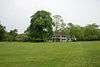
| 24 |
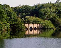
Frank Melville Memorial Park |
|
000000002010-07-19-0000July 19, 2010
(#10000486) |
Old Field Rd between Lake St. and Main St.
40°56′42″N 73°06′57″W / 40.945°N 73.115833°W / 40.945; -73.115833 (Frank Melville Memorial Park) |
Setauket |
|
| 25 |
Middle Island Presbyterian Church |
|
000000002005-12-07-0000December 7, 2005
(#05001388) |
271 Middle Country Road
40°52′49″N 72°57′48″W / 40.880278°N 72.963333°W / 40.880278; -72.963333 (Middle Island Presbyterian Church) |
Middle Island |
|
| 26 |
Miller Place Historic District |
|
000000001976-06-17-0000June 17, 1976
(#76001281) |
North Country Road
40°57′30″N 72°59′56″W / 40.958333°N 72.998889°W / 40.958333; -72.998889 (Miller Place Historic District) |
Miller Place |
|
| 27 |
William Sidney Mount House |
|
000000001966-10-15-0000October 15, 1966
(#66000575) |
Stony Brook Road and NY 25A
40°54′27″N 73°08′18″W / 40.9075°N 73.138333°W / 40.9075; -73.138333 (William Sidney Mount House) |
Stony Brook |
|
| 28 |
Old Field Club and Farm |
Upload image |
000000002016-02-02-0000February 2, 2016
(#15001027) |
86 W. Meadow Rd.
Coordinates missing |
East Setauket |
Early social center of Setauket when built for a residential community in 1930
|
| 29 |
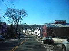
Port Jefferson Village Historic District |
|
000000002005-04-06-0000April 6, 2005
(#05000265) |
Roughly along East Main Street, East Broadway, Grant Street, High Street and South Street
40°56′49″N 73°03′58″W / 40.946944°N 73.066111°W / 40.946944; -73.066111 (Port Jefferson Village Historic District) |
Port Jefferson |
|
| 30 |
Setauket Presbyterian Church and Burial Ground |
|
000000001996-09-27-0000September 27, 1996
(#96001023) |
5 Caroline Avenue
40°56′45″N 73°06′41″W / 40.945833°N 73.111389°W / 40.945833; -73.111389 (Setauket Presbyterian Church and Burial Ground) |
Setauket |
|
| 31 |
Sherwood-Jayne House |
|
000000002009-12-02-0000December 2, 2009
(#09000969) |
55 Old Post Rd.
40°56′21″N 73°05′20″W / 40.939267°N 73.088786°W / 40.939267; -73.088786 (Sherwood-Jayne House) |
East Setauket |
|
| 32 |
Smith Estate |
|
000000001981-12-10-0000December 10, 1981
(#81000414) |
Longwood and Smith Roads
40°52′05″N 72°54′24″W / 40.868056°N 72.906667°W / 40.868056; -72.906667 (Smith Estate) |
Ridge |
Also known as Longwood Estate - Smith House[4]
|
| 33 |
Smith-Rourke House |
|
000000001989-11-28-0000November 28, 1989
(#89002021) |
350 South Country Road
40°45′43″N 72°58′44″W / 40.761944°N 72.978889°W / 40.761944; -72.978889 (Smith-Rourke House) |
East Patchogue |
|
| 34 |
St. Andrew's Episcopal Church |
|
000000001988-09-15-0000September 15, 1988
(#88001442) |
Main Street
40°50′12″N 72°54′55″W / 40.836667°N 72.915278°W / 40.836667; -72.915278 (St. Andrew's Episcopal Church) |
Yaphank |
|
| 35 |
St. James Chapel |
|
000000002000-06-16-0000June 16, 2000
(#00000583) |
East side of Main Street, 250 ft. North of Stony Brook Lane
40°54′56″N 73°08′50″W / 40.915556°N 73.147222°W / 40.915556; -73.147222 (St. James Chapel) |
Stony Brook |
|
| 36 |
St. Paul's Episcopal Church Complex |
|
000000001995-06-22-0000June 22, 1995
(#95000722) |
31 Rider Avenue
40°45′52″N 73°00′33″W / 40.764444°N 73.009167°W / 40.764444; -73.009167 (St. Paul's Episcopal Church Complex) |
Patchogue |
|
| 37 |
Stony Brook Grist Mill |
|
000000001990-08-03-0000August 3, 1990
(#90001140) |
Harbor Road, West of Main Street
40°54′49″N 73°08′47″W / 40.913611°N 73.146389°W / 40.913611; -73.146389 (Stony Brook Grist Mill) |
Stony Brook |
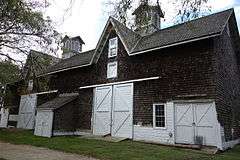
|
| 38 |
Suffolk County Almshouse Barn |
|
000000001986-09-11-0000September 11, 1986
(#86002512) |
West of Yaphank Avenue
40°49′41″N 72°55′18″W / 40.828056°N 72.921667°W / 40.828056; -72.921667 (Suffolk County Almshouse Barn) |
Yaphank |
|
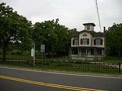
| 39 |
Terry-Ketcham Inn |
|
000000001993-06-24-0000June 24, 1993
(#92000555) |
81 Main Street
40°48′08″N 72°46′52″W / 40.802222°N 72.781111°W / 40.802222; -72.781111 (Terry-Ketcham Inn) |
Center Moriches |
|
| 40 |
Thompson House |
|
000000001988-01-07-0000January 7, 1988
(#87002283) |
North Country Road
40°56′01″N 73°07′04″W / 40.933501°N 73.117779°W / 40.933501; -73.117779 (Thompson House) |
Setauket |
|
| 41 |
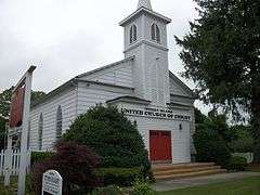
United Methodist Church |
|
000000001984-04-19-0000April 19, 1984
(#84003006) |
South Ocean Avenue and Church Street
40°45′52″N 73°00′53″W / 40.764439°N 73.014619°W / 40.764439; -73.014619 (United Methodist Church) |
Patchogue |
|
| 42 |
Union Savings Bank |
|
000000002010-06-11-0000June 11, 2010
(#10000337) |
62 South Ocean Avenue
40°45′52″N 73°00′54″W / 40.764497°N 73.014972°W / 40.764497; -73.014972 (Union Savings Bank) |
Patchogue |
On the opposite corner from United Methodist Church (Patchogue, New York)
|
| 43 |
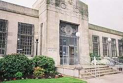
US Post Office-Patchogue |
|
000000001989-05-11-0000May 11, 1989
(#88002397) |
170 East Main Street
40°45′55″N 73°00′42″W / 40.765278°N 73.011667°W / 40.765278; -73.011667 (US Post Office-Patchogue) |
Patchogue |
|
| 44 |
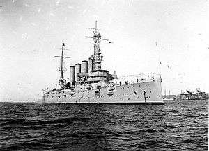
USS SAN DIEGO (Armored Cruiser) Shipwreck Site |
|
000000001998-02-17-0000February 17, 1998
(#98000071) |
Address Restricted
|
Fire Island |
|
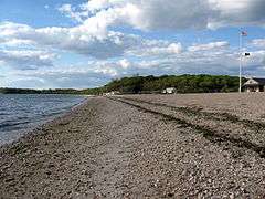
| 45 |
West Meadow Beach Historic District |
|
000000002004-10-28-0000October 28, 2004
(#04001195) |
Trustees Road
40°55′59″N 73°08′48″W / 40.933056°N 73.146667°W / 40.933056; -73.146667 (West Meadow Beach Historic District) |
Stony Brook |
|
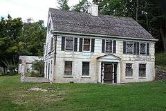
| 46 |
Josiah Woodhull House |
|
000000002011-08-24-0000August 24, 2011
(#11000602) |
170 North Country Rd.
40°57′30″N 72°52′12″W / 40.958333°N 72.87°W / 40.958333; -72.87 (Josiah Woodhull House) |
Shoreham |
|
.jpg)