| [3] |
Name on the Register |
Image |
Date listed[4] |
Location |
City or town |
Description |
|---|
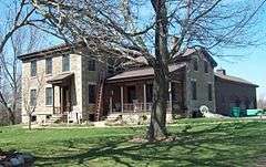
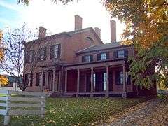
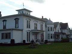
| 1 |
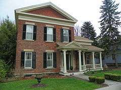
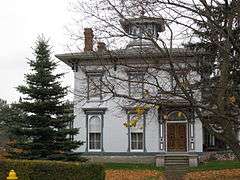
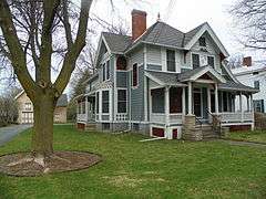
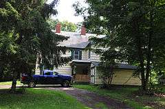
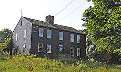
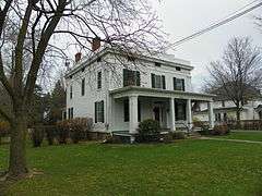
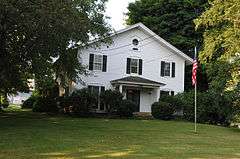
Alverson-Copeland House |
|
000000001989-08-31-0000August 31, 1989
(#89001133) |
1612 Rochester St.
42°54′52″N 77°37′00″W / 42.914444°N 77.616667°W / 42.914444; -77.616667 (Alverson-Copeland House) |
Lima |
|
| 2 |
Avon Five Arch Bridge |
|
000000002012-01-04-0000January 4, 2012
(#11001001) |
2078 Avon Geneseo Rd.
42°53′55″N 77°45′50″W / 42.898519°N 77.763889°W / 42.898519; -77.763889 (Avon Five Arch Bridge) |
Avon |
|
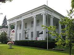
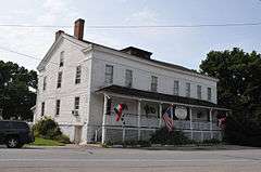
| 3 |
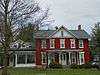
Avon Inn |
|
000000001991-04-16-0000April 16, 1991
(#91000423) |
55 E. Main St.
42°54′41″N 77°44′37″W / 42.911389°N 77.743611°W / 42.911389; -77.743611 (Avon Inn) |
Avon |
|
| 4 |
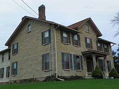
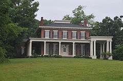
Aaron Barber Memorial Building |
|
000000002008-01-23-0000January 23, 2008
(#07001452) |
143 Genesee St.
42°54′35″N 77°44′52″W / 42.909722°N 77.747778°W / 42.909722; -77.747778 (Aaron Barber Memorial Building) |
Avon |
|
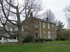
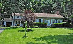
| 5 |
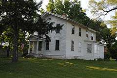
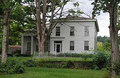
Barber-Mulligan Farm |
|
000000001980-05-19-0000May 19, 1980
(#80002647) |
NE of Avon at 5403 Barber Rd.
42°56′11″N 77°42′44″W / 42.936389°N 77.712222°W / 42.936389; -77.712222 (Barber-Mulligan Farm) |
Avon |
|
| 6 |
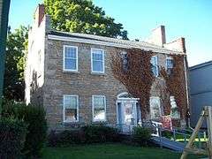
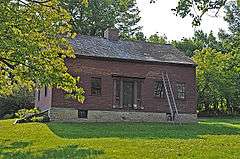
Barnard Cobblestone House |
|
000000001989-08-31-0000August 31, 1989
(#89001122) |
7192 W. Main St.
42°54′12″N 77°37′03″W / 42.903333°N 77.6175°W / 42.903333; -77.6175 (Barnard Cobblestone House) |
Lima |
|
| 7 |
Black and White Farm Barn |
|
000000001988-02-08-0000February 8, 1988
(#88000031) |
7420 Dansville-Mt. Morris Rd., NY 36
42°39′58″N 77°48′30″W / 42.666111°N 77.808333°W / 42.666111; -77.808333 (Black and White Farm Barn) |
Sonyea |
|
| 8 |
Boyd & Parker Park and Groveland Ambuscade |
|
000000002009-10-01-0000October 1, 2009
(#07000757) |
US 20A; Gray Hill Road
42°46′34″N 77°51′40″W / 42.77611°N 77.86111°W / 42.77611; -77.86111 (Boyd & Parker Park and Groveland Ambuscade) |
Groveland |
|
| 9 |
Bristol House |
|
000000001989-08-31-0000August 31, 1989
(#89001135) |
1950 Lake Ave.
42°54′11″N 77°36′45″W / 42.903056°N 77.6125°W / 42.903056; -77.6125 (Bristol House) |
Lima |
|
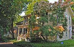
| 10 |
Caledonia Fish Hatchery |
Upload image |
000000002015-02-27-0000February 27, 2015
(#12000310) |
16 North St.
42°59′11″N 77°51′42″W / 42.986351°N 77.8617347°W / 42.986351; -77.8617347 (Caledonia Fish Hatchery) |
Caledonia |
Oldest fish hatchery in the Western Hemisphere; still in use by state.
|
| 11 |
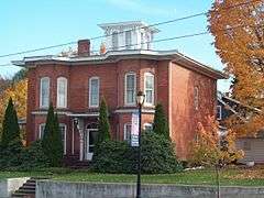
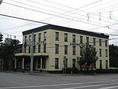
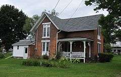
Caledonia House Hotel |
|
000000002001-09-13-0000September 13, 2001
(#01000997) |
3141 State St.
42°58′23″N 77°51′11″W / 42.973056°N 77.853056°W / 42.973056; -77.853056 (Caledonia House Hotel) |
Caledonia |
|
| 12 |
Cargill House |
|
000000001989-08-31-0000August 31, 1989
(#89001126) |
1839 Rochester St.
42°54′27″N 77°36′42″W / 42.9075°N 77.611667°W / 42.9075; -77.611667 (Cargill House) |
Lima |
|
| 13 |
Clark Farm Complex |
|
000000001989-08-31-0000August 31, 1989
(#89001125) |
7646 E. Main Rd.
42°54′13″N 77°35′37″W / 42.903611°N 77.593611°W / 42.903611; -77.593611 (Clark Farm Complex) |
Lima |
|
| 14 |
Clark-Keith House |
|
000000001998-08-28-0000August 28, 1998
(#98001114) |
3092 Main St.
42°58′22″N 77°51′37″W / 42.972778°N 77.860278°W / 42.972778; -77.860278 (Clark-Keith House) |
Caledonia |
|
| 15 |
Claud No. 1 Archeological Site |
|
000000001975-08-19-0000August 19, 1975
(#75001195) |
Address Restricted
|
Groveland |
|
| 16 |
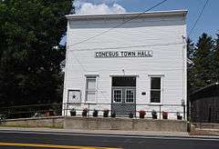
Conesus Amusement Hall |
|
000000002005-06-10-0000June 10, 2005
(#05000567) |
6210 S. Livonia Rd.
42°43′15″N 77°40′35″W / 42.720833°N 77.676389°W / 42.720833; -77.676389 (Conesus Amusement Hall) |
Conesus |
|
| 17 |
Corby Farm Complex |
Upload image |
000000002008-04-01-0000April 1, 2008
(#08000273) |
7400 Corby Road
42°56′00″N 77°36′19″W / 42.933333°N 77.605278°W / 42.933333; -77.605278 (Corby Farm Complex) |
Honeoye Falls |
|
| 18 |
Coverdale Cobblestone House |
|
000000002005-09-07-0000September 7, 2005
(#05000989) |
2049 Coverdale Rd.
42°47′05″N 77°55′57″W / 42.784722°N 77.9325°W / 42.784722; -77.9325 (Coverdale Cobblestone House) |
Leicester |
|
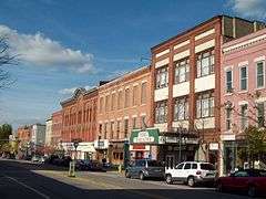
| 19 |
Dansville Downtown Historic District |
|
000000002007-06-01-0000June 1, 2007
(#07000485) |
Main St., Ossian St.
42°33′39″N 77°41′46″W / 42.5609°N 77.696106°W / 42.5609; -77.696106 (Dansville Downtown Historic District) |
Dansville |
|
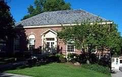
| 20 |
Dansville Library |
|
000000001977-09-14-0000September 14, 1977
(#77000947) |
200 Main St.
42°33′44″N 77°41′49″W / 42.562222°N 77.696944°W / 42.562222; -77.696944 (Dansville Library) |
Dansville |
|
| 21 |
Dayton House |
|
000000001989-08-31-0000August 31, 1989
(#89001131) |
7180 W. Main St.
42°54′12″N 77°37′05″W / 42.903333°N 77.618056°W / 42.903333; -77.618056 (Dayton House) |
Lima |
|
| 22 |
Delaware, Lackawanna & Western Railroad Station |
|
000000002005-12-07-0000December 7, 2005
(#05001390) |
South Park Dr.
42°46′17″N 77°53′52″W / 42.771389°N 77.897778°W / 42.771389; -77.897778 (Delaware, Lackawanna & Western Railroad Station) |
Leicester |
|
| 23 |
William DePuy House |
|
000000001989-08-31-0000August 31, 1989
(#89001127) |
1825 Genesee St.
42°54′27″N 77°36′50″W / 42.9075°N 77.613889°W / 42.9075; -77.613889 (William DePuy House) |
Lima |
|
| 24 |
Draper House |
|
000000001989-08-31-0000August 31, 1989
(#89001140) |
1764 Rochester St.
42°54′35″N 77°36′44″W / 42.909722°N 77.612222°W / 42.909722; -77.612222 (Draper House) |
Lima |
|
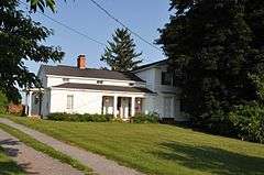
| 25 |
Edgerley |
|
000000001980-07-16-0000July 16, 1980
(#80002649) |
S of Oakland at 9303 Creek Rd.
42°34′29″N 77°58′22″W / 42.574722°N 77.972778°W / 42.574722; -77.972778 (Edgerley) |
Oakland |
|
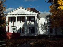
| 26 |
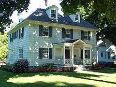
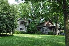
Elmwood |
|
000000002015-02-24-0000February 24, 2015
(#15000030) |
19 N. Walnut St.
42°34′56″N 77°56′07″W / 42.582287°N 77.9353657°W / 42.582287; -77.9353657 (Elmwood) |
Nunda |
1855 Italianate house is rare well-preserved work in that style by Rochester architect Andrew Jackson Warner
|
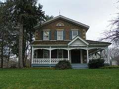
| 27 |
Engleside |
|
000000002009-03-23-0000March 23, 2009
(#09000156) |
9086 McNair Road
42°35′07″N 77°44′37″W / 42.585278°N 77.743611°W / 42.585278; -77.743611 (Engleside) |
Dansville |
|
| 28 |
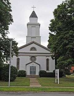
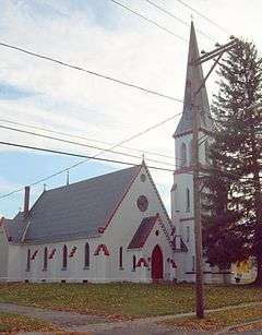
English Evangelical Lutheran Church of Dansville |
|
000000002013-06-25-0000June 25, 2013
(#13000448) |
21 Clara Barton St.
42°33′31″N 77°41′52″W / 42.558668°N 77.6976907°W / 42.558668; -77.6976907 (English Evangelical Lutheran Church of Dansville) |
Dansville |
American Red Cross founded here by Clara Barton
|
| 29 |
First Methodist Episcopal Church of Avon |
|
000000002005-03-15-0000March 15, 2005
(#05000165) |
130 Genesee St.
42°54′36″N 77°44′47″W / 42.91°N 77.746389°W / 42.91; -77.746389 (First Methodist Episcopal Church of Avon) |
Avon |
|
| 30 |
First Presbyterian Church of Avon |
|
000000002005-01-05-0000January 5, 2005
(#04001444) |
5605 Avon-Lima Rd.
42°54′35″N 77°42′24″W / 42.909722°N 77.706667°W / 42.909722; -77.706667 (First Presbyterian Church of Avon) |
East Avon |
|
| 31 |
First Presbyterian Church of Tuscarora |
|
000000002004-01-14-0000January 14, 2004
(#03001400) |
8082 Main St.
42°38′03″N 77°52′12″W / 42.634167°N 77.87°W / 42.634167; -77.87 (First Presbyterian Church of Tuscarora) |
Tuscarora |
|
| 32 |
G.A.R. Memorial Hall |
|
000000002006-09-28-0000September 28, 2006
(#06000888) |
Main St.
42°32′48″N 77°59′33″W / 42.546667°N 77.9925°W / 42.546667; -77.9925 (G.A.R. Memorial Hall) |
Hunt |
|
| 33 |
Ganoung Cobblestone Farmhouse |
|
000000001989-08-31-0000August 31, 1989
(#89001120) |
2798 Popular Hill Rd.
42°51′47″N 77°39′41″W / 42.863056°N 77.661389°W / 42.863056; -77.661389 (Ganoung Cobblestone Farmhouse) |
Lima |
|
| 34 |
Elias H. Geiger House |
|
000000002006-04-12-0000April 12, 2006
(#06000267) |
10693 Geiger Rd.
42°35′59″N 77°43′52″W / 42.599722°N 77.731111°W / 42.599722; -77.731111 (Elias H. Geiger House) |
Dansville |
|
| 35 |
Genesee Wesleyan Seminary and Genesee College Hall |
|
000000001976-07-19-0000July 19, 1976
(#76001227) |
College St.
42°54′32″N 77°36′53″W / 42.908889°N 77.614722°W / 42.908889; -77.614722 (Genesee Wesleyan Seminary and Genesee College Hall) |
Lima |
|
| 36 |
Godfrey House and Barn Complex |
|
000000001989-08-31-0000August 31, 1989
(#89001134) |
1325 Rochester Rd.
42°55′41″N 77°36′42″W / 42.928056°N 77.611667°W / 42.928056; -77.611667 (Godfrey House and Barn Complex) |
Lima |
|
| 37 |
Hall's Opera Block |
|
000000002006-09-29-0000September 29, 2006
(#06000884) |
15-19 Genesee St.
42°54′42″N 77°44′48″W / 42.911667°N 77.746667°W / 42.911667; -77.746667 (Hall's Opera Block) |
Avon |
|
| 38 |
Harden House |
|
000000001989-08-31-0000August 31, 1989
(#89001142) |
7343 E. Main St.
42°54′19″N 77°36′38″W / 42.905278°N 77.610556°W / 42.905278; -77.610556 (Harden House) |
Lima |
|
| 39 |
William Harmon House |
|
000000001989-08-31-0000August 31, 1989
(#89001130) |
1847 Genesee St.
42°54′24″N 77°36′50″W / 42.906667°N 77.613889°W / 42.906667; -77.613889 (William Harmon House) |
Lima |
|
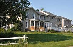
| 40 |
William Hartman Farmstead |
|
000000002000-04-14-0000April 14, 2000
(#00000381) |
9296 NY 63 N
42°34′37″N 77°42′45″W / 42.576944°N 77.7125°W / 42.576944; -77.7125 (William Hartman Farmstead) |
Dansville |
|
| 41 |
Hemlock Fairground |
Upload image |
000000002000-04-06-0000April 6, 2000
(#00000347) |
East Ave.
42°47′37″N 77°36′40″W / 42.793611°N 77.611111°W / 42.793611; -77.611111 (Hemlock Fairground) |
Hemlock |
|
| 42 |
Hillcrest |
|
000000001980-05-06-0000May 6, 1980
(#80002648) |
7242 W. Main St.
42°54′14″N 77°36′53″W / 42.903889°N 77.614722°W / 42.903889; -77.614722 (Hillcrest) |
Lima |
|
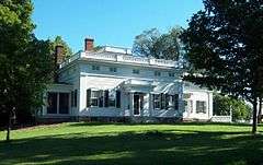
| 43 |
The Homestead |
|
000000001974-08-30-0000August 30, 1974
(#74001254) |
NY 39 and U.S. 20A
42°47′26″N 77°49′06″W / 42.790556°N 77.818333°W / 42.790556; -77.818333 (The Homestead) |
Geneseo |
|
| 44 |
House at No. 13 Grove Street |
|
000000001999-01-07-0000January 7, 1999
(#98001582) |
13 Grove St.
42°43′41″N 77°52′37″W / 42.728056°N 77.876944°W / 42.728056; -77.876944 (House at No. 13 Grove Street) |
Mount Morris |
|
| 45 |
House at No. 176 South Main Street |
|
000000001999-01-07-0000January 7, 1999
(#98001581) |
176 S. Main St.
42°43′08″N 77°52′16″W / 42.718889°N 77.871111°W / 42.718889; -77.871111 (House at No. 176 South Main Street) |
Mount Morris |
|
| 46 |
House at No. 30 Murray Street |
|
000000001999-01-07-0000January 7, 1999
(#98001585) |
30 Murray St.
42°43′22″N 77°52′32″W / 42.722778°N 77.875556°W / 42.722778; -77.875556 (House at No. 30 Murray Street) |
Mount Morris |
|
| 47 |
House at No. 48 Grove Street |
|
000000001999-01-07-0000January 7, 1999
(#98001583) |
48 Grove St.
42°43′39″N 77°52′54″W / 42.7275°N 77.881667°W / 42.7275; -77.881667 (House at No. 48 Grove Street) |
Mount Morris |
|
| 48 |
House at No. 8 State Street |
|
000000001999-01-07-0000January 7, 1999
(#98001580) |
8 State St.
42°43′33″N 77°52′24″W / 42.725833°N 77.873333°W / 42.725833; -77.873333 (House at No. 8 State Street) |
Mount Morris |
|
| 49 |
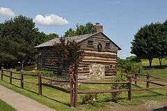
Kellerman Log Cabin |
|
000000002006-02-01-0000February 1, 2006
(#05001615) |
6074 S. Livonia Rd.
42°43′35″N 77°40′30″W / 42.726389°N 77.675°W / 42.726389; -77.675 (Kellerman Log Cabin) |
Conesus |
|
| 50 |
J. Francis Kellogg House |
|
000000002003-06-05-0000June 5, 2003
(#03000511) |
255 Genesee St.
42°54′22″N 77°44′55″W / 42.906111°N 77.748611°W / 42.906111; -77.748611 (J. Francis Kellogg House) |
Avon |
|
| 51 |
R. P. Kemp No. 1 Site |
|
000000001977-08-22-0000August 22, 1977
(#77000950) |
Address Restricted
|
West Sparta |
|
| 52 |
Leech-Lloyd Farmhouse and Barn Complex |
|
000000001989-08-31-0000August 31, 1989
(#89001117) |
1589 and 1601 York St.
42°55′00″N 77°35′31″W / 42.916667°N 77.591944°W / 42.916667; -77.591944 (Leech-Lloyd Farmhouse and Barn Complex) |
Lima |
|
| 53 |
Leech-Parker Farmhouse |
|
000000001989-08-31-0000August 31, 1989
(#89001116) |
1537 York St.
42°55′09″N 77°35′30″W / 42.919167°N 77.591667°W / 42.919167; -77.591667 (Leech-Parker Farmhouse) |
Lima |
|
| 54 |
Lima Village Historic District |
|
000000001987-11-20-0000November 20, 1987
(#87002042) |
1881-1885 & 1818-1870 Rochester St., Lima Presbyterian Church, 7304-7312 & 7303-7315 E. Main St.
42°54′19″N 77°36′44″W / 42.905278°N 77.612222°W / 42.905278; -77.612222 (Lima Village Historic District) |
Lima |
|
| 55 |
Linwood |
|
000000001997-12-15-0000December 15, 1997
(#97001493) |
1912 York Rd.
42°51′59″N 77°56′16″W / 42.866389°N 77.937778°W / 42.866389; -77.937778 (Linwood) |
York |
|
| 56 |
Livonia Baptist Church |
|
000000001977-03-25-0000March 25, 1977
(#77000949) |
9 High St.
42°49′13″N 77°39′57″W / 42.820278°N 77.665833°W / 42.820278; -77.665833 (Livonia Baptist Church) |
Livonia |
|
| 57 |
Main Street Historic District |
|
000000001977-07-09-0000July 9, 1977
(#77000948) |
Main St. from the courthouse at Court and North Sts.
42°47′46″N 77°49′02″W / 42.796111°N 77.817222°W / 42.796111; -77.817222 (Main Street Historic District) |
Geneseo |
Known also as Geneseo Historic District
|
| 58 |
Markham Cobblestone Farmhouse and Barn Complex |
|
000000001989-08-31-0000August 31, 1989
(#89001119) |
6857 Heath-Markham Rd.
42°55′56″N 77°38′11″W / 42.932222°N 77.636389°W / 42.932222; -77.636389 (Markham Cobblestone Farmhouse and Barn Complex) |
Lima |
|
| 59 |
Martin Farm Complex |
|
000000001989-08-31-0000August 31, 1989
(#89001136) |
1301 Bragg St.
42°55′50″N 77°34′36″W / 42.930556°N 77.576667°W / 42.930556; -77.576667 (Martin Farm Complex) |
Lima |
|
| 60 |
Gen. William A. Mills House |
|
000000001978-12-19-0000December 19, 1978
(#78001858) |
14 Main St.
42°43′36″N 77°52′31″W / 42.726667°N 77.875278°W / 42.726667; -77.875278 (Gen. William A. Mills House) |
Mount Morris |
|
| 61 |
Morgan Cobblestone Farmhouse |
|
000000001989-08-31-0000August 31, 1989
(#89001118) |
6870 W. Main Rd.
42°54′06″N 77°37′55″W / 42.901667°N 77.631944°W / 42.901667; -77.631944 (Morgan Cobblestone Farmhouse) |
Lima |
|
| 62 |
Ogilvie Moses Farmhouse |
|
000000001989-08-31-0000August 31, 1989
(#89001123) |
2150 Clay St.
42°53′37″N 77°35′52″W / 42.893611°N 77.597778°W / 42.893611; -77.597778 (Ogilvie Moses Farmhouse) |
Lima |
|
| 63 |
Zebulon Moses Farm Complex |
|
000000001989-08-31-0000August 31, 1989
(#89001132) |
2770 Clay Rd.
42°51′56″N 77°35′32″W / 42.865556°N 77.592222°W / 42.865556; -77.592222 (Zebulon Moses Farm Complex) |
Lima |
|
| 64 |
Murray Street Historic District |
|
000000001996-03-01-0000March 1, 1996
(#96000178) |
33-47 and 32-46 Murray St.
42°43′18″N 77°54′05″W / 42.721667°N 77.901389°W / 42.721667; -77.901389 (Murray Street Historic District) |
Mount Morris |
|
| 65 |
National Hotel |
|
000000002004-12-06-0000December 6, 2004
(#04001344) |
2927 Main St.
42°46′40″N 77°52′18″W / 42.777778°N 77.871667°W / 42.777778; -77.871667 (National Hotel) |
Cuylerville |
|
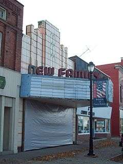
| 66 |
New Family Theater |
|
000000001997-08-01-0000August 1, 1997
(#97000846) |
102 Main St.
42°43′27″N 77°52′26″W / 42.724167°N 77.873889°W / 42.724167; -77.873889 (New Family Theater) |
Mount Morris |
|
| 67 |
North Bloomfield School |
Upload image |
000000001981-05-28-0000May 28, 1981
(#81000409) |
7840 Martin Rd.
42°56′15″N 77°34′43″W / 42.9375°N 77.578611°W / 42.9375; -77.578611 (North Bloomfield School) |
North Bloomfield |
|
| 68 |
Payne Cobblestone House |
|
000000002006-11-01-0000November 1, 2006
(#06000969) |
5813 Federal Rd.
42°44′11″N 77°39′51″W / 42.736389°N 77.664167°W / 42.736389; -77.664167 (Payne Cobblestone House) |
Conesus |
|
| 69 |
J. Franklin Peck House |
|
000000001989-08-31-0000August 31, 1989
(#89001128) |
7347 E. Main St.
42°54′20″N 77°36′36″W / 42.905556°N 77.61°W / 42.905556; -77.61 (J. Franklin Peck House) |
Lima |
|
| 70 |
Thomas Peck Farmhouse |
|
000000001989-08-31-0000August 31, 1989
(#89001137) |
7955 E. Main Rd.
42°54′34″N 77°34′21″W / 42.909444°N 77.5725°W / 42.909444; -77.5725 (Thomas Peck Farmhouse) |
Lima |
|
| 71 |
Pioneer Farm |
|
000000001970-12-18-0000December 18, 1970
(#70000422) |
S of Dansville on NY 36
42°33′04″N 77°42′04″W / 42.551111°N 77.701111°W / 42.551111; -77.701111 (Pioneer Farm) |
Dansville |
|
| 72 |
St. John's Episcopal Church |
|
000000001991-07-19-0000July 19, 1991
(#91000892) |
Jct. of State and Stanley Sts.
42°43′28″N 77°52′36″W / 42.724444°N 77.876667°W / 42.724444; -77.876667 (St. John's Episcopal Church) |
Mount Morris |
|
| 73 |
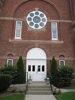
St. Rose Roman Catholic Church Complex |
|
000000001988-08-25-0000August 25, 1988
(#88001345) |
Lake Ave.
42°54′06″N 77°36′41″W / 42.901667°N 77.611389°W / 42.901667; -77.611389 (St. Rose Roman Catholic Church Complex) |
Lima |
|
| 74 |
School No. 6 |
|
000000001989-08-31-0000August 31, 1989
(#89001121) |
6679 Jenks Rd.
42°52′36″N 77°38′44″W / 42.876667°N 77.645556°W / 42.876667; -77.645556 (School No. 6) |
Lima |
|
| 75 |
Sliker Cobblestone House |
|
000000002007-01-25-0000January 25, 2007
(#06001300) |
6050 Sliker Rd.
42°42′51″N 77°41′28″W / 42.714167°N 77.691111°W / 42.714167; -77.691111 (Sliker Cobblestone House) |
Conesus |
|
| 76 |
South Main Street Historic District |
|
000000001996-03-01-0000March 1, 1996
(#96000177) |
123-159 and 124-158 S. Main St.
42°43′18″N 77°52′18″W / 42.721667°N 77.871667°W / 42.721667; -77.871667 (South Main Street Historic District) |
Mount Morris |
|
| 77 |
Sparta First Presbyterian Church |
|
000000002007-01-23-0000January 23, 2007
(#06001209) |
4687 Scottsburg Rd.
42°39′53″N 77°45′59″W / 42.664722°N 77.766389°W / 42.664722; -77.766389 (Sparta First Presbyterian Church) |
Groveland Station |
|
| 78 |
Spencer House |
|
000000001989-08-31-0000August 31, 1989
(#89001124) |
7372 E. Main St.
42°54′20″N 77°36′31″W / 42.905556°N 77.608611°W / 42.905556; -77.608611 (Spencer House) |
Lima |
|
| 79 |
Stanley House |
|
000000001989-08-31-0000August 31, 1989
(#89001129) |
7364 E. Main St.
42°54′20″N 77°36′33″W / 42.905556°N 77.609167°W / 42.905556; -77.609167 (Stanley House) |
Lima |
|
| 80 |
State and Eagle Streets Historic District |
|
000000001996-03-01-0000March 1, 1996
(#96000179) |
16-34 and 15-39 State St. and 6-12 Eagle St.
42°43′28″N 77°52′42″W / 42.724444°N 77.878333°W / 42.724444; -77.878333 (State and Eagle Streets Historic District) |
Mount Morris |
|
| 81 |
Sweet Briar |
|
000000002010-03-29-0000March 29, 2010
(#10000104) |
5126 Mount Morris Rd.
42°46′29″N 77°49′41″W / 42.774708°N 77.828136°W / 42.774708; -77.828136 (Sweet Briar) |
Geneseo |
|
| 82 |
Union Block |
|
000000002000-02-10-0000February 10, 2000
(#00000092) |
38-42 State St.
42°34′52″N 77°56′34″W / 42.581111°N 77.942778°W / 42.581111; -77.942778 (Union Block) |
Nunda |
|
| 83 |
US Post Office-Dansville |
|
000000001988-11-17-0000November 17, 1988
(#88002476) |
100 Main St.
42°33′35″N 77°41′40″W / 42.559722°N 77.694444°W / 42.559722; -77.694444 (US Post Office-Dansville) |
Dansville |
|
| 84 |
William L. Vary House |
|
000000001989-08-31-0000August 31, 1989
(#89001141) |
7378 E. Main St.
42°54′21″N 77°36′30″W / 42.905833°N 77.608333°W / 42.905833; -77.608333 (William L. Vary House) |
Lima |
|
| 85 |
Wadsworth Fort Site |
|
000000001975-06-11-0000June 11, 1975
(#75001194) |
Address Restricted
|
Geneseo |
|
| 86 |
Asahel Warner House |
|
000000001989-08-31-0000August 31, 1989
(#89001139) |
7136 W. Main St.
42°54′09″N 77°37′15″W / 42.9025°N 77.620833°W / 42.9025; -77.620833 (Asahel Warner House) |
Lima |
|
| 87 |
Matthew Warner House |
|
000000001989-08-31-0000August 31, 1989
(#89001138) |
7449 E. Main St.
42°54′30″N 77°36′15″W / 42.908333°N 77.604167°W / 42.908333; -77.604167 (Matthew Warner House) |
Lima |
|
| 88 |
Westerly |
|
000000001974-12-19-0000December 19, 1974
(#74001255) |
Chandler Rd.
42°49′14″N 77°51′16″W / 42.820556°N 77.854444°W / 42.820556; -77.854444 (Westerly) |
Piffard |
|
| 89 |
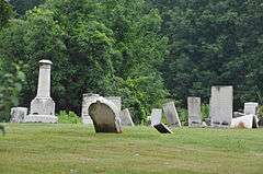
Williamsburg Cemetery |
|
000000002002-11-14-0000November 14, 2002
(#02001328) |
Abel Rd.
42°44′54″N 77°49′55″W / 42.748333°N 77.831944°W / 42.748333; -77.831944 (Williamsburg Cemetery) |
Hampton Corners |
|

.jpg)