| [3] |
Name on the Register[4] |
Image |
Date listed[5] |
Location |
City or town |
Description |
|---|
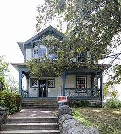
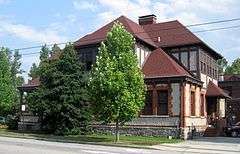
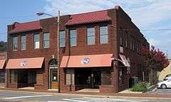
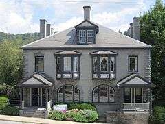
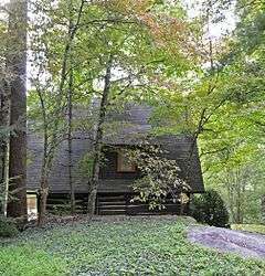
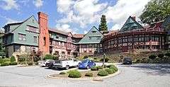
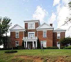
| 1 |
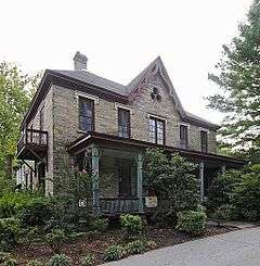
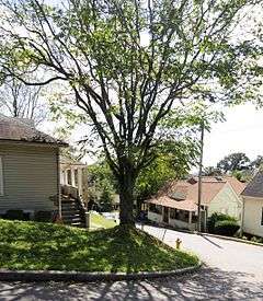
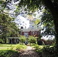
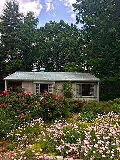
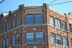
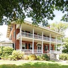
Judge Junius G. Adams House |
Upload image |
000000002001-10-05-0000October 5, 2001
(#01001077) |
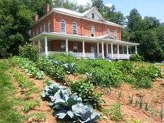
11 Stuyvesant Rd.
35°32′09″N 82°32′14″W / 35.535833°N 82.537222°W / 35.535833; -82.537222 (Judge Junius G. Adams House) |
Biltmore Forest |
|
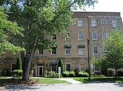
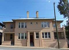
| 2 |
Alexander Inn |
Upload image |
000000001984-05-31-0000May 31, 1984
(#84001932) |
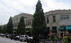
Address Restricted
|
Swannanoa |
|
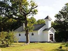
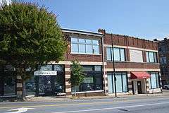
| 3 |
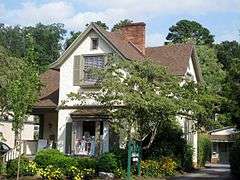
Mrs. Minnie Alexander Cottage |
|
000000001989-12-21-0000December 21, 1989
(#89002135) |
218 Patton Ave.
35°35′34″N 82°33′40″W / 35.592778°N 82.561111°W / 35.592778; -82.561111 (Mrs. Minnie Alexander Cottage) |
Asheville |
|
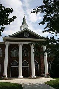
| 4 |
All Souls Episcopal Church and Parish House |
|
000000001979-11-15-0000November 15, 1979
(#79001664) |
2 Angle St.
35°33′55″N 82°32′34″W / 35.565278°N 82.542778°W / 35.565278; -82.542778 (All Souls Episcopal Church and Parish House) |
Asheville |
|
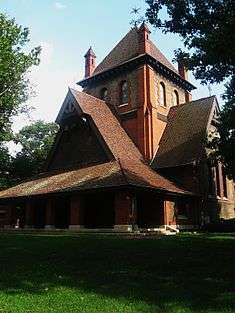
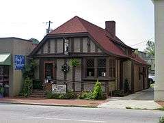
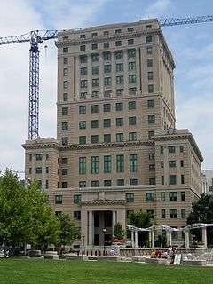
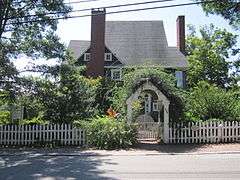
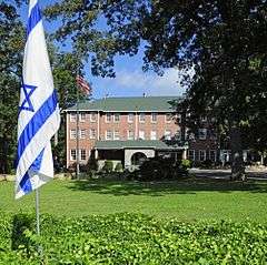
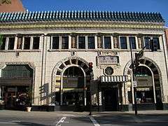
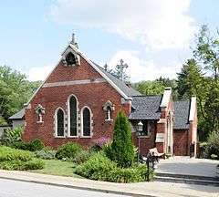
| 5 |
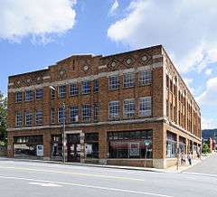
Arcade Building |
|
000000001976-05-19-0000May 19, 1976
(#76001306) |
Battery Park, Battle Sq.
35°35′44″N 82°33′24″W / 35.595556°N 82.556667°W / 35.595556; -82.556667 (Arcade Building) |
Asheville |
|
| 6 |
Asheville City Hall |
|
000000001976-11-07-0000November 7, 1976
(#76001307) |
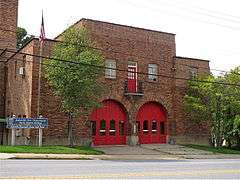
City County Plaza
35°35′44″N 82°32′55″W / 35.595556°N 82.548611°W / 35.595556; -82.548611 (Asheville City Hall) |
Asheville |
|
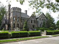
| 7 |
Asheville High School |
|
000000001996-04-26-0000April 26, 1996
(#96000481) |
419 McDowell St.
35°34′17″N 82°33′08″W / 35.571389°N 82.552222°W / 35.571389; -82.552222 (Asheville High School) |
Asheville |
|
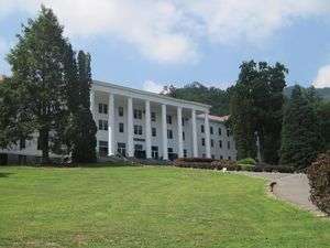
| 8 |
Asheville School |
Upload image |
000000001996-06-03-0000June 3, 1996
(#96000614) |
Roughly bounded by Patton Ave., Southern RR line, US 40, Sand Hill Rd., and Malvern Hills subdivision
35°33′43″N 82°37′21″W / 35.561944°N 82.6225°W / 35.561944; -82.6225 (Asheville School) |
Asheville |
|
| 9 |
Asheville Transfer and Storage Company Building |
|
000000001979-04-26-0000April 26, 1979
(#79001665) |
192-194 Coxe Ave.
35°35′14″N 82°33′16″W / 35.587222°N 82.554444°W / 35.587222; -82.554444 (Asheville Transfer and Storage Company Building) |
Asheville |
|
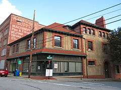
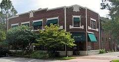
| 10 |
B & B Motor Company Building |
|
000000001979-04-26-0000April 26, 1979
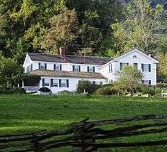
(#79001666) |
84-94 Coxe Ave.
35°35′28″N 82°33′17″W / 35.591111°N 82.554722°W / 35.591111; -82.554722 (B & B Motor Company Building) |
Asheville |
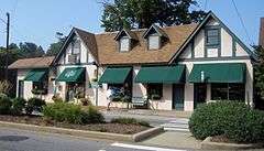
|
| 11 |
Zebulon H. Baird House |
Upload image |
000000002009-04-30-0000April 30, 2009
(#09000261) |
460 Weaverville Rd.
35°39′57″N 82°35′03″W / 35.665836°N 82.584189°W / 35.665836; -82.584189 (Zebulon H. Baird House) |
Weaverville vicinity |
|
| 12 |
Clarence Barker Memorial Hospital |
|
000000001979-11-15-0000November 15, 1979
(#79001667) |
2-6 Reed St.
35°33′54″N 82°32′28″W / 35.565°N 82.541111°W / 35.565; -82.541111 (Clarence Barker Memorial Hospital) |
Asheville |
|
| 13 |
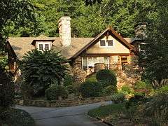
Dr. John G. & Nannie H. Barrett Farm |
Upload image |
000000002013-05-08-0000May 8, 2013
(#13000245) |
75 Ox Creek Rd.
35°41′32″N 82°29′40″W / 35.692177°N 82.494415°W / 35.692177; -82.494415 (Dr. John G. & Nannie H. Barrett Farm) |
Weaverville |
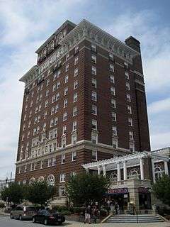
|
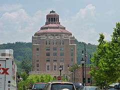
| 14 |
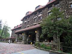
Battery Park Hotel |
|
000000001977-07-14-0000July 14, 1977
(#77000990) |
Battle Sq.
35°35′49″N 82°32′19″W / 35.596944°N 82.538611°W / 35.596944; -82.538611 (Battery Park Hotel) |
Asheville |
|
| 15 |
Bent Creek Campus of the Appalachian Forest Experiment Station |
Upload image |
000000001993-04-29-0000April 29, 1993
(#93000373) |
Brevard Rd. S of jct. with I-26
35°30′09″N 82°35′49″W / 35.5025°N 82.596944°W / 35.5025; -82.596944 (Bent Creek Campus of the Appalachian Forest Experiment Station) |
Asheville |
|
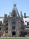
| 16 |
Biltmore Estate |
|
000000001966-10-15-0000October 15, 1966
(#66000586) |
One Biltmore Plaza
35°34′03″N 82°32′34″W / 35.567492°N 82.542858°W / 35.567492; -82.542858 (Biltmore Estate) |
Asheville |
|
| 17 |
Biltmore Estate Office |
|
000000001979-11-15-0000November 15, 1979
(#79001668) |
10 Biltmore Plaza
35°34′03″N 82°32′34″W / 35.5675°N 82.542778°W / 35.5675; -82.542778 (Biltmore Estate Office) |
Asheville |
|
| 18 |
Biltmore Hardware Building |
|
000000002003-08-21-0000August 21, 2003
(#03000800) |
28-32 Hendersonville Rd.
35°34′03″N 82°32′38″W / 35.5675°N 82.543889°W / 35.5675; -82.543889 (Biltmore Hardware Building) |
Asheville |
|
| 19 |
Biltmore Hospital |
|
000000002005-09-01-0000September 1, 2005
(#05000938) |
14 All Souls Crecent
35°33′52″N 82°32′29″W / 35.564444°N 82.541389°W / 35.564444; -82.541389 (Biltmore Hospital) |
Asheville |
|
| 20 |
Biltmore Industries, Inc. |
|
000000001980-02-01-0000February 1, 1980
(#80002802) |
Grovewood Rd.
35°37′20″N 82°32′41″W / 35.622222°N 82.544722°W / 35.622222; -82.544722 (Biltmore Industries, Inc.) |
Asheville |
|
| 21 |
Biltmore Shoe Store |
|
000000001979-11-15-0000November 15, 1979
(#79001669) |
8 Lodge St.
35°34′03″N 82°32′34″W / 35.5675°N 82.542778°W / 35.5675; -82.542778 (Biltmore Shoe Store) |
Asheville |
|
| 22 |
Biltmore Village Commercial Buildings |
|
000000001979-11-15-0000November 15, 1979
(#79001670) |
Brook St. and Biltmore Plaza
35°34′03″N 82°32′34″W / 35.5675°N 82.542778°W / 35.5675; -82.542778 (Biltmore Village Commercial Buildings) |
Asheville |
|
| 23 |
Biltmore Village Cottage District |
|
000000001979-11-15-0000November 15, 1979
(#79001671) |
Swan St., All Souls Crescent and Boston Way
35°33′58″N 82°32′29″W / 35.566111°N 82.541389°W / 35.566111; -82.541389 (Biltmore Village Cottage District) |
Asheville |
|
| 24 |
Biltmore Village Cottages |
Upload image |
000000001979-11-15-0000November 15, 1979
(#79001672) |
18 Angle St. and 75 Hendersonville Rd.
35°33′58″N 82°32′38″W / 35.566111°N 82.543889°W / 35.566111; -82.543889 (Biltmore Village Cottages) |
Asheville |
Moved away from listed addresses in 1983.[6] Still listed as a historic place, but nomination form states "no longer on NR".
|
| 25 |
Biltmore-Oteen Bank Building |
|
000000001979-11-15-0000November 15, 1979
(#79001673) |
12 Lodge St.
35°34′03″N 82°32′34″W / 35.5675°N 82.542778°W / 35.5675; -82.542778 (Biltmore-Oteen Bank Building) |
Asheville |
|
| 26 |
Black Mountain College Historic District |
|
000000001982-10-05-0000October 5, 1982
(#82001281) |
SR 2468
35°37′59″N 82°22′17″W / 35.633056°N 82.371389°W / 35.633056; -82.371389 (Black Mountain College Historic District) |
Black Mountain |
|
| 27 |
Black Mountain Downtown Historic District |
|
000000002004-06-02-0000June 2, 2004
(#04000570) |
Black Mountain Ave., Sutton Ave., Cherry, Broadway and State Sts.
35°36′58″N 82°19′14″W / 35.616111°N 82.320556°W / 35.616111; -82.320556 (Black Mountain Downtown Historic District) |
Black Mountain |
|
| 28 |
Blake House |
|
000000002010-08-30-0000August 30, 2010
(#10000600) |
150 Royal Pines Dr.
35°28′28″N 82°31′01″W / 35.474444°N 82.516944°W / 35.474444; -82.516944 (Blake House) |
Arden |
|
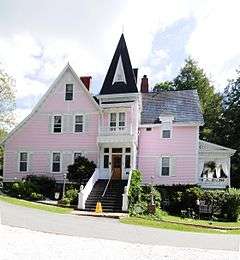
| 29 |
Bledsoe Building |
Upload image |
000000002003-04-18-0000April 18, 2003
(#03000267) |
771-783 Haywood Rd.
35°34′44″N 82°35′40″W / 35.578889°N 82.594444°W / 35.578889; -82.594444 (Bledsoe Building) |
Asheville |
|
| 30 |
Blue Ridge Assembly Historic District |
|
000000001979-09-17-0000September 17, 1979
(#79003327) |
S of Black Mountain on SR 2720
35°35′06″N 82°20′21″W / 35.585°N 82.339167°W / 35.585; -82.339167 (Blue Ridge Assembly Historic District) |
Black Mountain |
|
| 31 |
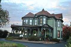
William E. Breese, Sr., House |
|
000000001980-04-28-0000April 28, 1980
(#80002803) |
674 Biltmore Ave.
35°34′23″N 82°32′44″W / 35.573056°N 82.545556°W / 35.573056; -82.545556 (William E. Breese, Sr., House) |
Asheville |
|
| 32 |
Brigman-Chambers House |
Upload image |
000000002004-06-02-0000June 2, 2004
(#04000573) |
NC 1003, 0.6. miles W of jct. with NC 2118
35°42′22″N 82°29′27″W / 35.706111°N 82.490833°W / 35.706111; -82.490833 (Brigman-Chambers House) |
Weaverville |
|
| 33 |
Broadway Market Building |
Upload image |
000000002005-09-01-0000September 1, 2005
(#05000939) |
201 Broadway
35°36′04″N 82°33′22″W / 35.601111°N 82.556111°W / 35.601111; -82.556111 (Broadway Market Building) |
Asheville |
Demolished.[7]
|
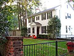
| 34 |
William Jennings Bryan House |
|
000000001983-06-23-0000June 23, 1983
(#83001836) |
107 Evelyn Pl.
35°36′45″N 82°33′02″W / 35.6125°N 82.550556°W / 35.6125; -82.550556 (William Jennings Bryan House) |
Asheville |
|
| 35 |
Building at 130-132 Biltmore Avenue |
|
000000001979-04-26-0000April 26, 1979
(#79003323) |
130-132 Biltmore Ave.
35°35′25″N 82°33′04″W / 35.590278°N 82.551111°W / 35.590278; -82.551111 (Building at 130-132 Biltmore Avenue) |
Asheville |
|
| 36 |
Building at 134-136½ Biltmore Avenue |
|
000000001979-04-26-0000April 26, 1979
(#79003324) |
134-136 1⁄2 Biltmore Ave.
35°35′25″N 82°33′04″W / 35.590278°N 82.551111°W / 35.590278; -82.551111 (Building at 134-136½ Biltmore Avenue) |
Asheville |
|
| 37 |
Building at 140 Biltmore Avenue |
|
000000001979-04-26-0000April 26, 1979
(#79003325) |
140 Biltmore Ave.
35°35′25″N 82°33′04″W / 35.590278°N 82.551111°W / 35.590278; -82.551111 (Building at 140 Biltmore Avenue) |
Asheville |
|
| 38 |
Buncombe County Boys' Training School |
Upload image |
000000001997-09-30-0000September 30, 1997
(#97001197) |
177 Erwin Hills Rd.
35°37′14″N 82°37′23″W / 35.620556°N 82.623056°W / 35.620556; -82.623056 (Buncombe County Boys' Training School) |
Asheville |
|
| 39 |
Buncombe County Courthouse |
|
000000001979-05-10-0000May 10, 1979
(#79001674) |
College and Davidson Sts.
35°35′45″N 82°32′55″W / 35.595833°N 82.548611°W / 35.595833; -82.548611 (Buncombe County Courthouse) |
Asheville |
|
| 40 |
Camp Academy |
|
000000001985-09-19-0000September 19, 1985
(#85002421) |
NC 63
35°39′22″N 82°42′52″W / 35.656111°N 82.714444°W / 35.656111; -82.714444 (Camp Academy) |
Leicester |
|
| 41 |
William Nelson Camp, Jr., House |
|
000000001998-12-17-0000December 17, 1998
(#98001530) |
92 Flat Top Mountain Rd.
35°32′56″N 82°23′31″W / 35.548889°N 82.391944°W / 35.548889; -82.391944 (William Nelson Camp, Jr., House) |
Fairview |
|
| 42 |
Carter-Swain House |
Upload image |
000000001987-07-02-0000July 2, 1987
(#87001114) |
E side SR 2162, N of jct. with SR 2163
35°47′24″N 82°29′31″W / 35.79°N 82.491944°W / 35.79; -82.491944 (Carter-Swain House) |
Democrat |
|
| 43 |
Chestnut Hill Historic District |
|
000000001983-03-17-0000March 17, 1983
(#83001837) |
Roughly bounded by Hillside, Washington, Broad, Hollywood, Orchards Sts. and Merrimon Ave.
35°36′13″N 82°32′55″W / 35.603611°N 82.548611°W / 35.603611; -82.548611 (Chestnut Hill Historic District) |
Asheville |
|
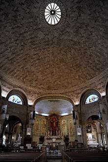
| 44 |
Church of St. Lawrence |
|
000000001978-03-24-0000March 24, 1978
(#78001933) |
97 Haywood St.
35°35′51″N 82°33′23″W / 35.5975°N 82.556389°W / 35.5975; -82.556389 (Church of St. Lawrence) |
Asheville |
|
| 45 |
Church of the Redeemer |
Upload image |
000000001985-09-19-0000September 19, 1985
(#85002419) |
1202 Riverside Dr.
35°37′28″N 82°35′33″W / 35.624444°N 82.5925°W / 35.624444; -82.5925 (Church of the Redeemer) |
Asheville |
|
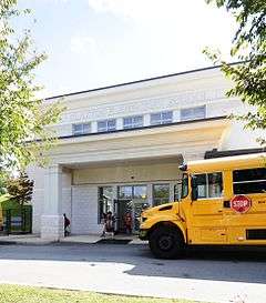
| 46 |
Claxton School |
|
000000001992-06-04-0000June 4, 1992
(#92000671) |
241 Merrimon Ave.
35°36′28″N 82°33′13″W / 35.607778°N 82.553611°W / 35.607778; -82.553611 (Claxton School) |
Asheville |
|
| 47 |
Clingman Avenue Historic District |
|
000000002004-06-09-0000June 9, 2004
(#04000583) |
Roughly along Clingman Ave., from Hillard Ave. to Haywood Ave.
35°35′24″N 82°33′48″W / 35.59°N 82.563333°W / 35.59; -82.563333 (Clingman Avenue Historic District) |
Asheville |
|
| 48 |
Conabeer Chrysler Building |
|
000000001979-04-26-0000April 26, 1979
(#79001675) |
162-164 Coxe Ave.
35°35′18″N 82°33′17″W / 35.588333°N 82.554722°W / 35.588333; -82.554722 (Conabeer Chrysler Building) |
Asheville |
|
| 49 |
Demens-Rumbough-Crawley House |
|
000000001982-06-01-0000June 1, 1982
(#82003435) |
31 Park Ave.
35°35′21″N 82°33′59″W / 35.589167°N 82.566389°W / 35.589167; -82.566389 (Demens-Rumbough-Crawley House) |
Asheville |
|
| 50 |
Dougherty Heights Historic District |
Upload image |
000000002011-01-14-0000January 14, 2011
(#10001132) |
Church St., Connally St., and North Dougherty St., Laurel Circle, Prospect St., and New Bern Ave.
35°37′03″N 82°19′26″W / 35.6175°N 82.323889°W / 35.6175; -82.323889 (Dougherty Heights Historic District) |
Black Mountain |
|
| 51 |
Downtown Asheville Historic District |
|
000000001979-04-26-0000April 26, 1979
(#79001676) |
Roughly bounded by 1240 Valley St., Hilliard Ave., and Broad Ave.; also 60 and 64 Biltmore Ave.; also Church St. and Ravenscroft Dr.; also 76-129 Biltmore Ave., 64 Carter St., 11-23 Grove St., 14-44 N. French Broad Ave., 12-25 S. French Broad Ave.
35°35′42″N 82°33′12″W / 35.595°N 82.553333°W / 35.595; -82.553333 (Downtown Asheville Historic District) |
Asheville |
Second, third, and fourth sets of boundaries represent boundary increases of 000000001989-05-25-0000May 25, 1989, 000000001990-08-23-0000August 23, 1990, and (increase-and-decrease) 000000002011-12-28-0000December 28, 2011
|
| 52 |
E. D. Latta Nurses' Residence |
Upload image |
000000001979-04-26-0000April 26, 1979
(#79001677) |
159 Woodfin St.
35°35′58″N 82°32′48″W / 35.599444°N 82.546667°W / 35.599444; -82.546667 (E. D. Latta Nurses' Residence) |
Asheville |
|
| 53 |
Eliada Home |
Upload image |
000000001993-04-22-0000April 22, 1993
(#93000314) |
2 Compton Dr.
35°36′08″N 82°37′08″W / 35.602222°N 82.618889°W / 35.602222; -82.618889 (Eliada Home) |
Asheville |
|
| 54 |
Joseph P. Eller House |
Upload image |
000000002004-08-11-0000August 11, 2004
(#04000826) |
494 Clarks' Chapel Rd.
35°43′51″N 82°34′20″W / 35.730833°N 82.572222°W / 35.730833; -82.572222 (Joseph P. Eller House) |
Weaverville |
|
| 55 |
Douglas Ellington House |
|
000000001986-10-16-0000October 16, 1986
(#86002881) |
583 Chunns Cove Rd.
35°37′07″N 82°31′24″W / 35.618611°N 82.523333°W / 35.618611; -82.523333 (Douglas Ellington House) |
Asheville |
|
| 56 |
Bruce A. and June L. Elmore Lustron House |
|
000000002013-08-27-0000August 27, 2013
(#13000635) |
70 Hampden Rd.
35°35′01″N 82°29′48″W / 35.583513°N 82.496595°W / 35.583513; -82.496595 (Bruce A. and June L. Elmore Lustron House) |
Asheville |
|
| 57 |
Engadine |
Upload image |
000000002001-09-24-0000September 24, 2001
(#01001027) |
US 19/23, 0.3 miles E of Haywood
35°32′20″N 82°45′43″W / 35.538889°N 82.761944°W / 35.538889; -82.761944 (Engadine) |
Candler |
|
| 58 |
Fire Station Number 4 |
|
000000002000-04-06-0000April 6, 2000
(#00000336) |
300 Merrimon Ave.
35°36′32″N 82°33′17″W / 35.608889°N 82.554722°W / 35.608889; -82.554722 (Fire Station Number 4) |
Asheville |
|
| 59 |
First Baptist Church |
|
000000001976-07-13-0000July 13, 1976
(#76001308) |
Oak and Woodfin Sts.
35°35′57″N 82°32′52″W / 35.599167°N 82.547778°W / 35.599167; -82.547778 (First Baptist Church) |
Asheville |
|
| 60 |
George A. Mears House |
|
000000001979-04-26-0000April 26, 1979
(#79001678) |
137 Biltmore Ave.
35°35′25″N 82°33′04″W / 35.590278°N 82.551111°W / 35.590278; -82.551111 (George A. Mears House) |
Asheville |
|
| 61 |
Grove Park Historic District |
Upload image |
000000001989-04-13-0000April 13, 1989
(#89000247) |
Roughly bounded by Evelyn Pl., Macon Ave., Howland Rd., Woodland Rd., Canterbury Ln., Charlotte St., and Murdock Ave.; also roughly Kimberly Ave. from Maywood St. to north of Evelyn Pl., including Grove Park Inn Country Club
35°36′38″N 82°32′45″W / 35.610556°N 82.545833°W / 35.610556; -82.545833 (Grove Park Historic District) |
Asheville |
Second set of boundaries represents a boundary increase of 000000001990-12-18-0000December 18, 1990
|
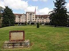
| 62 |
Grove Park Inn |
|
000000001973-04-03-0000April 3, 1973
(#73001295) |
Macon Ave.
35°37′15″N 82°31′26″W / 35.620833°N 82.523889°W / 35.620833; -82.523889 (Grove Park Inn) |
Asheville |
|
| 63 |
Rafael Guastavino, Sr., Estate |
|
000000001989-07-13-0000July 13, 1989
(#89000849) |
NC 9, 0.8 miles S of jct. with SR 2713
35°35′51″N 82°18′35″W / 35.5975°N 82.309722°W / 35.5975; -82.309722 (Rafael Guastavino, Sr., Estate) |
Black Mountain |
|
| 64 |
Gunston Hall |
Upload image |
000000001991-10-24-0000October 24, 1991
(#91001505) |
324 Vanderbilt Rd.
35°32′50″N 82°32′11″W / 35.547222°N 82.536389°W / 35.547222; -82.536389 (Gunston Hall) |
Biltmore Forest |
|
| 65 |
Intheoaks |
Upload image |
000000001991-04-10-0000April 10, 1991
(#91000361) |
510 Vance Ave.
35°36′40″N 82°19′40″W / 35.611111°N 82.327778°W / 35.611111; -82.327778 (Intheoaks) |
Black Mountain |
|
| 66 |
Thomas Jarrett House |
|
000000001994-01-21-0000January 21, 1994
(#93001535) |
46 Louisiana Ave.
35°34′47″N 82°35′28″W / 35.579722°N 82.591111°W / 35.579722; -82.591111 (Thomas Jarrett House) |
Asheville |
|
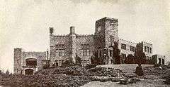
| 67 |
Kenilworth Inn |
|
000000002001-12-31-0000December 31, 2001
(#01001423) |
60 Caledonia Rd.
35°34′20″N 82°32′27″W / 35.572222°N 82.540833°W / 35.572222; -82.540833 (Kenilworth Inn) |
Asheville |
|
| 68 |
John A. Lanning House |
Upload image |
000000001982-09-23-0000September 23, 1982
(#82003437) |
W of Fairview on SR 3128
35°31′15″N 82°25′56″W / 35.520833°N 82.432222°W / 35.520833; -82.432222 (John A. Lanning House) |
Fairview |
|
| 69 |
Manor and Cottages |
|
000000001978-01-26-0000January 26, 1978
(#78001934) |
265 Charlotte St.
35°36′29″N 82°32′33″W / 35.608056°N 82.5425°W / 35.608056; -82.5425 (Manor and Cottages) |
Asheville |
|
| 70 |
Dr. Cireo McAfee McCracken House |
Upload image |
000000001995-09-01-0000September 1, 1995
(#95001066) |
1384 Charlotte Hwy.
35°31′28″N 82°24′34″W / 35.524444°N 82.409444°W / 35.524444; -82.409444 (Dr. Cireo McAfee McCracken House) |
Fairview |
|
| 71 |
McGeahy Building |
|
000000001979-11-15-0000November 15, 1979
(#79001679) |
7 1⁄2 Biltmore Plaza
35°34′03″N 82°32′34″W / 35.5675°N 82.542778°W / 35.5675; -82.542778 (McGeahy Building) |
Asheville |
|
| 72 |
Monte Vista Hotel |
|
000000002008-04-30-0000April 30, 2008
(#08000366) |
308 W. State St.
35°36′50″N 82°19′37″W / 35.613822°N 82.326806°W / 35.613822; -82.326806 (Monte Vista Hotel) |
Black Mountain |
|
| 73 |
Montford Area Historic District |
|
000000001977-11-25-0000November 25, 1977
(#77000991) |
Irregular pattern along Montford Ave.
35°36′10″N 82°33′53″W / 35.602778°N 82.564722°W / 35.602778; -82.564722 (Montford Area Historic District) |
Asheville |
|
| 74 |
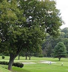
Municipal Golf Course |
|
000000002005-04-20-0000April 20, 2005
(#05000318) |
226 Fairway Dr.
35°34′45″N 82°30′08″W / 35.579167°N 82.502222°W / 35.579167; -82.502222 (Municipal Golf Course) |
Asheville |
|
| 75 |
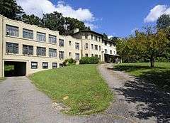
North Carolina Electrical Power Company Electric Generating Plant |
Upload image |
000000001999-06-25-0000June 25, 1999
(#99000754) |
2024 Riverside Dr.
35°38′25″N 82°35′53″W / 35.640278°N 82.598056°W / 35.640278; -82.598056 (North Carolina Electrical Power Company Electric Generating Plant) |
Woodfin |
|
| 76 |
Norwood Park Historic District |
Upload image |
000000002008-08-29-0000August 29, 2008
(#08000815) |
District is bounded roughly on the W. and S. by Murdock St.; on the N. by Woodward Ave; on the E. by Norwood Ave.
35°36′56″N 82°33′09″W / 35.61545°N 82.552403°W / 35.61545; -82.552403 (Norwood Park Historic District) |
Asheville |
|
| 77 |
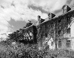
Oteen Veterans Administration Hospital Historic District |
|
000000001985-11-20-0000November 20, 1985
(#85003529) |
N side of US 70
35°35′27″N 82°29′05″W / 35.590833°N 82.484722°W / 35.590833; -82.484722 (Oteen Veterans Administration Hospital Historic District) |
Asheville |
|
| 78 |
Ottari Sanitarium |
|
000000001986-10-16-0000October 16, 1986
(#86002876) |
491 Kimberly Ave.
35°37′45″N 82°32′51″W / 35.629167°N 82.5475°W / 35.629167; -82.5475 (Ottari Sanitarium) |
Asheville |
|
| 79 |
Overlook |
|
000000001980-10-22-0000October 22, 1980
(#80002804) |
710 Town Mountain Rd.
35°36′40″N 82°32′04″W / 35.611111°N 82.534444°W / 35.611111; -82.534444 (Overlook) |
Asheville |
|
| 80 |
Proximity Park Historic District |
Upload image |
000000002008-10-08-0000October 8, 2008
(#08000974) |
Roughly bounded by Macon Ave., Howland Rd., Woodlink Rd., Charlotte St., and Sunset Trail
35°36′52″N 82°32′33″W / 35.614419°N 82.542525°W / 35.614419; -82.542525 (Proximity Park Historic District) |
Asheville |
|
| 81 |
Thomas Wadley Raoul House |
Upload image |
000000002006-11-28-0000November 28, 2006
(#06001105) |
394 Vanderbilt Rd.
35°32′03″N 82°32′24″W / 35.534167°N 82.54°W / 35.534167; -82.54 (Thomas Wadley Raoul House) |
Asheville |
|
| 82 |
Ravenscroft School |
|
000000001978-12-12-0000December 12, 1978
(#78001935) |
29 Ravenscroft Dr.
35°35′29″N 82°33′15″W / 35.591389°N 82.554167°W / 35.591389; -82.554167 (Ravenscroft School) |
Asheville |
|
| 83 |
Samuel Harrison Reed House |
Upload image |
000000001979-11-15-0000November 15, 1979
(#79001680) |
119 Dodge St.
35°33′51″N 82°32′22″W / 35.564167°N 82.539444°W / 35.564167; -82.539444 (Samuel Harrison Reed House) |
Asheville |
|
| 84 |
Reynolds House |
Upload image |
000000001984-09-13-0000September 13, 1984
(#84001934) |
100 Reynolds Hts.
35°38′37″N 82°34′41″W / 35.643611°N 82.578056°W / 35.643611; -82.578056 (Reynolds House) |
Asheville |
|
| 85 |
Dr. Carl V. Reynolds House |
Upload image |
000000001982-08-19-0000August 19, 1982
(#82003436) |
86 Edgemont Rd.
35°36′52″N 82°32′32″W / 35.614444°N 82.542222°W / 35.614444; -82.542222 (Dr. Carl V. Reynolds House) |
Asheville |
|
| 86 |
Richbourg Motors Building |
|
000000001979-04-26-0000April 26, 1979
(#79001681) |
50 Coxe Ave.
35°35′32″N 82°33′17″W / 35.592222°N 82.554722°W / 35.592222; -82.554722 (Richbourg Motors Building) |
Asheville |
|
| 87 |
Richmond Hill House |
Upload image |
000000001977-08-16-0000August 16, 1977
(#77000992) |
45 Richmond Hill Rd.
35°36′40″N 82°34′50″W / 35.611111°N 82.580556°W / 35.611111; -82.580556 (Richmond Hill House) |
Asheville |
|
| 88 |
Riverside Industrial Historic District |
|
000000002004-08-11-0000August 11, 2004
(#04000825) |
Roughly bounded by Clingman Ave., Lyman St., Roberts St., and Riverside Dr.
35°35′10″N 82°34′01″W / 35.586111°N 82.566944°W / 35.586111; -82.566944 (Riverside Industrial Historic District) |
Asheville |
|
| 89 |
S And W Cafeteria |
|
000000001977-03-28-0000March 28, 1977
(#77000993) |
Patton Ave.
35°35′40″N 82°33′14″W / 35.594419°N 82.553939°W / 35.594419; -82.553939 (S And W Cafeteria) |
Asheville |
|
| 90 |
Sawyer Motor Company Building |
|
000000001979-04-26-0000April 26, 1979
(#79001682) |
100 Coxe Ave.
35°35′26″N 82°33′17″W / 35.590556°N 82.554722°W / 35.590556; -82.554722 (Sawyer Motor Company Building) |
Asheville |
|
| 91 |
Schoenberger Hall |
Upload image |
000000001979-04-26-0000April 26, 1979
(#79001683) |
60 Ravenscroft Dr.
35°35′25″N 82°33′12″W / 35.590278°N 82.553333°W / 35.590278; -82.553333 (Schoenberger Hall) |
Asheville |
Destroyed[8]
|
| 92 |
Seven Oaks |
Upload image |
000000002015-08-13-0000August 13, 2015
(#15000528) |
82 Westwood Pl.
35°34′52″N 82°34′44″W / 35.5810°N 82.5789°W / 35.5810; -82.5789 (Seven Oaks) |
Asheville |
|
| 93 |
Sherrill's Inn |
|
000000001975-04-16-0000April 16, 1975
(#75001244) |
2.5 miles S of Fairview off U.S. 74
35°29′36″N 82°21′59″W / 35.493333°N 82.366389°W / 35.493333; -82.366389 (Sherrill's Inn) |
Fairview |
|
| 94 |
Richard Sharp Smith House |
|
000000002009-01-22-0000January 22, 2009
(#08001361) |
655 Chunns Cove Rd.
35°37′07″N 82°31′28″W / 35.618736°N 82.524383°W / 35.618736; -82.524383 (Richard Sharp Smith House) |
Asheville |
|
| 95 |
Whitford G. Smith House |
|
000000002005-05-04-0000May 4, 2005
(#05000375) |
263 Haywood St.
35°35′41″N 82°33′43″W / 35.594722°N 82.561944°W / 35.594722; -82.561944 (Whitford G. Smith House) |
Asheville |
|
| 96 |
Smith-McDowell House |
|
000000001975-08-01-0000August 1, 1975
(#75001243) |
283 Victoria Rd.
35°34′23″N 82°33′18″W / 35.573056°N 82.555°W / 35.573056; -82.555 (Smith-McDowell House) |
Asheville |
|
| 97 |
South Montreat Road Historic District |
Upload image |
000000002010-12-27-0000December 27, 2010
(#10001056) |
Along Montreat Rd., 102 First St., 100 Third St., 100 Ninth St., and 101 Beech St.
35°37′23″N 82°19′15″W / 35.623056°N 82.320833°W / 35.623056; -82.320833 (South Montreat Road Historic District) |
Black Mountain |
|
| 98 |
Southern Railway Passenger Depot |
|
000000001979-11-15-0000November 15, 1979
(#79001684) |
1 Biltmore Plaza
35°34′03″N 82°32′34″W / 35.5675°N 82.542778°W / 35.5675; -82.542778 (Southern Railway Passenger Depot) |
Asheville |
|
| 99 |
Spinning Wheel |
|
000000001999-07-28-0000July 28, 1999
(#99000913) |
1096 Hendersonville Rd.
35°32′07″N 82°31′41″W / 35.535278°N 82.528056°W / 35.535278; -82.528056 (Spinning Wheel) |
Asheville |
|
| 100 |
St. Luke's Episcopal Church |
|
000000001997-09-30-0000September 30, 1997
(#97001198) |
219 Chunn's Cove Rd.
35°36′07″N 82°31′53″W / 35.601944°N 82.531389°W / 35.601944; -82.531389 (St. Luke's Episcopal Church) |
Asheville |
|
| 101 |
St. Mary's Church |
|
000000001994-12-23-0000December 23, 1994
(#94001476) |
337 Charlotte St.
35°36′39″N 82°32′42″W / 35.610833°N 82.545°W / 35.610833; -82.545 (St. Mary's Church) |
Asheville |
|
| 102 |
St. Matthias Episcopal Church |
|
000000001979-05-10-0000May 10, 1979
(#79001685) |
Valley St.
35°35′30″N 82°32′54″W / 35.591667°N 82.548333°W / 35.591667; -82.548333 (St. Matthias Episcopal Church) |
Asheville |
|
| 103 |
Sunset Terrace Historic District |
Upload image |
000000002005-12-16-0000December 16, 2005
(#05001411) |
9-48 Sunset Terrace
35°36′58″N 82°32′30″W / 35.616111°N 82.541667°W / 35.616111; -82.541667 (Sunset Terrace Historic District) |
Asheville |
|
| 104 |
Thomas Chapel A.M.E. Zion Church |
|
000000002009-04-30-0000April 30, 2009
(#09000262) |
300 Cragmont Rd.
35°37′09″N 82°21′20″W / 35.619283°N 82.355656°W / 35.619283; -82.355656 (Thomas Chapel A.M.E. Zion Church) |
Black Mountain |
|
| 105 |
Weaverville United Methodist Church |
|
000000001996-03-01-0000March 1, 1996
(#96000195) |
85 N. Main St.
35°41′57″N 82°33′37″W / 35.699167°N 82.560278°W / 35.699167; -82.560278 (Weaverville United Methodist Church) |
Weaverville |
|
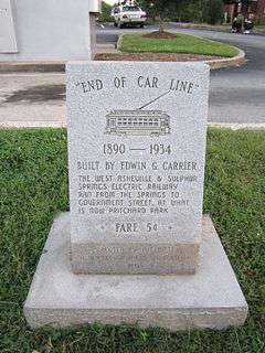
| 106 |
West Asheville End of Car Line Historic District |
|
000000002006-08-09-0000August 9, 2006
(#06000691) |
Both sides of Haywood Rd. from 715 to 814 and 7-9 Brevard Rd.
35°34′41″N 82°35′39″W / 35.578056°N 82.594167°W / 35.578056; -82.594167 (West Asheville End of Car Line Historic District) |
Asheville |
|
| 107 |
West Asheville-Aycock School Historic District |
Upload image |
000000002006-08-23-0000August 23, 2006
(#06000718) |
401-441 Haywood Rd.
35°34′42″N 82°34′53″W / 35.578333°N 82.581389°W / 35.578333; -82.581389 (West Asheville-Aycock School Historic District) |
Asheville |
Boundary increase 2014-09-03
|
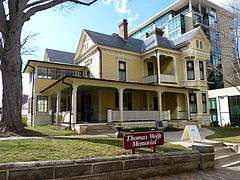
| 108 |
Thomas Wolfe House |
|
000000001971-11-11-0000November 11, 1971
(#71000572) |
48 Spruce St.
35°35′51″N 82°32′43″W / 35.5975°N 82.545278°W / 35.5975; -82.545278 (Thomas Wolfe House) |
Asheville |
|
| 109 |
Young Men's Institute Building |
|
000000001977-07-14-0000July 14, 1977
(#77000994) |
Market and Eagle Sts.
35°35′38″N 82°33′01″W / 35.593889°N 82.550278°W / 35.593889; -82.550278 (Young Men's Institute Building) |
Asheville |
|
| 110 |
Zealandia |
Upload image |
000000001977-03-14-0000March 14, 1977
(#77000995) |
40 Vance Gap Rd.
35°35′47″N 82°32′21″W / 35.596389°N 82.539167°W / 35.596389; -82.539167 (Zealandia) |
Asheville |
|


.JPG)