| [3] |
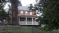
Name on the Register[4] |
Image |
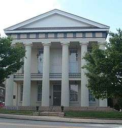
Date listed[5] |
Location |
City or town |
Description |
|---|
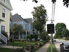
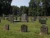
| 1 |
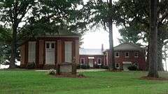
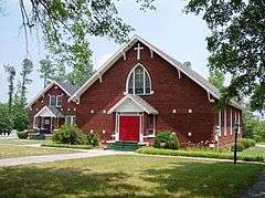
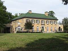
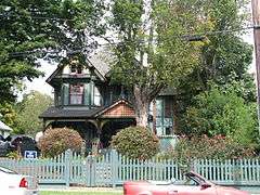
Back Creek Presbyterian Church and Cemetery |
|
000000001983-12-29-0000December 29, 1983
(#83003998) |
SR 1763
35°39′03″N 80°42′24″W / 35.650833°N 80.706667°W / 35.650833; -80.706667 (Back Creek Presbyterian Church and Cemetery) |
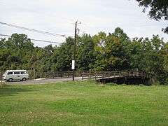
Mt. Ulla |
|
| 2 |
Barber Farm |
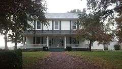
Upload image |
000000002003-01-15-0000January 15, 2003
(#02001717) |
225 Redmon Rd.
35°42′57″N 80°38′42″W / 35.715833°N 80.645°W / 35.715833; -80.645 (Barber Farm) |
Cleveland |
|
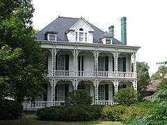
| 3 |
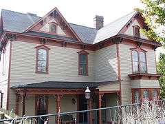
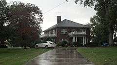
Bernhardt House |
|
000000001992-06-11-0000June 11, 1992
(#92000701) |
305 E. Innes St.
35°39′54″N 80°28′04″W / 35.665°N 80.467778°W / 35.665; -80.467778 (Bernhardt House) |
Salisbury |
|
| 4 |
George Matthias Bernhardt House |
Upload image |
000000001982-11-26-0000November 26, 1982
(#82001303) |
S of Rockwell on SR 2361
35°30′27″N 80°25′42″W / 35.5075°N 80.428333°W / 35.5075; -80.428333 (George Matthias Bernhardt House) |
Rockwell |
|
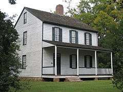
| 5 |
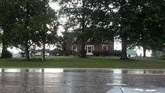
Henry Connor Bost House |
Upload image |
000000001982-11-12-0000November 12, 1982
(#82001304) |
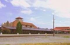
E of Woodleaf off US 601
35°46′01″N 80°30′45″W / 35.766944°N 80.5125°W / 35.766944; -80.5125 (Henry Connor Bost House) |
South River |
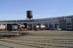
|
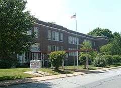
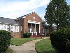
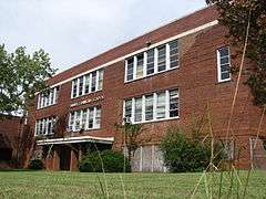
| 6 |
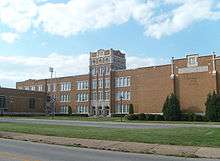
Boyden High School |
|
000000001996-05-23-0000May 23, 1996
(#96000564) |
500 Lincolnton Rd.
35°39′53″N 80°29′05″W / 35.664722°N 80.484722°W / 35.664722; -80.484722 (Boyden High School) |
Salisbury |
After desegregation, school name changed to Salisbury High.
|
| 7 |
Michael Braun House |
|
000000001971-09-28-0000September 28, 1971
(#71000618) |
NW of Granite Quarry on SR 2308 off U.S. 52
35°37′20″N 80°26′28″W / 35.622222°N 80.441111°W / 35.622222; -80.441111 (Michael Braun House) |
Granite Quarry |
|
| 8 |
Brooklyn-South Square Historic District |
Upload image |
000000001985-07-05-0000July 5, 1985
(#85001449) |
Roughly bounded by Fisher, Shaver, Walls and Lee Sts.
35°39′49″N 80°28′08″W / 35.663611°N 80.468889°W / 35.663611; -80.468889 (Brooklyn-South Square Historic District) |
Salisbury |
|
| 9 |
Maxwell Chambers House |
Upload image |
000000001972-01-20-0000January 20, 1972
(#72000992) |
116 S. Jackson St.
35°40′09″N 80°28′20″W / 35.669075°N 80.472233°W / 35.669075; -80.472233 (Maxwell Chambers House) |
Salisbury |
|
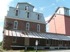
| 10 |
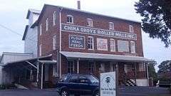
China Grove Roller Mill |
|
000000001983-12-29-0000December 29, 1983
(#83003995) |
308 N. Main St.
35°34′16″N 80°34′41″W / 35.571111°N 80.578056°W / 35.571111; -80.578056 (China Grove Roller Mill) |
China Grove |
|
| 11 |
Christ Episcopal Church |
|
000000002011-12-05-0000December 5, 2011
(#11000623) |
3430 Old US 70
35°43′59″N 80°39′55″W / 35.732922°N 80.665303°W / 35.732922; -80.665303 (Christ Episcopal Church) |
Cleveland vicinity |
|
| 12 |
Community Building |
|
000000001970-03-05-0000March 5, 1970
(#70000468) |
200 N. Main St.
35°40′06″N 80°28′07″W / 35.668333°N 80.468611°W / 35.668333; -80.468611 (Community Building) |
Salisbury |
Now home to the Rowan Museum
|
| 13 |
Corriher Grange Hall |
Upload image |
000000001982-09-23-0000September 23, 1982
(#82003507) |
NW of Five Points on SR 1555
35°36′04″N 80°41′43″W / 35.601111°N 80.695278°W / 35.601111; -80.695278 (Corriher Grange Hall) |
Enochville |
|
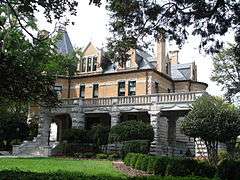
| 14 |
Eastover |
Upload image |
000000002011-01-24-0000January 24, 2011
(#10001176) |
5510 S. Main St.
35°36′31″N 80°32′28″W / 35.608611°N 80.541111°W / 35.608611; -80.541111 (Eastover) |
Salisbury |
|
| 15 |
Ellis Street Graded School Historic District |
|
000000001999-03-05-0000March 5, 1999
(#99000273) |
Roughly bounded by Craig, Innes, Jackson, and Cemetery Sts.
35°40′20″N 80°28′14″W / 35.672222°N 80.470556°W / 35.672222; -80.470556 (Ellis Street Graded School Historic District) |
Salisbury |
A 24-acre (9.7 ha) historic district with 76 contributing buildings and the Shober Bridge.
|
| 16 |
Fulton Heights Historic District |
|
000000001999-03-25-0000March 25, 1999
(#99000394) |
Roughly bounded by Fulton St., Heilig Ave., Ridge Ave., and Boyden St.
35°39′40″N 80°29′25″W / 35.661111°N 80.490278°W / 35.661111; -80.490278 (Fulton Heights Historic District) |
Salisbury |
|
| 17 |
Grace Evangelical and Reformed Church |
|
000000001972-01-20-0000January 20, 1972
(#72000990) |
S of Rockwell on SR 1221
35°31′15″N 80°25′17″W / 35.520931°N 80.4213°W / 35.520931; -80.4213 (Grace Evangelical and Reformed Church) |
Rockwell |
|
| 18 |
Granite Quarry School |
Upload image |
000000002001-02-07-0000February 7, 2001
(#01000017) |
706 Dunn's Mountain Rd.
35°36′57″N 80°26′07″W / 35.615833°N 80.435278°W / 35.615833; -80.435278 (Granite Quarry School) |
Granite Quarry |
|
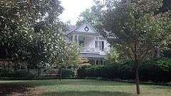
| 19 |
Griffith-Sowers House |
Upload image |
000000002009-09-09-0000September 9, 2009
(#09000703) |
5050 Statesville Boulevard
35°42′50″N 80°34′07″W / 35.713889°N 80.568611°W / 35.713889; -80.568611 (Griffith-Sowers House) |
Salisbury |
|
| 20 |
Grimes Mill |
|
000000001984-02-06-0000February 6, 1984
(#84002492) |
600 N. Church St.
35°40′22″N 80°27′56″W / 35.672778°N 80.465556°W / 35.672778; -80.465556 (Grimes Mill) |
Salisbury |
Destroyed by fire on 1/16/13.[6]
|
| 21 |
Grubb-Sigmon-Weisiger House |
|
000000001999-02-12-0000February 12, 1999
(#99000198) |
213 McCoy Rd.
35°41′15″N 80°30′06″W / 35.6875°N 80.501667°W / 35.6875; -80.501667 (Grubb-Sigmon-Weisiger House) |
Salisbury |
|
| 22 |
Hall Family House |
|
000000001982-10-05-0000October 5, 1982
(#82001305) |
NE of Bear Poplar on NC 801
35°40′54″N 80°39′52″W / 35.681667°N 80.664444°W / 35.681667; -80.664444 (Hall Family House) |
Bear Poplar |
|
| 23 |
Hambley-Wallace House |
|
000000001997-12-15-0000December 15, 1997
(#97001545) |
508 S. Fulton St.
35°39′59″N 80°28′42″W / 35.666389°N 80.478333°W / 35.666389; -80.478333 (Hambley-Wallace House) |
Salisbury |
|
| 24 |
Archibald Henderson Law Office |
|
000000001972-01-20-0000January 20, 1972
(#72000993) |
Church and Fisher Sts.
35°40′03″N 80°28′20″W / 35.6675°N 80.472222°W / 35.6675; -80.472222 (Archibald Henderson Law Office) |
Salisbury |
On the property of Rowan Public Library – Headquarters.
|
| 25 |
J. C. Price High School |
|
000000002010-04-21-0000April 21, 2010
(#10000208) |
1300–1400 W. Bank St.
35°40′36″N 80°29′07″W / 35.676539°N 80.485147°W / 35.676539; -80.485147 (J. C. Price High School) |
Salisbury |
|
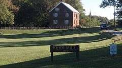
| 26 |
Kerr Mill |
|
000000001976-05-11-0000May 11, 1976
(#76001337) |
W of Mill Bridge on Sloan Rd., S of NC 1768
35°31′11″N 80°25′21″W / 35.519722°N 80.4225°W / 35.519722; -80.4225 (Kerr Mill) |
Mill Bridge |
|
| 27 |
Gen. William Kerr House |
Upload image |
000000001982-09-23-0000September 23, 1982
(#82003505) |
NW of Enochville on SR 1353
35°32′49″N 80°43′29″W / 35.546944°N 80.724722°W / 35.546944; -80.724722 (Gen. William Kerr House) |
Enochville |
|
| 28 |
Kesler Manufacturing Co.-Cannon Mills Co. Plant No. 7 Historic District |
|
000000001985-06-20-0000June 20, 1985
(#85001346) |
Park Ave. and Martin Luther King, Jr. Ave.
35°40′35″N 80°27′44″W / 35.676389°N 80.462222°W / 35.676389; -80.462222 (Kesler Manufacturing Co.-Cannon Mills Co. Plant No. 7 Historic District) |
Salisbury |
|
| 29 |
Knox Farm Historic District |
Upload image |
000000001983-04-01-0000April 1, 1983
(#83001914) |
Knox and Amity Hill Rds.
35°43′01″N 80°44′49″W / 35.716944°N 80.746944°W / 35.716944; -80.746944 (Knox Farm Historic District) |
Cleveland |
|
| 30 |
Knox-Johnstone House |
Upload image |
000000001993-08-05-0000August 5, 1993
(#93000737) |
100 Beaumont Farm Rd.
35°44′01″N 80°40′58″W / 35.733611°N 80.682778°W / 35.733611; -80.682778 (Knox-Johnstone House) |
Cleveland |
|
| 31 |
Livingstone College Historic District |
|
000000001982-05-27-0000May 27, 1982
(#82003509) |
W. Monroe St.
35°40′14″N 80°28′59″W / 35.670556°N 80.483056°W / 35.670556; -80.483056 (Livingstone College Historic District) |
Salisbury |
|
| 32 |
Alexander Long House |
Upload image |
000000001972-02-01-0000February 1, 1972
(#72000995) |
N of Spencer on Sowers Ferry Rd.
35°42′10″N 80°25′13″W / 35.702778°N 80.420278°W / 35.702778; -80.420278 (Alexander Long House) |
Spencer |
|
| 33 |
Lyerly Building for Boys |
Upload image |
000000001989-01-05-0000January 5, 1989
(#88003006) |
Crescent Rd./Rt. 3
35°34′12″N 80°25′47″W / 35.57°N 80.429722°W / 35.57; -80.429722 (Lyerly Building for Boys) |
Gold Hill Township |
|
| 34 |
Napoleon Bonaparte McCanless House |
Upload image |
000000002014-05-22-0000May 22, 2014
(#14000264) |
619 S. Main St.
35°39′45″N 80°28′33″W / 35.6626°N 80.4759°W / 35.6626; -80.4759 (Napoleon Bonaparte McCanless House) |
Salisbury |
|
| 35 |
Walter McCanless House |
|
000000002005-05-21-0000May 21, 2005
(#05000452) |
200 Confederate Ave.
35°40′59″N 80°28′08″W / 35.683056°N 80.468889°W / 35.683056; -80.468889 (Walter McCanless House) |
Salisbury |
|
| 36 |
McNeely-Strachan House |
|
000000001972-02-01-0000February 1, 1972
(#72000994) |
226 S. Jackson St.
35°40′04″N 80°28′27″W / 35.667778°N 80.474167°W / 35.667778; -80.474167 (McNeely-Strachan House) |
Salisbury |
|
| 37 |
Monroe Street School |
|
000000002004-05-19-0000May 19, 2004
(#04000463) |
1100 West Monroe St.
35°40′24″N 80°29′06″W / 35.673333°N 80.485°W / 35.673333; -80.485 (Monroe Street School) |
Salisbury |
|
| 38 |
Mount Vernon |
Upload image |
000000001980-05-27-0000May 27, 1980
(#80002899) |
SR 1003 and SR 1986
35°47′18″N 80°38′40″W / 35.788333°N 80.644444°W / 35.788333; -80.644444 (Mount Vernon) |
Woodleaf |
|
| 39 |
Mount Zion Baptist Church |
|
000000001985-12-30-0000December 30, 1985
(#85003188) |
413 N. Church St.
35°40′15″N 80°28′02″W / 35.670833°N 80.467222°W / 35.670833; -80.467222 (Mount Zion Baptist Church) |
Salisbury |
|
| 40 |
North Long Street-Park Avenue Historic District |
|
000000001985-06-20-0000June 20, 1985
(#85001347) |
North Long St. and Park Ave.
35°40′00″N 80°27′41″W / 35.666667°N 80.461389°W / 35.666667; -80.461389 (North Long Street-Park Avenue Historic District) |
Salisbury |
|
| 41 |
North Main Street Historic District |
Upload image |
000000001985-07-29-0000July 29, 1985
(#85001674) |
Roughly bounded by N. Main, 17th, Lee and Lafayette Sts.
35°40′33″N 80°27′25″W / 35.675833°N 80.456944°W / 35.675833; -80.456944 (North Main Street Historic District) |
Salisbury |
|
| 42 |
Owen-Harrison House |
Upload image |
000000001983-07-21-0000July 21, 1983
(#83001911) |
Entrance off north side of SR 1768
35°39′10″N 80°39′37″W / 35.652778°N 80.660278°W / 35.652778; -80.660278 (Owen-Harrison House) |
Mill Bridge |
|
| 43 |
John Phifer Farm |
Upload image |
000000001990-12-28-0000December 28, 1990
(#90001991) |
Jct. of Phifer Rd. and SR 1978
35°46′48″N 80°43′24″W / 35.78°N 80.723333°W / 35.78; -80.723333 (John Phifer Farm) |
Cleveland |
|
| 44 |
John Carlyle and Anita Sherrill House |
|
000000002009-09-01-0000September 1, 2009
(#09000704) |
14175 NC 801
35°39′31″N 80°43′52″W / 35.658611°N 80.731111°W / 35.658611; -80.731111 (John Carlyle and Anita Sherrill House) |
Mount Ulla |
|
| 45 |
Rankin-Sherrill House |
|
000000001982-09-23-0000September 23, 1982
(#82003508) |
NC 801
35°39′27″N 80°43′41″W / 35.6575°N 80.728056°W / 35.6575; -80.728056 (Rankin-Sherrill House) |
Mt. Ulla |
|
| 46 |
Salisbury Historic District |
|
000000001975-11-12-0000November 12, 1975
(#75001289) |
Roughly bounded by Jackson, Innes, Caldwell, Marsh, Church, E. Bank, Lee, and Liberty Sts.; also 117 S. Lee St.; also roughly bounded by Ellis St., Monroe St., Church St., Bank St., S. Main St., and McCubbins St.; also portions of E. Council, E. Innes, Lee, and E. Liberty Sts. between Main and Depot Sts.
35°40′04″N 80°28′10″W / 35.667778°N 80.469444°W / 35.667778; -80.469444 (Salisbury Historic District) |
Salisbury |
Legislative center of the historic Salisbury District. The Second, third, and fourth sets of boundaries represent boundary increases of 000000001988-01-06-0000January 6, 1988, 000000001989-07-06-0000July 6, 1989, and 000000002000-07-20-0000July 20, 2000 respectively
|
| 47 |
Salisbury National Cemetery |
|
000000001999-04-12-0000April 12, 1999
(#99000393) |
202 Government Rd.
35°39′37″N 80°28′27″W / 35.660278°N 80.474167°W / 35.660278; -80.474167 (Salisbury National Cemetery) |
Salisbury |
|
| 48 |
Salisbury Railroad Corridor Historic District |
|
000000001987-05-13-0000May 13, 1987
(#86003460) |
Roughly East Council, Liberty, Kerr, Cemetery, Franklin, Lee, and Depot Sts.; also the 300 and 400 blocks of N. Lee St.
35°40′06″N 80°27′53″W / 35.668333°N 80.464722°W / 35.668333; -80.464722 (Salisbury Railroad Corridor Historic District) |
Salisbury |
Second set of addresses represents a boundary increase of 000000002003-05-01-0000May 1, 2003
|
| 49 |
Salisbury Southern Railroad Passenger Depot |
|
000000001975-07-30-0000July 30, 1975
(#75001290) |
E side of Depot St. between Kerr and Council Sts.
35°40′02″N 80°27′58″W / 35.667222°N 80.466111°W / 35.667222; -80.466111 (Salisbury Southern Railroad Passenger Depot) |
Salisbury |
|
| 50 |
Shaver Rental Houses District |
|
000000001988-01-12-0000January 12, 1988
(#87002233) |
303, 309 & 315 W. Council & 120 N. Jackson
35°40′12″N 80°28′17″W / 35.67°N 80.471389°W / 35.67; -80.471389 (Shaver Rental Houses District) |
Salisbury |
|
| 51 |
Shuping's Mill Complex |
Upload image |
000000001982-09-23-0000September 23, 1982
(#82003506) |
S of Faith on NC 152
35°33′04″N 80°29′00″W / 35.551111°N 80.483333°W / 35.551111; -80.483333 (Shuping's Mill Complex) |
Faith |
Burned[7]
|
| 52 |
Southern Railway Spencer Shops |
|
000000001978-03-17-0000March 17, 1978
(#78001972) |
Salisbury Ave. between 3rd and 8th Sts.
35°41′13″N 80°26′05″W / 35.686944°N 80.434722°W / 35.686944; -80.434722 (Southern Railway Spencer Shops) |
Spencer |
|
| 53 |
Spencer Historic District |
Upload image |
000000001984-12-20-0000December 20, 1984
(#84000619) |
Roughly bounded by N to S Salisbury Ave., 8th St., Whitehead Ave., and Jefferson St.
35°41′32″N 80°26′04″W / 35.692222°N 80.434444°W / 35.692222; -80.434444 (Spencer Historic District) |
Spencer |
|
| 54 |
St. Andrew's Episcopal Church and Cemetery |
Upload image |
000000001982-08-19-0000August 19, 1982
(#82003510) |
NE of Woodleaf on SR 1950
35°47′14″N 80°33′44″W / 35.787222°N 80.562222°W / 35.787222; -80.562222 (St. Andrew's Episcopal Church and Cemetery) |
Woodleaf |
|
| 55 |
John Steele House |
|
000000001994-09-12-0000September 12, 1994
(#94001051) |
1010 Richard St.
35°40′27″N 80°27′31″W / 35.674167°N 80.458611°W / 35.674167; -80.458611 (John Steele House) |
Salisbury |
|
| 56 |
John Stigerwalt House |
Upload image |
000000001984-12-20-0000December 20, 1984
(#84000595) |
E of Kannapolis off SR 1221 (Old Beatty Ford Rd.)
35°31′06″N 80°31′00″W / 35.518333°N 80.516667°W / 35.518333; -80.516667 (John Stigerwalt House) |
Bostian Heights |
|
| 57 |
Third Creek Presbyterian Church and Cemetery |
Upload image |
000000001983-07-21-0000July 21, 1983
(#83001912) |
SR 1973
35°45′39″N 80°41′04″W / 35.760833°N 80.684444°W / 35.760833; -80.684444 (Third Creek Presbyterian Church and Cemetery) |
Cleveland |
|
| 58 |
Thyatira Presbyterian Church, Cemetery, and Manse |
|
000000001984-02-17-0000February 17, 1984
(#84002488) |
Off NC 150
35°39′01″N 80°38′12″W / 35.650278°N 80.636667°W / 35.650278; -80.636667 (Thyatira Presbyterian Church, Cemetery, and Manse) |
Mill Bridge |
|
| 59 |
Calvin H. Wiley School |
|
000000001988-10-20-0000October 20, 1988
(#88002028) |
200 blk. of Ridge Ave.
35°39′46″N 80°29′12″W / 35.662778°N 80.486667°W / 35.662778; -80.486667 (Calvin H. Wiley School) |
Salisbury |
School closed in 1983; became Wiley School Apartments in 1985.[8]
|
| 60 |
Wood Grove |
|
000000001982-09-23-0000September 23, 1982
(#82003504) |
E of Bear Poplar on SR 1743
35°40′48″N 80°40′28″W / 35.68°N 80.674444°W / 35.68; -80.674444 (Wood Grove) |
Bear Poplar |
|
| 61 |
Zion Lutheran Church |
Upload image |
000000001972-01-20-0000January 20, 1972
(#72000991) |
SW of Rockwell on SR 1006 off SR 1221
35°31′40″N 80°27′00″W / 35.527778°N 80.45°W / 35.527778; -80.45 (Zion Lutheran Church) |
Rockwell |
|
.jpg)
.jpg)

.jpg)
_station_front.jpg)